.jpg)
Weerribben-Wieden National Park
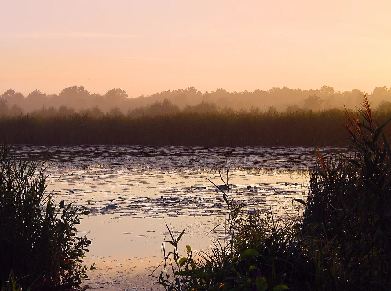
Nearly every lake you see here was dug by hand. For centuries Frisian peat cutters worked these wetlands, slicing wet turf into bricks, drying them in the wind, and selling them as winter fuel for the cities of Holland. The strips they left between cuts came to be called ribben — ribs — and the flooded trenches became the wieden, the wides. When the demand for peat finally collapsed after World War II, the cutters walked away and the water stayed. What looks today like pristine wilderness, the largest bog in northwestern Europe, is in fact a working industrial landscape that nature spent eighty years quietly repossessing.
Ribs and Wides
The park covers roughly 100 square kilometers and stitches together two adjoining areas: De Weerribben, protected since 1882, and De Wieden, added in 2009. The names tell you exactly what happened here. Peat cutters left narrow strips of ground — the ribs — between the trenches they dug, then floated the harvested turf out by boat. Over generations the ribs eroded and the trenches widened into open water. The whole landscape became a hand-cut mosaic of reed beds, willow scrub, and shallow lakes, threaded together by canals just wide enough for a punt. The pattern is so regular you can read the cutters' working rhythm from the air.
Things That Live in Reeds
The reed beds are the heart of the park's wildlife, and they are full of birds you have to learn to listen for rather than look at. The Eurasian Bittern hides in the reeds and broadcasts a low, foghorn boom that carries across the water. The Bluethroat flashes its sapphire patch only when it turns. Black Terns hunt insects above the canals. The European Otter, reintroduced to the Netherlands here in 2002 after going locally extinct, now slips through the channels at dawn and dusk — almost never seen, but increasingly present. Where reed-cutting has stopped, the marshes are slowly succeeding into bog forest, and ducks have moved in among the new willows.
Travel by Punt
Cars are not allowed in most of the interesting parts of the park, which leaves four ways to move: on foot, by bicycle, by punt, or by canoe. The canoe is the most honest choice. Most of the canals are too narrow for anything larger, and from a low boat the reed walls rise on either side like soft green corridors, the sky reduced to a strip of pale Frisian blue overhead. The thatched farmhouses you glide past are people's homes, not museums — Weerribben-Wieden is what the Dutch call a cultuurlandschap, a cultivated landscape, where farms and tractors are still part of the scene. Marked hiking trails range from a one-kilometer boardwalk through the marsh to an eight-and-a-half-kilometer combination that takes most of an afternoon. Bring boots for the laarzenpad — the boot trail — which lives up to its name.
Giethoorn and the Working Mill
Near the village of Kalenberg stands De Wicher, a working drainage mill that still occasionally turns its sails to lift water out of the polder, much as smaller windmills have done across these wetlands for centuries. To the south sits Giethoorn, the village threaded with canals that became famous as the so-called Venice of the North — overrun in high season, but quietly extraordinary in the shoulder months when the punts ghost down the waterways past gardens and arched footbridges. The combination is what makes Weerribben-Wieden distinct: a wilderness that was made by labor, where the wildlife arrived because the work stopped, and where the work — reed cutting, dairy farming, mill turning — still goes on.
From the Air
Coordinates 52.7769°N, 5.9489°E, in the Frisian-Overijssel border country east of the IJsselmeer. From cruising altitude the park reads as an intricate pale-and-dark mosaic of straight-edged reed plots and water — a hand-cut texture quite unlike anything natural around it. Recommended viewing altitude 3,000-5,000 feet to see the cutting pattern clearly. Lelystad (EHLE) is about 35 nautical miles southwest; Drachten (EHDR) lies 20 nautical miles north.
Nearby Stories
- Zuiderzee Works 0.3 km away
- Wytgaard 6.2 km away
- Ommen 7.6 km away
- Kampen, Overijssel 8.1 km away
- Westerkwartier 9.7 km away
- Pinksterlanddagen 15 km away
- Fort near Edam 15 km away
- Zuidwal Volcano 16 km away