Ommen
Every evening at nine o'clock in the centre of Ommen, two bells named Maria and Salvator ring out over the Vecht. They were cast in 1517 by Hendrick de Tremonia of Dordrecht. The ringing once signalled that the city gates were closing for the night; the gates have been gone for centuries, but the bells still toll on schedule, an Ave-Maria peal more than 500 years old. Ommen is that kind of town. Small, quietly stubborn, and stacked with stories that do not match its size: a Hanseatic city, the site of an Indian spiritual teacher's Order, and the location of one of the cruellest social experiments in Dutch history.
City by Charter
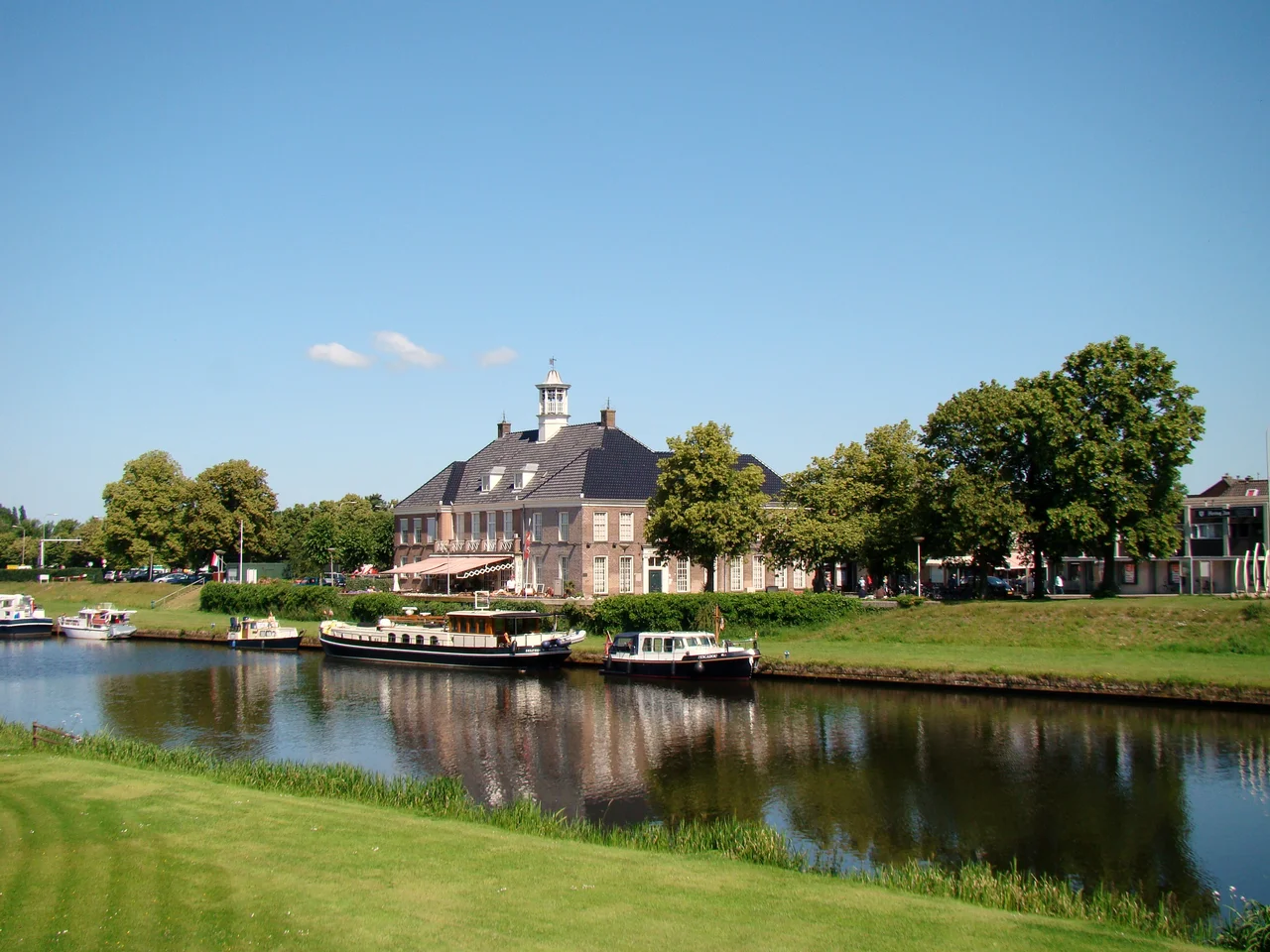
Ommen sits where the Regge river meets the Vecht in eastern Overijssel. Written records first name the settlement as de Vmme in 1133. By around 1150 there was a church at its centre, soon rebuilt in stone. The story that turned a village into a city is unusual: it grew up because of a robber baron. Rudolf of Coevorden and his militia of freemen pillaged the town in 1215 and again after the Battle of Ane in 1227. The Prince-Bishop of Utrecht, who claimed this corner of his domain Oversticht, decided he needed a permanent strategic base. On 25 August 1248, Otto III granted Ommen city rights and the right to build fortifications. That made Ommen the fourth-oldest officially recognised city in Overijssel, after Deventer, Zwolle, and Rijssen. Walls and three gates went up. The town joined the Hanseatic League, trading not directly with the Baltic but as a subsidiary partner of nearby Deventer. A toll bridge across the Vecht, first built in 1492, collected revenue for the city until 1925.
Fires and Pillagings
The 17th century was hard on Ommen. In 1522 troops from Zwolle had already sacked and burned the town, sparing only the church and a women's home called de Heilige Geest. A great fire in 1624 left only the foundations and a few walls of the church. In 1672, the rampjaar, or disaster year, of the Franco-Dutch War, an even more devastating fire raged through the city, destroying everything but the church again; foreign troops from Münster passed through repeatedly demanding food, lodging, and money. Recovery was slow. It took until 1753 for Ommen to afford a new city hall on the Vrijthof square. Discontent with oligarchical rule finally boiled over in 1732, when citizens delivered a petition demanding the council resign. The council refused, riots followed, and order was only restored after a night guard was established in 1762. The unrest did not really settle until the Batavian Revolution in 1795.
Eerde and Krishnamurti
Four kilometres southeast of town stands Eerde, a Dutch-classical castle from 1715 on a 1,667-hectare baroque-style estate, now managed by Natuurmonumenten. The first castle here was built in the 14th century and destroyed by the bishop's men in 1380. The Van Twickelo, Van Renesse, and Van Pallandt families lived in successive houses on the site. In the 1920s Baron Philip van Pallandt, a devoted follower of the Indian philosopher Jiddu Krishnamurti, granted him use of the castle and a tract of land at the nearby Besthemerberg. Krishnamurti held lectures there for his Order of the Star in the East from about 1924 until just before the Second World War, drawing audiences of thousands from dozens of countries. The same Besthemerberg later became the site of Kamp Erika, a Nazi camp notorious for the brutality of its personnel, where Dutchmen convicted of resistance or black-market trade were held. It was liberated on 11 April 1945. Today the castle houses an international boarding school offering the IB programme.
The Ommerschans
Ten kilometres due north of the city lies the ground where the Ommerschans once stood, and the story it tells is the darkest in Ommen's history. The fortress was built in 1628 as part of a defensive line. By 1715 it was decommissioned; it was briefly revived, then in 1787 was looted of weapons by Patriot militias and abandoned. In the early 19th century the Dutch government turned the site into something new: a resocialisation institution and labour camp for beggars, sex workers, and alcoholics swept up from Amsterdam and other western cities. They were supposed to learn farming and morals through work, then return to society. In practice they were used as semi-forced, all-but-unpaid labour to reclaim the surrounding wetlands. The writer Jacob van Lennep visited in the summer of 1823 and wrote that the hours he spent there were among the saddest of his life. The camp ran until 1889. Across its years of operation, an estimated 5,448 people died while interned. The land they drained still exists; their graves mostly do not.
The Bissing and Other Survivals
For all that history, modern Ommen is mostly a quiet rural town of about 8,700 in the city proper, surrounded by heathlands and forests that fill fifteen campgrounds in season. Gilwell Ada's Hoeve on the Vecht was the Netherlands' first Scouting campground. The Pieterpad, the country's most popular long-distance walking trail, runs through. Five windmills survive in and around town; three stand in Ommen itself, including the Lelie, which has been milling since 1846. The National Tin Figurine Museum, in a former town hall, holds more than 200,000 figurines, including four panoramas of the Battle of Ane that helped trigger the city's founding eight centuries ago. And then there is the Bissing, a fair and market held since at least 1557 on the second Tuesday of July. It was so famous for brawls that the Dutch Reformed Church demanded its public festivities be suspended in 1918; they were not restored until 1958. It has become a tourist draw that runs across five Wednesdays of midsummer.
From the Air
Ommen sits at roughly 52.52 degrees north, 6.42 degrees east, in the Vecht river valley of eastern Overijssel. From altitude the city reads as a small urban kernel where the Regge meets the Vecht, surrounded by the heath, forest, and reclaimed wetlands of the Salland landscape. The nearest commercial airport is Groningen Eelde (EHGG) to the north or Münster/Osnabrück (EDDG) to the east; Schiphol (EHAM) lies about 130 km west. The N34 road and the Zwolle-Emmen rail line are the most visible linear features cutting through the area.
Nearby Stories
- Nordhorn 4.8 km away
- Weerribben-Wieden National Park 5.1 km away
- Veluwe 9.5 km away
- Kampen, Overijssel 10 km away
- Berkelland 10 km away
- Westerbork 15 km away
- Haren, Germany 15 km away
- Steinfurt 22 km away