Steinfurt
Stemmert, the locals call it - and they have been calling it that since before the Reformation reshuffled the religious map of northern Germany. The official name, Steinfurt, simply means stony ford: a passage of flat rock across the little river Aa where, in the twelfth century, coaches could cross without sinking into the marsh. Whoever controlled the ford collected the tolls. Whoever collected the tolls built a castle. And whoever built the castle drew a town toward it, one cobbled lane at a time.
Two Towns, One Stone Ford
Modern Steinfurt is really two old towns stitched together in 1975 - Borghorst, which grew prosperous on textiles, and Burgsteinfurt, which preferred culture and administration. It is Burgsteinfurt that nineteenth-century travelers nicknamed the Paradise of Westphalia and the Royal Diamond, counting some seventy-five monumental buildings inside a fortification that once consisted of city wall, inner moat, rampart, outer moat, and a forward wall. Four gates pierced that ring - Kirchpforte, Rottpforte, Steinpforte, Wasserpforte - and the citizens divided themselves into three Eise, or guard districts, responsible for keeping the moat clear and, in winter, breaking up the ice so attackers could not simply walk across.
An Island of Heretics
Steinfurt's most peculiar achievement was theological. In the 1560s, Count Arnold II converted to Lutheranism for his wife's sake, and on 25 January 1564, while the count slept, townsfolk seized the Great Church from the Catholic Knights of St. John. They still call it the Robber-Feast. The noble family then moved on again, this time to Calvinism, and in 1591 founded a Hohe Schule - a Protestant academy - to oppose the Jesuits in nearby Munster. It could not award doctorates, but it pulled in Dutch students and freethinkers, sheltered Mennonites and Calvinists from elsewhere, and turned Steinfurt into a Reformed island floating in a Catholic sea. From 1596 to 1610, Conrad Vorstius taught here before being called to Leiden to succeed Arminius himself.
The Bagno and the Counts' Whims
East of the still-inhabited castle, the counts laid out something Westphalia had never seen: an amusement park. Count Charles Paul Ernest founded the Bagno in 1765, taking his name from the Italian word for bath, and filled it with French-style geometry. His heir Louis ripped that out for an English landscape garden full of follies - a Chinese palace, an Arion ship, a Gothic house, an artificial castle ruin. Most are gone now. What remains is the concert hall, the island with its ruin, and the New Guardhouse - enough that the Bagno still draws walkers two and a half centuries later.
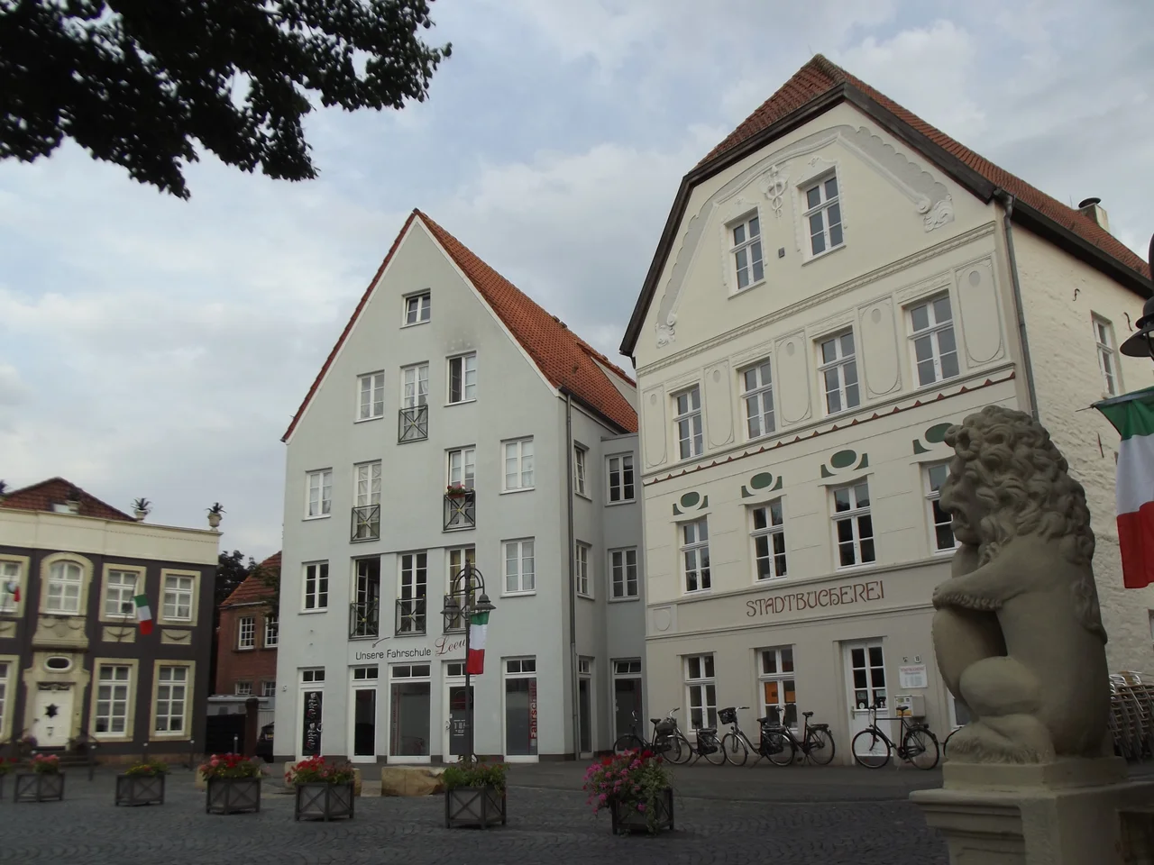
The Stones That Watched Everything
Walk the old market square and the buildings name their owners aloud. The Weinhaus from around 1450, the count's guesthouse. The Town Hall of 1561, its Renaissance gable climbing in seven peaked pyramids around the city crest, the turret resting on a single great beam the locals call the Kaiserstiel. House Markt 16, rebuilt by Dr. Kestering in 1648 from the rubble the Thirty Years' War had left, two lions still flanking his door. The Huck-Beifang-Haus from 1607, where the count's financial administrator carved a Latin boast onto the bay window about hoping to ascend from here to heaven. And, in a narrow lane called Kautenstege, a single memorial stone for the synagogue destroyed in November 1938 and the Jewish citizens of Steinfurt deported and murdered.
Stemmert Today
The Gymnasium Arnoldinum still teaches under the name of the count who founded the old Hohe Schule - a direct line stretching back to 1591. The Fachhochschule Munster's engineering faculties moved into town and never left. Trains leave Steinfurt-Burgsteinfurt station every hour for Munster in one direction and Enschede, across the Dutch border, in the other. The Rolinck brewery still operates. Stemmerter descendants in Ohio and Missouri trace their roots to the hungry 19th-century harvests that pushed their great-great-grandparents onto westbound ships. The moats are gardens now, the gates long gone, and the castle is still inhabited by the noble family - which is why tourists only see a portion of it.
From the Air
Coordinates 52.150 N, 7.337 E. Recommended viewing altitude 2,500-4,000 ft AGL to pick out the moated castle complex on the west side of town and the wooded Bagno park east of it. The town sits in the rolling Munsterland farmland northwest of Munster. Nearest airports: Munster/Osnabruck International (FMO/EDDG) about 30 km southeast, and Enschede Airport Twente (EHTW) across the Dutch border to the west. The Munster-Enschede railway line is a clean visual ground reference. Generally good VFR conditions; low stratus and morning fog over the Aa floodplain are common in autumn.
Nearby Stories
- Ladbergen 2 km away
- Vriezenveen 4.9 km away
- RAF Nordhorn 5.9 km away
- Siege of Groenlo (1627) 8.8 km away
- Osnabrück Canal 15 km away
- Haldern Pop 16 km away
- Lembeck Castle 19 km away
- Hamm (Westfalen) Hauptbahnhof 20 km away