
Welford National Park
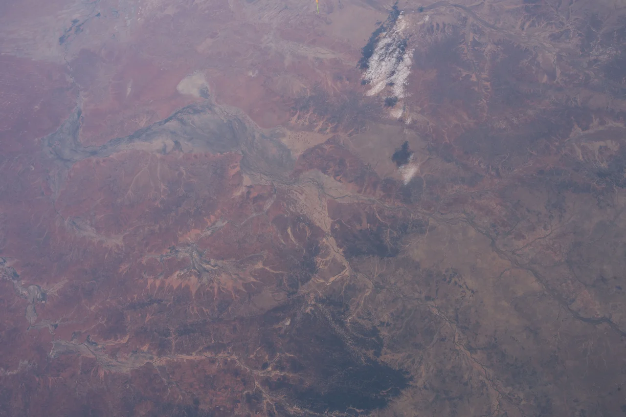
The soil here cannot decide on a color. It shifts from rose-pink through dusty apricot to a red so deep it looks impossible, the kind of red that stains your boots and your camera and your memory. These are the easternmost dunes of the vast Simpson-Strzelecki sand sea, and they stop, abruptly, where the Mitchell-grass plains begin. Add the channels and billabongs of the Barcoo River, lined with ancient river red gums, and you have Welford National Park: a single protected place where three of the outback's great country types collide. Established in 1994 and spread along the Barcoo nearly a thousand kilometers west of Brisbane, it is a cross-section of arid Australia, compressed into one driveable landscape.
Three Countries in One
Most parks protect a single ecosystem. Welford protects the seams between several. Drive its three self-guided routes - more than a hundred kilometers of track in total - and the land transforms beneath your tires. Golden-green spinifex gives way to red sand dunes, then to the silver-grey of Mitchell-grass plains, then to mulga scrub and the rocky escarpments above the river. The park was set aside in 1994 specifically to safeguard this overlap, where the Mulga Lands, the Mitchell Grass Downs and the Channel Country bioregions all meet. White-barked ghost gums punctuate the dunes. The Barcoo River draws the southern boundary and the green thread that ties it all together, its permanent waterholes the difference between life and dust.
The River That Stays
In a country defined by drought, permanent water is everything, and the Barcoo's deep waterholes hold it through the dry. They are why people have always come here, and why visitors come now - to fish, to paddle a canoe across glassy water at dawn, to camp at the single permitted site along the riverbank under a sky thick with stars. The river red gums lean over the channels, their pale trunks catching the low light. The rare yellow-footed rock-wallaby shelters in the rocky country, one of the most striking marsupials in Australia, its ringed tail and apricot flanks a flash of color against grey stone. Birds gather where the water gathers. Everything in this landscape, ultimately, bends toward the Barcoo.
The People of the Country
Long before the surveyors and the stock, the Maiawali and Karuwali people moved through every part of this landscape, reading the dunes, the plains and the river as a single living system. Their presence is written into the ground - in the water wells they dug and maintained, and in the stone arrangements that remain across the park. These were not curiosities but the working knowledge of people who had thrived here for thousands of years, who knew where water hid and when the country would give. Their strong spiritual connections to this land endure today, carried by descendants who have never stopped belonging to it.
A Hard History on the Barcoo
The park's name comes from Richard Welford, a pastoralist killed on his run in 1872 by an Aboriginal man - known as Kangaroo, or Jiu-Jiu - who had deserted from the Native Police. What followed was not justice but reprisal. Native Police detachments and local pastoralists, including Charles Lumley Hill, mounted punitive expeditions that left many of the region's Aboriginal people dead along the Barcoo, at Welford's station, and in the Cheviot Range near what is now Hell Hole Gorge. It is a hard truth, and it belongs in the story of this place. The dunes are beautiful and the river is generous, but the country also holds the memory of a frontier violence that fell hardest on the people who knew it best.
The Outback, Distilled
What makes Welford remarkable is its honesty. It does not flatten the outback into a single postcard. It offers the full spectrum instead - the searing red of the dunes, the soft endless grey of the grass plains, the green refuge of the river - and it lets the visitor move through all of it in a day. Remote, demanding to reach, rewarding to those who make the journey, the park feels less like a destination than a complete small world. You arrive expecting desert. You leave understanding that the desert is many things at once.
From the Air
Welford National Park lies at approximately 25.06 degrees south, 143.43 degrees east, roughly 30 km southeast of Jundah on the Barcoo River in central-west Queensland. From altitude the park is a vivid mosaic: the rose-to-crimson dunes of the Simpson-Strzelecki system in the west, pale Mitchell-grass plains to the east, and the dark, tree-lined channels of the Barcoo carving the southern edge - an unmistakable navigation feature in otherwise uniform country. Recommended viewing altitude is 3,000-6,000 ft AGL for the full ecosystem contrast. Nearest airfield is Jundah (YJDA, elevation 476 ft); Windorah (YWDH) lies south and Longreach (YLRE, elevation 627 ft) to the north for fuel and services. Expect excellent visibility in the dry winter months, with the strongest dune color near sunrise and sunset; airborne dust can degrade visibility after wind events.
Nearby Stories
- Windorah Solar Farm 14 km away
- Yaraka 35 km away
- Hell Hole Gorge National Park 44 km away
- Tenham (meteorite) 56 km away
- Lochern National Park 61 km away
- Cooper Floodplain below Windorah 74 km away
- Isisford, Queensland 87 km away
- Davenport Downs Station 180 km away