
West Coast Wilderness Railway
On the steepest pitches, the locomotive stops relying on its wheels and starts biting. A toothed central rail rises between the running tracks, and a cog beneath the engine drops into it, gear meeting gear, and the train hauls itself up grades far too severe for steel wheels to grip. This is the Abt system, invented by a Swiss engineer named Roman Abt in the 1880s, and it is the reason a railway exists here at all. Between Queenstown and the harbour town of Strahan, 34.5 kilometres of track climb and plunge through some of the wettest temperate rainforest on Earth. It is the only working Abt rack railway in the Southern Hemisphere, and for decades it was the single thread tying this isolated mining frontier to the outside world.
Copper Made the Line
The railway was never built for scenery. It was built for copper. The Mount Lyell Mining and Railway Company opened the first section in 1896 and pushed it through to Strahan by November 1899, carving a path the engineers had been told was impossible. Ore had to reach the port, and there was no other way out. Until a road link to Hobart was completed in 1932, this line was the only practical access through to Queenstown. Everything came and went on these rails: the copper, the men, the mail, the machinery, the news. The terrain fought back the whole way. Because of the punishing gradients, the trains could only haul limited loads, inching their cargo down to the sea one careful descent at a time.
The King River Gorge
The line's drama is geological. Leaving Queenstown, the track threads the gorge of the King River, where the engine drops onto the rack rail and grinds down toward the water through a tunnel of dripping green. Here the contrast is total. Above the gorge lie the bare, eroded hills that mining stripped of life; below, the rainforest closes in, thick with myrtle beech, leatherwood, and tree ferns that have never known a clear day. The original Quarter Mile Bridge near Teepookana was swept away by a flood in 1974, and its replacement sits just south of where the first one stood. At the bottom, the King River runs the colour of weak tea and old metal, still carrying the chemical memory of a century of ore.
Closure and Rebirth
The last passenger service ran on 29 June 1963, and the railway closed that August. Road improvements, especially the opening of the Murchison Highway from the north, had made the slow, costly line obsolete. The track was lifted, the bridges left to rot, and the rainforest began reclaiming the formation. For more than thirty years it sat abandoned. Then, in the 1990s, with the old mining operations winding down, West Coast locals campaigned to bring the Abt railway back, not as industry but as heritage. A twenty-million-dollar federal grant, matched by state and private money, made it possible. Rebuilding the line to modern standards demanded almost as much skill as the original construction had a century before.
Riding the Rebuilt Line
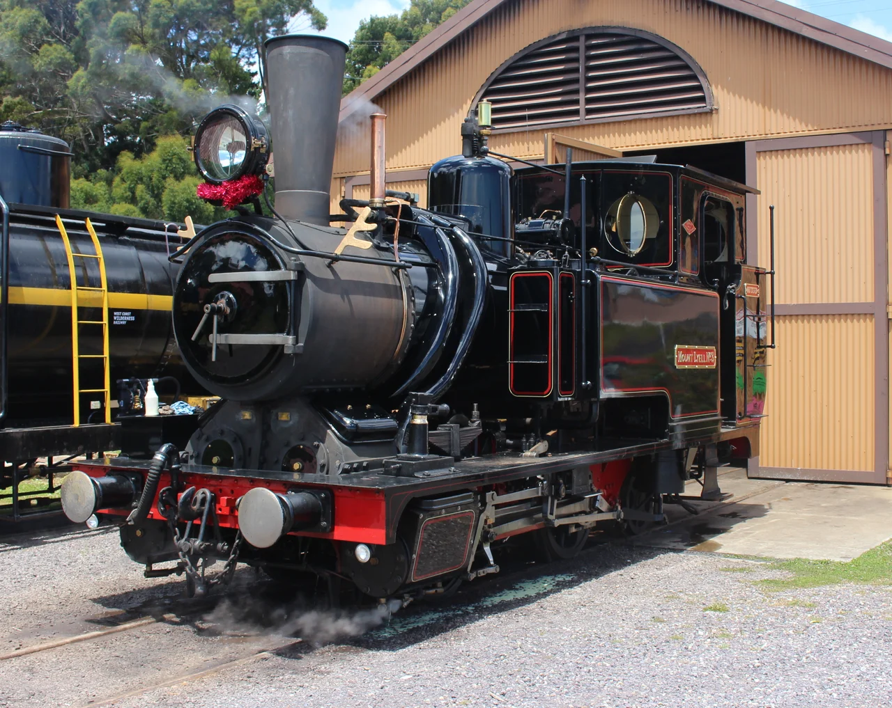
The first reconstructed section, between Queenstown and Lynchford, opened in November 2000, and the full line followed in December 2002. Prime Minister John Howard and Premier Jim Bacon cut the ribbon in April 2003. The trains that run today are not replicas but survivors: three of the original Mount Lyell locomotives were brought back into service, built by Dübs and Company of Glasgow in the 1880s and 1890s, their boilers hammering up the same grades they climbed when copper was king. The journey has not always been smooth in its second life. A commercial operator handed the line back in 2013, and the government had to step in; full operations resumed in December 2014 under a state-owned corporation. Engineers Australia has marked the railway with an Engineering Heritage International Marker, an acknowledgement that the achievement here was never ordinary.
From the Air
The West Coast Wilderness Railway runs roughly 34.5 km between Queenstown (42.08 S, 145.55 E) and Regatta Point near Strahan, threading the King River gorge at approximately 42.15 S, 145.50 E. From the air the route is best read by following the river corridor of dark rainforest cutting between Queenstown's bare ochre hills and the broad sheet of Macquarie Harbour to the west. Recommended viewing altitude 3,000 to 5,000 ft AGL; terrain rises sharply around the West Coast Range, so maintain clearance over peaks near 1,000 m. The nearest airfield is Strahan Airport (YSRN), with Queenstown's emergency airstrip (YQNS) close to the eastern terminus. Expect frequent low cloud, rain, and reduced visibility; this is one of the wettest regions in Australia, and clear windows over the gorge are brief.
Nearby Stories
- Cradle Mountain-Lake St Clair National Park 2.2 km away
- Macquarie Harbour Penal Station 6.9 km away
- Mount Bischoff 48 km away
- Overland Track 52 km away
- Southwest National Park 56 km away
- Cape Grim Massacre 130 km away
- Cataraqui 244 km away
- Chatham Islands 3119 km away