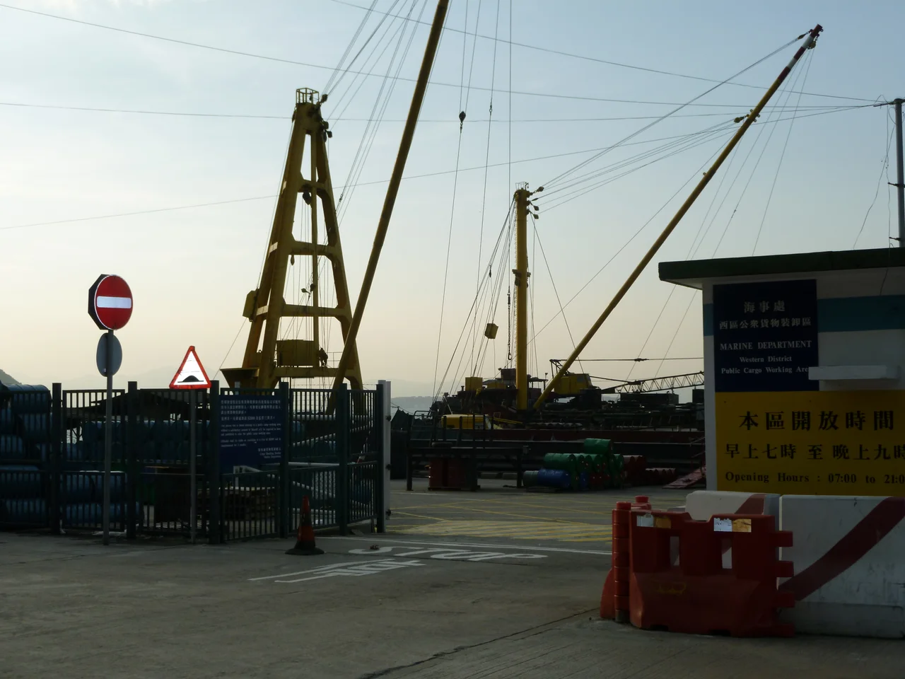

Western District Public Cargo Working Area
There are warning notices at the entrance, and the Marine Department has posted them clearly: only those engaged in loading and unloading operations are officially permitted beyond this point. Nobody pays much attention. Every evening, photographers arrive with tripods over their shoulders, hiking toward the open end of the Western District Public Cargo Working Area as the sun tilts toward Lantau Island. They call it the Instagram Pier — a nickname the place earned not from any planner's vision but from the sheer accumulation of images people posted from here, each one seemingly more golden than the last. It is a peculiar Hong Kong success story: a functional freight dock that became, almost by accident, one of the city's most beloved places.
A Pier That Stopped Working
The Western District Public Cargo Working Area is one of six public cargo working areas managed by Hong Kong's Marine Department, and for most of its history it was exactly what the name suggests — a utilitarian loading dock where small and medium-sized freight companies moved goods between shore and sea. As large transportation corporations absorbed the trade, the smaller operators grew scarcer. The frequency of loading operations dropped. The dock fell quiet in the way that industrial places do when commerce moves on: not abandoned exactly, but no longer fully occupied, its concrete apron open and its bollards idle. Residents from the surrounding Western District — the neighbourhood the British colonial administration once called Sai Wan — discovered the empty space and began using it. People walked their dogs there. Fishermen dropped lines into the harbour. By around 2010, the pier had become known for its sunsets.
Mirror of the Sky
After rainfall, a thick layer of water pools across the concrete surface of the pier and does something extraordinary. The sky appears in it — not as a rippled suggestion but as a clear, nearly perfect reflection. Stand at the right angle and your silhouette doubles beneath you, a shadow reaching down into a mirror that holds the clouds and the colour of the light. Photographers named this effect the Mirror of the Sky, and it became the pier's signature image: figures standing at the horizon of their own reflection, the boundary between above and below dissolved by a film of rainwater on concrete. The visual is specific to this place in a way that made it almost impossible to stop sharing.
Voted the Best Place Nobody Was Allowed to Be
In 2013 the Instagram Pier won the Outstanding Public Space Elections, a competition jointly organized by Designing Hong Kong, the Hong Kong Public Space Initiative, and other civic groups. It received the highest number of votes. The irony was complete: the most beloved public space in Hong Kong was technically not a public space. The Marine Department's warning notices remained in place. The crowds came anyway, and then grew larger after December 2014 when the West Island MTR line opened nearby, making the pier reachable by rail. Overseas visitors began appearing alongside local regulars. By late afternoon the sun falls at exactly the right angle for the harbour view, and the tripod queue stretches back toward the entrance.
The Fight Over Its Future
Hong Kong's government had plans. The pier, it noted, lacked proper railings — a genuine safety concern, and one that had caused accidents. Town planners floated proposals for renovation: guardrails along the edge, perhaps landmark structures at the extended tip, possibly a waterfront promenade and cycle track absorbing part of the site. In 2015 news of these plans leaked to a local newspaper and was met with immediate and vocal opposition from residents. The District Council pushed back and the project stalled. The government did not abandon the idea entirely. A 2017 policy address proposed converting more than 70 percent of the pier — roughly 7,500 square metres — into a community garden. Protest followed again. The Instagram Pier, it turns out, generates strong feelings not despite being technically off-limits but perhaps because of it: the place belongs to its visitors in a way that official public spaces rarely do.
Still There at Dusk
On 1 March 2021, the Marine Department used the COVID-19 epidemic as grounds to close the pier to all but authorized workers. The sunsets continued without an audience. For the regulars who had been coming for years — not just photographers but couples, families, people who simply wanted to stand somewhere open at the end of a day in one of the world's most densely built cities — the closure was another chapter in the same long argument: who gets to decide what a place is for? The pier was built to load cargo. The cargo largely stopped. The people arrived and made something else of it. The answer to that question, and the pier's future, remains unresolved.
From the Air
The Western District Public Cargo Working Area sits at approximately 22.29°N, 114.13°E on the northern shore of Hong Kong Island, in the Sai Wan neighbourhood west of the Sheung Wan MTR station. From the air at 2,000-4,000 feet, the pier is visible as a concrete finger extending into the harbour just west of the Kennedy Town area, with the green hills of Pok Fu Lam rising behind it. The nearest airport is VHHH (Hong Kong International Airport) approximately 22 km to the west. Victoria Harbour stretches to the north, with the Kowloon skyline as backdrop. The pier is most photogenic in the late afternoon, when the low western sun creates the reflective conditions visible from above as a bright horizontal flash on wet concrete.
Nearby Stories
- Lok Ma Chau Loop 2.3 km away
- Portas do Cerco 2.3 km away
- Kweilin Incident 17 km away
- Wanshan Archipelago Campaign 34 km away
- Nanxiong Formation 115 km away
- Battle of Nanpeng Island 148 km away
- Heyuan 169 km away
- Cape Maobitou 632 km away