Whitewater River
The name the river had before it was called the Whitewater was Agua Blanco — White Water, or more precisely, Milky Water. The color that gave it both names comes from silicate and lime sediments carried in suspension from the high slopes of San Gorgonio Mountain, where the North Fork begins at around 10,000 feet elevation. By the time it reaches the canyon bottom and threads its way toward the Coachella Valley, the river has dropped thousands of feet through terrain that the Pacific Crest Trail follows for part of its length.
From Mountain Summit to Valley Floor
San Gorgonio Mountain, at 11,503 feet the highest peak in Southern California, is where the Whitewater River's North Fork originates. The river descends through Whitewater Canyon, a gorge that runs roughly perpendicular to the San Gorgonio Pass — the low gap between the San Bernardino and San Jacinto ranges that channels traffic between the Los Angeles Basin and the desert. The Pacific Crest Trail follows the Whitewater River through the lower canyon, making this one of the few places in Southern California where thru-hikers walk alongside a stream with year-round flow in its upper reaches. Non-native rainbow trout have established themselves in the shaded, cooler sections where the canyon walls block enough sun to keep water temperatures viable.
Wild and Scenic, Then Damaged
In 2019, Congress designated the Whitewater River under the Wild and Scenic Rivers Act — a federal protection that restricts development and water diversion along the river corridor. The designation came after years of advocacy by conservation organizations who argued that the river's ecological value, its recreational significance along the PCT, and its role as one of the few perennial streams in the Colorado Desert justified federal protection. Less than four years later, Hurricane Hilary struck Southern California in August 2023 with rainfall totals unprecedented in recorded history for the region, damaging access to Whitewater Canyon. A February 2019 Valentine's Day storm had similarly caused damage. The climate that the Wild and Scenic designation was meant to protect against is increasingly the climate that tests the canyon's infrastructure.
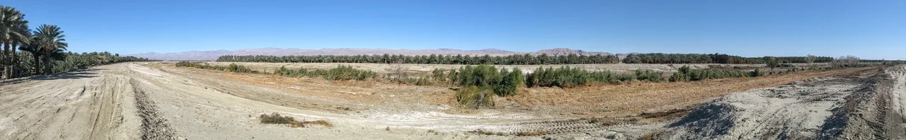
The Color of the Water
What makes the Whitewater River visually distinctive is also what makes it geologically interesting. The milky appearance that gave the river its original Spanish name comes from mineral sediments — primarily silicate and calcium compounds — carried from the granitic and metamorphic geology of the San Bernardino Mountains. In certain lighting conditions, particularly after rain, the water running over the canyon bottom has an almost luminescent quality against the dark rock walls. This quality diminishes in dry conditions when flow is lower and sediment concentrations drop, but returns with each significant rain event. It is the kind of detail that rewards attention on the approach from the pass, where the river's course is visible below as a pale ribbon threading the canyon floor.
From the Air
The Whitewater River flows through Whitewater Canyon at approximately 33.51°N, 116.06°W, draining from the San Gorgonio Mountain area southeast toward the Coachella Valley. The canyon is visible from approaches through the San Gorgonio Pass — the low mountain gap at the northwest end of the Coachella Valley through which Interstate 10 passes. From the air, the canyon appears as a significant drainage cutting southward from the pass area, with the pale sandy wash of the river bottom visible in lower flow conditions. The San Gorgonio Pass Wind Farm, with thousands of wind turbines, is immediately to the west and provides a distinctive visual reference. Nearest airports: Palm Springs International (KPSP, approximately 15 miles southeast), Bermuda Dunes (UDD). The pass itself creates significant turbulence due to wind channeling effects.
Nearby Stories
- Borrego Valley Groundwater Basin 6.7 km away
- Chocolate Mountains 7.8 km away
- Imperial Valley Geothermal Project 7.9 km away
- Coachella Valley National Wildlife Refuge 13 km away
- Kumeyaay 15 km away
- Coxcomb Mountains 18 km away
- Cabazon Dinosaurs 20 km away
- Mountain Fire (2013) 24 km away