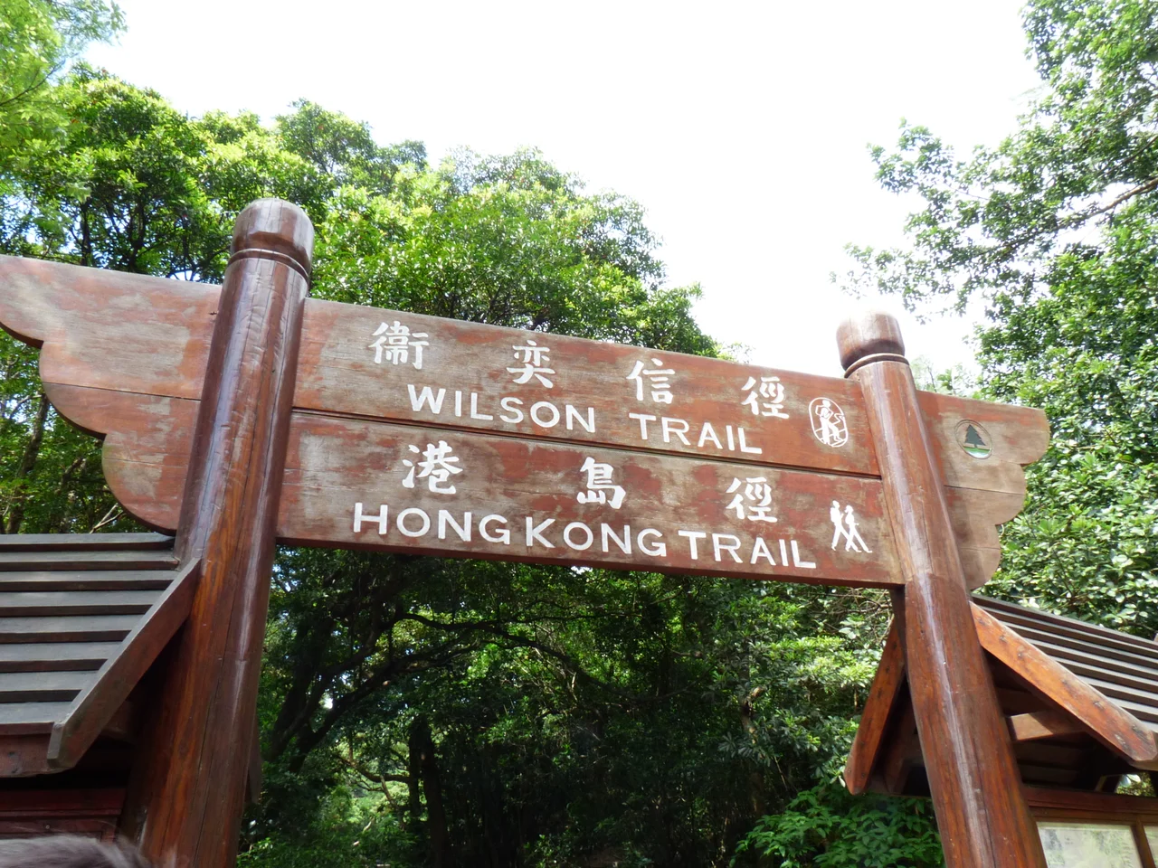

Wilson Trail
From the slopes above Stanley on Hong Kong Island's south coast, the trail heads north for 78 kilometres and does not stop until it reaches the ridgeline of Pat Sin Leng in the northeastern New Territories, where on clear days the lights of Shenzhen are visible across the border. Between those two endpoints, the Wilson Trail crosses eight country parks, threads through ancient villages, climbs and descends ridges that overlook both the South China Sea and the Pearl River estuary, and requires hikers — in one unavoidable gap between sections — to descend into the city and take the MTR before resuming on the other side of Victoria Harbour. It is a walk through the full geographic range of Hong Kong, and almost nobody does it all at once.
Named After the Penultimate Governor
The trail takes its name from David Wilson, Baron Wilson of Tillyorn, who served as Governor of Hong Kong from 1987 to 1992 — the second-to-last governor before the 1997 handover to China. Wilson was a supporter of conservation and outdoor recreation during his term, and the Friends of the Country Park organization developed the trail in his honour, with private sponsors funding the project. Construction began in 1994. The trail was first opened on 21 January 1996, about eighteen months before the political transition it would outlive. It is marked along its length by 137 distance posts numbered W001 through W137, placed at intervals ranging from 500 to 650 metres — not the perfectly regular spacing the original plan called for, a discrepancy that has frustrated navigation-minded hikers ever since.
Ten Sections, Eight Parks
The trail is divided into ten numbered sections of varying difficulty and character. Section 1 begins on Stanley Gap Road, climbs Stone Hill and Cheung Lin Shan, and winds through the Tai Tam watershed before ending at Tai Tam Reservoir Road. Section 2 ascends through the hills above Quarry Bay, passing Jardine's Lookout and briefly merging with the Hong Kong Trail. The crossing of Victoria Harbour — an inescapable interruption of any north-south traverse of Hong Kong — falls between Sections 2 and 3, requiring a ride on the MTR from Tai Koo to Yau Tong Station. On the Kowloon side, the trail climbs to Devil's Peak and works northeast and north through a series of country parks: Ma On Shan, Lion Rock, Kam Shan, Shing Mun, and finally Tai Mo Shan Country Park before the long push into the Pat Sin Leng mountain range for the final two sections.
What the Ridge Reveals
The view shifts as the trail moves north, and the shift tells the story of Hong Kong's layered geography. Early sections on Hong Kong Island look out over reservoirs and wooded ravines, with the city visible only at the edges. Crossing into the New Territories, the horizon opens. From Section 4's higher points, Kowloon Peak, Elephant Hill, and Tate's Cairn appear to the south, while the New Territories spread northward in a patchwork of villages, reservoirs, and secondary forest. By Section 8 the trail is running along hillsides above Tai Po, where the Lam Tsuen River valley opens wide. Section 9 crosses the Pat Sin Leng ridge — a jagged east-west spine of peaks where the wind is constant and the views in both directions are unobstructed — before descending toward the final section and the trail's northern end near Nam Chung.
Villages, Campsites, and the Rhesus Macaques of Section 7
The trail is not only a landscape experience. It passes through or near inhabited places: Shatin Tau New Village, a Hakka settlement; San Uk Ka Village in Tai Po, where a store on Wun Yiu Road serves as a resupply point for hikers; O Tau Village in the New Territories. Camping sites punctuate the middle sections — Lead Mine Pass Campsite between distance posts W083 and W084, Shing Mun Picnic Site No. 7 with its adjacent meadow above the reservoir. In the Kam Shan section, hikers are likely to encounter the park's resident rhesus macaques, troops of which have made the area their territory for decades, posing on trail markers and raiding unguarded packs. The macaques are wild, agile, and entirely unimpressed by hikers.
The Raleigh Challenge and the Long Game
Most Wilson Trail walkers tackle it section by section across multiple weekends, a common approach for Hong Kong's working population. The trail's full length is possible in one continuous push — Raleigh International's Raleigh Challenge event was the first hiking competition to cover the complete distance, running from Hong Kong Island to the northern boundary of the New Territories in a single effort. For participants who complete all ten sections, the route amounts to a physical survey of a territory most people navigate only at sea level, through tunnels and across bridges, in air-conditioned carriages. On the ridge, Hong Kong resolves into something older and stranger than its reputation as a financial centre: mountain and forest and reservoir, a green interior that the city has conspicuously failed to fill.
From the Air
The Wilson Trail spans a long north-south corridor through Hong Kong, from approximately 22.21°N (Section 1, near Stanley) to 22.50°N (Section 10, near Nam Chung in the northeastern New Territories). The central reference coordinates are approximately 22.25°N, 114.20°E. From the air at 5,000-8,000 feet, the trail's route is visible as a series of green ridgelines threading between reservoirs and dense urban development. Key landmarks include Lion Rock (a distinctive lion-profile ridge visible from most of Kowloon), the Shing Mun Reservoir complex, and the ragged Pat Sin Leng mountain range in the northeast. The nearest airport is VHHH (Hong Kong International Airport), approximately 30 km to the west. The MTR crossing between Sections 2 and 3, near Tai Koo on Hong Kong Island and Yau Tong in Kowloon, is the only urban interruption in an otherwise green traverse of the territory.
Nearby Stories
- Lok Ma Chau Loop 2.3 km away
- Portas do Cerco 2.3 km away
- Kweilin Incident 17 km away
- Wanshan Archipelago Campaign 34 km away
- Nanxiong Formation 115 km away
- Battle of Nanpeng Island 148 km away
- Heyuan 169 km away
- Cape Maobitou 632 km away