
Witwatersrand
Drive across the Highveld and you might miss it entirely: a low ridge running east to west, grass-covered, unremarkable against the wide South African sky. But under that ridge lies the single greatest concentration of gold in the history of the planet. The Afrikaans name means "ridge of white waters," for the streams that once spilled over its hard quartzite lip in pale ribbons. Nobody named it for gold, because for most of its existence nobody knew the gold was there. Then, in 1886, a prospector cracked open a rock on a farm called Langlaagte, and the ridge began to swallow a city whole.
Three Billion Years in the Making
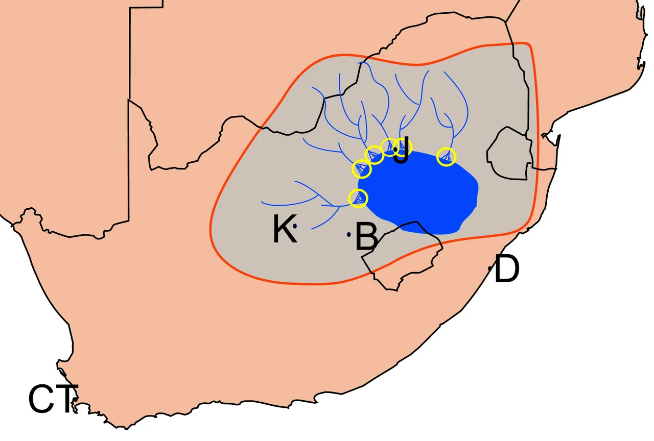
The story begins almost unimaginably long ago. The Witwatersrand rocks were laid down across roughly 260 million years, starting nearly three billion years ago, when this part of Africa lay beneath a shallow sea geologists call the Witwatersrand Sea. The Kaapvaal craton beneath it is among the oldest stable pieces of crust anywhere on Earth. As the sea retreated and rivers braided across a flat coastal plain, they carried gold washed down from greenstone belts to the north and west, dropping it grain by grain into ancient deltas. Compressed and buried for eons, those gold-flecked gravels hardened into a conglomerate that miners call banket, after a sticky Afrikaner sweet it resembles. The gold had been waiting there, sealed in stone, since long before the first complex life appeared.
The Reef That Made a City
George Harrison's 1886 discovery on Langlaagte set off one of history's great gold rushes. Within a year a chaotic mining camp had a name, Johannesburg, and within a generation it was the largest city in southern Africa. The Main Reef, as the gold-bearing layer became known, dips underground and plunges for kilometers, and the mines chased it down. Some Witwatersrand shafts reach roughly four kilometers below the surface, where rock temperatures climb past 60 degrees Celsius and engineers pump ice underground just to keep the air breathable. More than 40,000 tonnes of gold have come out of these rocks since 1886, somewhere near 40 percent of all the gold ever mined on Earth. No other gold field comes close.
A Ridge Worth a Currency
Few landforms have left so deep a mark on a nation's identity. The gold of the Rand underwrote South Africa's economy for more than a century, and when the republic was declared in 1961, the new currency took the ridge's name: the rand. The Witwatersrand gave its name to a great university, to whole regions, the East Rand and West Rand, and to the conurbation that sprawled along its length. It was once the W in PWV, the old shorthand for the Pretoria-Witwatersrand-Vereeniging heartland that became Gauteng province. A geological accident three billion years old became the engine of a modern state.
What the Gold Left Behind
The wealth came at a cost the land is still paying. Pale yellow mine dumps, mountains of crushed and processed rock, ring southern Johannesburg like a strange artificial range. When the ore was hauled up from oxygen-starved depths, its iron pyrite began to react with air and rain, producing sulfuric acid. This acid mine drainage now seeps into groundwater, dissolving heavy metals, uranium among them, that the rock had safely locked away for billions of years. Below the city the hollowed-out ground occasionally shifts, opening sinkholes or trembling with small tremors. The ridge gave South Africa extraordinary fortune, and it left behind an equally extraordinary reckoning.
From the Air
The Witwatersrand runs roughly east-west across Gauteng at about 25.79 S, 27.85 E, with the ridge crest near 1,700 to 1,800 meters above sea level. From the air the giant pale mine dumps south of central Johannesburg are the clearest visual marker of the gold reef beneath. The dense Johannesburg-Pretoria conurbation spreads across the plateau to the north. O.R. Tambo International (FAOR) lies just east near Bedfordview, with Lanseria (FALA) to the northwest and Wonderboom (FAWB) near Pretoria. Recommended viewing altitude 4,000 to 6,000 feet AGL; Highveld afternoons often bring dramatic thunderstorms and haze from the urban sprawl.
Nearby Stories
- Premier Mine 9.3 km away
- Liliesleaf Farm 11 km away
- Tswaing crater 16 km away
- Royal Bafokeng Nation 32 km away
- Sun City 37 km away
- TauTona Mine 45 km away
- Secunda CTL 91 km away
- Bushveld Igneous Complex 107 km away