
Wutong Mountain
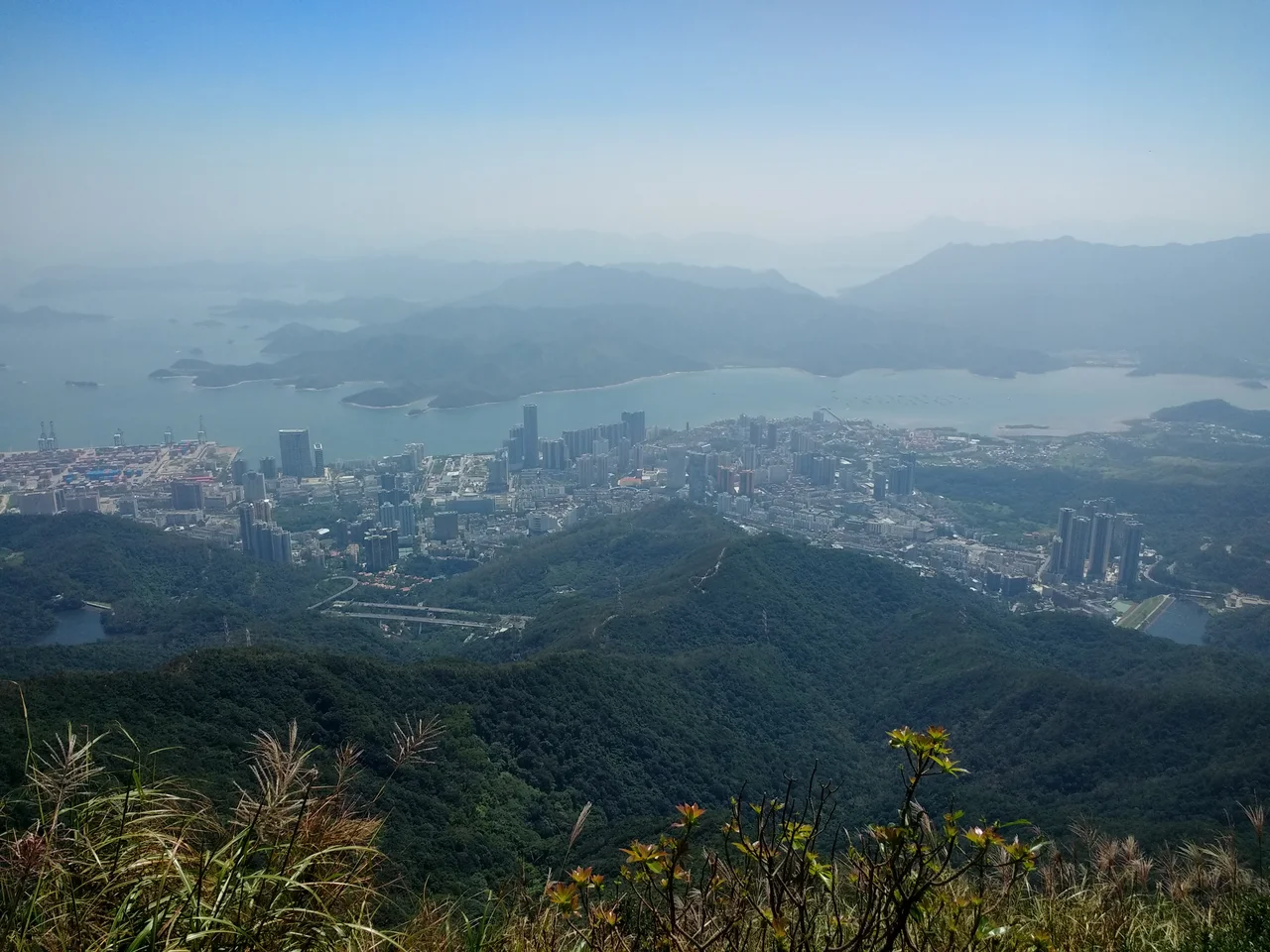
The phoenix, according to an ancient Chinese poem in the Classic of Poetry, would only land in a wutong tree. The tree — Firmiana simplex, the Chinese parasol tree — was considered noble enough for a mythical bird of impeccable taste. Wutong Mountain takes its name from that tree, and by extension from that legend. At 943.7 metres above sea level, it is the highest point in Shenzhen: a forested ridge above the city's northeastern districts, where the skyline of one of China's fastest-growing metropolises gives way, entirely and abruptly, to forest.
The Name and Its Many Origins
The etymology of Wutong Mountain is genuinely disputed, which gives it a richer history than most place names. The most poetic explanation ties it to the Classic of Poetry and the legend of the phoenix resting in the parasol tree. But Shenzhen Evening News has documented two other serious contenders.
The first alternative points to the mountain's shape: viewed from above, the ridgeline snakes and undulates like a centipede — and since the Mandarin word for centipede sounds similar to "wutong," the name may have evolved phonetically from an older nickname. The second alternative is botanical: the mountain was once thick with a plant that sounded like "wutong" in Mandarin, though that plant was quite different from the parasol tree. All three explanations have their advocates. The mountain keeps all of them, unnamed and unresolved, in its history.
A Mountain at the Border
Wutong Mountain spans the border of Luohu, Longgang, and Yantian districts in Shenzhen, near where the city touches Hong Kong to the south. Mirs Bay of the South China Sea lies to the east; Shenzhen Reservoir to the west. From the summit of Big Wutong — the highest of the mountain's three main peaks, along with Small Wutong and Bean Curd Head — on a clear day you can see both Shenzhen's towers and Hong Kong's hills.
The Shenzhen River originates on Wutong Mountain, descending to become the boundary between the two territories. The mountain's 31.82 km² park area was first protected in 1980, designated as the Shatoujiao-Haishan National Forest Park in 1984 — China's second National Forest Park, after Zhangjiajie — and elevated to a National Area of Scenic and Historic Interest in 2009. The "Wutong Clouds" phenomenon, in which the peaks gather and shift cloud cover in unusual ways, is listed as one of the eight new scenic wonders of Shenzhen.
Forest in a City
Wutong Mountain is described as a "lung of the city" — an unusual distinction that reflects how rare it is to have a forested mountain of this scale inside an urban area. The forest coverage rate of the park reaches 88.6%. Vegetation zones change with altitude: subtropical seasonal rainforest at the base, broad-leaf forest on the middle slopes, dwarf forest near the hilltops, and shrubland at the summit. The orchid family is represented among the mountain's flora; rhododendrons produce seasonal flower displays that cover entire hillsides.
The park divides into eight named scenic areas, among them Phoenix Valley, Wutong Clouds, East Lake Park, and the Fairy Lake Botanical Garden. In 2004, Wutong Mountain was selected as one of eight official scenic spots of Shenzhen. It remains one of the clearest examples anywhere in China of an intact natural landscape surviving inside a major city.
Trails and the Hiking Festival
Three main trails lead to Big Wutong's summit, each with a distinct character. Wutong Mountain Road North is the gentlest — no vehicles, no cyclists, a 7.8 km walk from the archway gate to Small Wutong Square, taking two and a half to three and a half hours one way. Taishan Stream Trail is the oldest and most popular, following a watercourse up through the forest, roughly 5.5 km and three to four hours. Bitong Road, completed in September 2007, is the longest and most physically demanding at 6.7 km, entering from Yantian District.
On October 2, 2003, the first Wutong Mountain Hiking Festival was held in Shenzhen. Thousands of people participated. Since then, an annual hiking festival has been held each October, drawing residents from across the city to the trails. The mountain that the phoenix chose, according to the old poem, has in turn become a destination for people choosing the forest over the city, for at least a day.
From the Air
Wutong Mountain is located at approximately 22.582°N, 114.215°E on the border of Luohu and Yantian districts in Shenzhen. Nearest major airport is Shenzhen Bao'an International Airport (ZGSZ), approximately 45 km to the west. The mountain's peak at 943.7 m is the highest terrain feature in the Shenzhen area and is a useful navigation reference; it stands clearly above the urban grid to its west and the coastal hills of Mirs Bay to its east. Recommended viewing altitude 3,000–5,000 feet for full terrain perspective. The Shenzhen River valley and the Hong Kong border are visible to the south.
Nearby Stories
- Hong Kong Disneyland 4.1 km away
- Mount Guanyin (Dongguan) 7 km away
- 2024 Lixinsha Bridge Collapse 7.4 km away
- Portas do Cerco 12 km away
- Lotus Hill 15 km away
- Nanxiong Formation 78 km away
- Heyuan 130 km away
- Checheng Fu'an Temple 629 km away