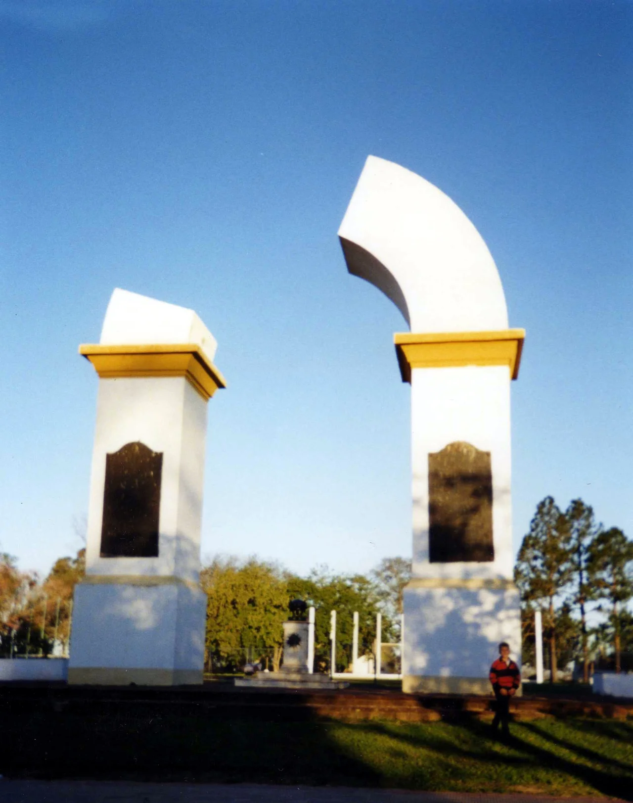

Yapeyú, Corrientes
A town of about two thousand people sits on the banks of the Uruguay River, and from it came the man who freed three nations. José de San Martín, the soldier who would liberate Argentina, Chile, and Peru from Spanish rule, was born here in Yapeyú on 25 February 1778. There is something fitting in the name itself: in Guaraní, Yapeyú is said to mean 'ripe fruit,' though one scholar reads it as 'the place where the wind blows.' Both suit a quiet riverside town that produced one of the towering figures of the Americas and then watched him leave it forever as a small boy.
A Mission on the Frontier
Yapeyú began as a mission. On 4 December 1626, the Jesuit Pedro Romero founded it, giving it the elaborate name Villa de Nuestra Señora de los Santos Reyes Magos y Yapeyú. It became one of the thirty Jesuit missions among the Guaraní, a network of self-governing communities that stretched across this borderland in the seventeenth and eighteenth centuries. These were settlements where Guaraní people and Jesuit priests built churches, workshops, and farms together, a complex and often contradictory experiment in faith, labor, and survival on the colonial frontier. Yapeyú was among them, a place where the Guaraní language and Catholic ritual braided together into something distinctly its own. The word Yapeyú itself comes from Guaraní, and it once named the river now called the Guaviraví, a reminder that the language of this place long predated the mission's Spanish saints.
The Boy Who Would Free Three Nations
By the late eighteenth century, the old mission had become an administrative seat. San Martín's father, Juan de San Martín, a Spanish professional soldier, served as governor of the Yapeyú district within the Government of the Guaraní Missions. In the family's home, the future Liberator was born. He would not stay long: the family left for Spain when José was a small child, and he grew into manhood as a soldier in European wars before returning across the Atlantic to fight for South American independence. He never came home to Yapeyú. Yet the town claims him absolutely, and the country knows it as his birthplace, the cradle of the man Argentines still call simply El Libertador.
What the Portuguese Left Standing
History was not gentle to Yapeyú. In 1817, a Portuguese army swept through and destroyed the mission, as it did to others across the region during the wars that tore through these borderlands. The town was later rebuilt, but much was lost. What survived includes the ruins of the small fortress that had, by the end of the eighteenth century, been the home of Lt. Juan de San Martín and his wife, Gregoria Matorras, the Liberator's parents. To walk among those remains is to stand where the family once lived, on the literal foundations of a national legend. The town also keeps the Arco Trunco, the 'broken arch,' among its monuments to the past.
Pilgrimage to a Quiet Place
Today Yapeyú is small and unhurried, a town of roughly two thousand people, but it carries an outsized place in the Argentine imagination. It is a site of pilgrimage, drawing visitors who come to honor San Martín at the place where his life began. A museum dedicated to him preserves the memory, and the preserved ruins anchor the town's identity. There is a poignancy to it: the man celebrated across three countries for what he did far away is most intimately remembered here, in the modest town he barely knew, on a river that has carried far more history than its quiet surface suggests. San Martín died in exile in France in 1850, never having returned to his birthplace, and so Yapeyú keeps a memory of a beginning rather than an end. To stand here is to glimpse the ordinary frontier soil from which an extraordinary life set out.
From the Air
Yapeyú lies at 29.47°S, 56.82°W on the western bank of the Uruguay River in the San Martín Department of Corrientes Province, Argentina. The river itself, marking the border with Brazil, is the dominant navigation feature; the town sits on a gentle bend. The nearest airports are across the river and to the south: Paso de los Libres Airport (ICAO: SARL) and Uruguaiana–Ruben Berta International Airport (ICAO: SBUG) lie downstream to the southeast, and Monte Caseros Airport (ICAO: SARM) is to the south. Recommended viewing altitude is 2,500–4,000 feet AGL to take in the river bend and the small grid of the town. The humid subtropical climate brings summer haze; clearest light comes in the cooler, drier winter.
Nearby Stories
- Battle of Yatay 9.2 km away
- Siege of Uruguaiana 30 km away
- Brazilian Island 62 km away
- São Borja 63 km away
- Mercedes, Corrientes 80 km away
- Iberá Wetlands 82 km away
- João Goulart's House 90 km away
- Battle of Ituzaingó 145 km away