,_delta_del_Okavango,_Botsuana,_2018-07-31,_DD_11.jpg)
Zambezian flooded grasslands
The rainy season arrives in November and runs until March, and over those months the Zambezi and its tributaries swell beyond their banks in ways that redraw the map of southern Africa. Entire landscapes flood and then, slowly, recede. Grasses that have lain dormant through the dry months surge back. Herds of lechwe antelope move in pursuit of fresh growth; the waterbucks follow; crocodiles and hippos occupy the deeper channels. By the end of the wet season, wetlands across six countries have become seasonal inland seas, some of them large enough to be visible from orbit. These are the Zambezian flooded grasslands - not a single place, but a scattered archipelago of wetlands threaded across the southern African interior, all tied together by the rhythms of African rains.
An Archipelago of Wetlands
The ecoregion runs from northern Botswana, Namibia, and Angola in the west to Tanzania and Mozambique in the east - a broad belt punctuated by places where rivers slow down enough to spread out. The Okavango Delta in Botswana is the best-known fragment, a fan of water that empties the Okavango River into the Kalahari sand without ever reaching the sea. The Kilombero Valley and Mkata Plain flood seasonally in southern Tanzania, the Malagarasi-Muyovozi and Ugalla River floodplains in the west, and the Wembere River and Lake Kitangiri farther east. Around Lake Chilwa in Malawi, rice farmers and fishermen have worked wetland margins for generations. Inside Zambia, the Barotse Floodplain, Kafue Flats, Busanga Swamp, and Lukanga Swamp form the Zambezi basin's wet heart, while the upper Chambeshi River, the Bangweulu Swamp, and the Luapula delta south of Lake Mweru anchor the north. Each of these floodplains is distinct, yet the ecology they share - tropical climate, hot wet summer, grasses that boom and crash with the water - gives them a common signature.
The Animals That Follow the Water
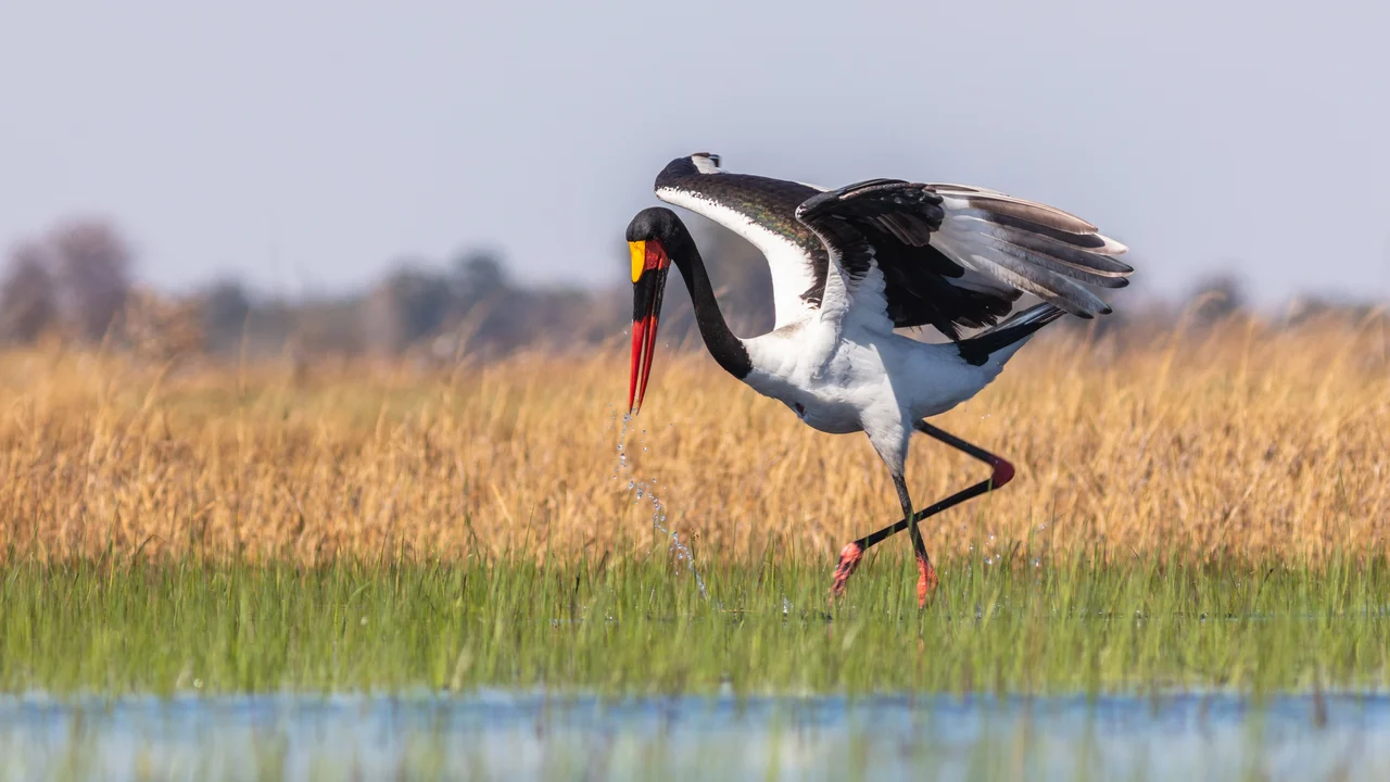
Floodplain ecology is driven by the pulse of the flood and the grass that follows it. Even through the dry season, enough water remains to support grazing African buffalo, wildebeest, elephants, zebras, and giraffes, along with hippopotamus and crocodiles in the permanent channels. The antelope community is what these grasslands are famous for - waterbucks, pukus, elands, and above all the lechwe, a semi-aquatic antelope built for wading and leaping through shallow water. The Bangweulu Swamp is home to the black lechwe, Kobus leche smithermani, whose dark flanks distinguish it from its southern cousins. The Kafue Flats hold vast herds of Kafue lechwe and Burchell's zebra. Tsessebe antelope and the cryptic sitatunga - an antelope so thoroughly adapted to marsh that its splayed hooves are almost useless on dry ground - round out the larger fauna. Saddle-billed storks, one of Africa's most striking waterbirds, hunt across the shallows. Two reptiles are endemic to the ecoregion: the Merara toad (Amietophrynus reesi) in the Kilombero Valley, and the Barotse water snake (Crotaphopeltis barotseensis) in the floodplain that gives it its name.
People on the Edge of Water
The floodplains have been home to communities for centuries, despite the challenges - tsetse fly in the bush, malaria in the wet season, soft ground through much of the year. The Lozi people of the Barotse Floodplain have built an entire cultural system around the rhythm of the flood, including the Kuomboka ceremony that each year moves the Litunga, the Lozi king, from his lowland palace to high ground as the waters rise. The Tonga, who have lived in the Kafue Flats and along the middle Zambezi for generations, developed fishing techniques and cattle-grazing patterns tuned to the seasonal geography. Other communities ring the Okavango, fish Lake Chilwa, farm the edges of Bangweulu. These are the places where the labor of getting a living from the wetland has produced cultures that other places do not have - specialist boat builders, fishermen who read shallow water, women who know the dozens of local wetland plants by use and season.
Under Pressure, Under Protection
The floodplains are mostly unspoilt, but the pressures are real and growing. Poaching targets the larger wildlife. Illegal farming and grazing chip at the edges. Population growth in the surrounding countryside raises demand for water and farmland, and fires are set to clear grassland that then does not recover on the old schedule. Rivers are dammed or diverted. The Kafue Flats have been drastically changed by damming of the Kafue River, which has altered the flood pulse that wetland species depend on; similar projects have been floated for the Okavango. Against these pressures, formal protection has accumulated - the Okavango Delta within the Moremi Game Reserve, Bangweulu's communal management areas, the Moyowosi and Kilombero swamps in Tanzania, the Kafue Flats within Lochinvar and Blue Lagoon National Parks in Zambia, and Lake Chilwa as a Ramsar wetland of international importance. Maun, the safari town at the edge of the Okavango, has grown into a substantial tourism hub - one of the floodplains' success stories, and a demonstration that well-managed wetlands can sustain both wildlife and livelihoods.
From the Air
Zambezian flooded grasslands (scattered ecoregion). Central reference 14.72°S, 29.45°E near Lukanga Swamp, Zambia. Major fragments: Okavango Delta (near Maun/FBMN), Kafue Flats (south of Lusaka/FLKK), Bangweulu Swamp (near Mansa/FLMA), Barotse Floodplain (near Mongu/FLMG). Recommended viewing altitude 10,000-20,000 ft; look for the sharp boundary where wetland gives way to miombo woodland.
Nearby Stories
- Central Zambia 5.9 km away
- Luangwa Bridge 36 km away
- Kabwe Mine 49 km away
- Northern Rhodesia 57 km away
- Central Province, Zambia 60 km away
- Lusaka Province 65 km away
- Luangwa River 114 km away
- Kasanka National Park 223 km away