Luangwa River
In the dry season the river retreats into its bends, and then the hippos become impossible to miss. Hundreds of them, sometimes thousands, pack into isolated pools along what has been called the world's largest concentration of the animal. The Luangwa River is one of Southern Africa's biggest unaltered waterways, meaning no dams interrupt its flood-and-retreat rhythm. That rhythm is everything here. It shapes the valley, the wildlife that crowds its banks each dry winter, and the long emptiness that separates this place from the rest of Zambia.
From the Mafinga Hills
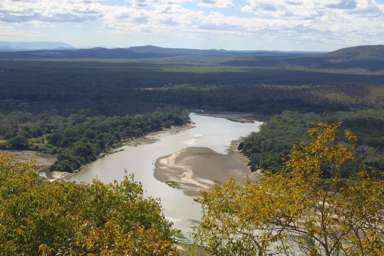
The Luangwa begins at around 1,500 metres in the Lilonda and Mafinga Hills of northeastern Zambia, near the borders of Tanzania and Malawi. It flows southwest through a broad valley, dropping fast. Within 150 kilometres the river has fallen to 690 metres and begun to meander, its floodplain spreading several kilometres wide. Over the next 300 kilometres, the meanders tighten and loosen, carving oxbow lakes and leaving the old curves stranded in the grass. Near the town of Mfuwe the floodplain widens to about 10 kilometres, and the valley itself opens to 100 kilometres across. A 700-metre escarpment, the Muchinga, rises to the northwest; another, 450 metres high, guards the southwest. The river is, in the truest sense, caught between walls.
Where the Hippos Gather
The upper and middle valley holds both North Luangwa and South Luangwa National Parks, and the river sustains them. It carries the largest hippo population in the world, along with dense numbers of crocodiles. In the dry season, when the water shrinks to pools and shallow stretches, the hippos have nowhere to hide. They cluster in the remaining water by the hundreds, surfacing and submerging in a choreography of breath and bulk. At night they climb out to graze, and their dung feeds the fish, the fish feed the birds and crocodiles, and the pools become small engines of life. Leopards hunt the Nsefu sector. Elephants cross the river at familiar fords. Predators and prey alike concentrate near the shrinking water, which is why safari travellers come in the dry months rather than the wet.
Inside a Rift
The Luangwa runs along four-fifths of a rift valley, a southwest branch of the East African Rift that reaches almost to Lusaka. The junction is buried under material spewed out by an ancient volcano, and at least twenty hot springs still bubble up along the escarpments, the kind of signature rifts always leave behind. Millions of years ago there was no way out of this valley. The rift filled with water and became the Madumabisa Lake, rival in size to modern Lake Malawi. It drained southwest toward what is now the Kalahari. Then the geology shifted. A new rift opened to the south, a tributary of the Shire cut backward through the crust, and the captured drainage became the Zambezi. The old lake emptied out, and the Luangwa became the Zambezi's tributary instead of its own contained world.
A Wall That Stays Wild
The combination of steep walls, low population density, and protected parks has kept most of the valley roadless. Between the Lusaka–Kabwe roads in the west and the Isoka-Chisenga road in the north, some 800 kilometres of river has no highway crossing. The lower valley is breached by only one road, the Great East Road at the Luangwa Bridge, just south of where the Luangwa meets the Lunsemfwa. The river becomes the border with Mozambique as it approaches the Zambezi, then slips into the larger river at Luangwa town. Very few humans live in the valley itself. That absence, in a continent where human pressure on rivers is almost everywhere, is what makes this one remarkable. Mfuwe, the valley's main settlement, exists mostly to serve visitors who have come to see what a river looks like when it is still allowed to behave like a river.
From the Air
The Luangwa River valley sits at roughly 15.57°S, 30.39°E in eastern Zambia. From cruising altitude the broad floodplain and its dramatic meanders read as a pale ribbon cutting through darker bush, with the Muchinga Escarpment rising as a clear wall to the northwest. Mfuwe Airport (FLMF) serves South Luangwa National Park; Lusaka's Kenneth Kaunda International (FLKK / FLLS) lies roughly 550 km southwest. Best viewing altitude is 6,000–10,000 feet AGL for valley structure; visibility drops sharply in burning season (August–October) when hazy smoke fills the valley.
Nearby Stories
- Luangwa Bridge 41 km away
- Lower Zambezi National Park 63 km away
- Great Dyke 75 km away
- Zambezian flooded grasslands 79 km away
- Cahora Bassa 97 km away
- Karoi 112 km away
- Tengenenge 114 km away
- Kalemba Rockshelter 177 km away