
Afrikanisches Viertel
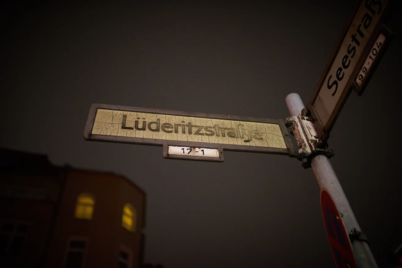
Cornelius Fredericks died on 16 February 1907 in the concentration camp on Shark Island, at the German colonial port of Lüderitz — a place named for the Bremen merchant Adolf Lüderitz. He had been captain of the ǃAman since 1893, had fought a guerrilla campaign alongside Hendrik Witbooi against the German colonial army in South West Africa, and had surrendered on 3 March 1906. He was shipped to the island that September with roughly 1,795 other Nama prisoners. Most of them died there of cold, hunger and neglect; the bodies were buried at low tide and taken by the sea. On 2 December 2022, in a district of Berlin called Wedding, a street called Lüderitzstraße became Cornelius-Fredericks-Straße. It had carried the other name for more than a century.
The Zoo That Was Never Built
The Afrikanisches Viertel exists because of a plan that failed. Before the First World War the animal dealer Carl Hagenbeck — whose Hamburg Tierpark had made him famous — proposed a second park on the sandy ground north of Wedding, on what is now the Volkspark Rehberge. It was to include what the era called a Völkerschau and what we call a human zoo: people brought from Germany's overseas colonies and displayed to paying Berliners alongside the animals. The war stopped the project before anything was built. It did not stop the street names, which had largely been assigned by then, in anticipation of a colonial attraction that never opened. The neighbourhood was named for an exhibition of human beings that was cancelled.
An Atlas of an Empire
Read the street signs and you are reading a gazetteer of German colonial ambition. Kameruner Straße and Togostraße and Ghanastraße and Guineastraße and Senegalstraße and Kongostraße. Windhuker Straße and Swakopmunder Straße and Otawistraße, from German South West Africa. Sansibarstraße, Tangastraße and Usambarastraße, from German East Africa. Sambesistraße and Transvaalstraße and Damarastraße and Dualastraße and Ugandastraße and Mohasistraße. Africa reduced to a residential grid of Berlin, tidy and alphabetised and entirely a German projection. Three streets went further and honoured particular Germans: Adolf Lüderitz, the Bremen merchant whose name the colonial port carried; Carl Peters, the driving force behind German East Africa, recalled by Africans of his day as "mkono wa damu" — the man with blood on his hands — and dismissed from imperial service in 1897 for the killings he ordered of Africans under his authority; and Gustav Nachtigal, the imperial commissioner who raised the German flag over Cameroon and Togo. Those three were the ones people eventually fought over.
The Sign That Did Not Change
The first attempt to deal with Carl Peters shows how these arguments go when nobody wants to have them properly. In 1986 the Petersallee was quietly re-dedicated — not to a different name, but to a different Peters. It would henceforth honour Hans Peters, a jurist who had resisted the Nazis. The sign stayed exactly as it was. The street stayed exactly as it was. Anyone walking down it still walked down Petersallee, and the colonial administrator whose name was on the map remained on the map, now with a legal fiction attached. It took another three decades, and sustained pressure from Black Berliners and postcolonial initiatives who had been raising the question for years, before the district was willing to change the letters.
Four New Names
A jury was formed in 2016. Six candidate names were selected in May 2017, and in April 2018 the district assembly of Mitte made its choices. The signs themselves did not come down until late 2022 for Lüderitzstraße and Nachtigalplatz. Nachtigalplatz became Manga-Bell-Platz, for Rudolf Duala Manga Bell and his wife Emily Engome Dayas: Manga Bell, born in Douala in 1873, spent years from 1910 petitioning the Reichstag against the German plan to expropriate Duala riverside land, citing the treaty of 1884 that the colonial administration was breaking. When the petitions failed he sought support elsewhere in Europe and Africa. He was tried summarily for high treason and hanged on 8 August 1914, alongside Adolf Ngoso Din. Petersallee, the longest and most contested of the three streets, took longer still: it was not actually split until 23 August 2024, nearly two years after the other signs changed — Maji-Maji-Allee, for the rebellion against German rule in East Africa, and Anna-Mungunda-Allee, for Anna Kakurukaze Mungunda, born 1932, a Herero domestic worker in Windhoek. On 10 December 1959, during the Old Location uprising, she is said to have watched her son shot dead; she then poured petrol over a senior administrator's car and set it alight, and was shot herself. Twelve demonstrators were killed that day. She was the only woman among them.
Who Actually Lives Here
For all its symbolism this is an ordinary Berlin quarter, mostly built up in the 1920s and 1930s, hemmed in by Müllerstraße, Seestraße, the Volkspark Rehberge, the Goethepark and the boundary with Reinickendorf. Four apartment blocks on Afrikanische Straße between Sambesistraße and Seestraße were designed by Ludwig Mies van der Rohe and completed in 1927 — social housing, the largest project he had built to that point, and about as far from the Barcelona Pavilion as his career gets. Of Berlin's roughly 20,000 legally registered residents of African heritage, a substantial share live in Wedding and neighbouring Tiergarten, and around 2,500 registered African nationals live in the quarter itself. Which is the plain fact underneath the whole argument about names: for thousands of people, this was never a debate about history. It was the address on their post.
From the Air
The Afrikanisches Viertel occupies roughly 52.554°N, 13.339°E in the north of Wedding, about 5 km north-northwest of the Brandenburg Gate. Best viewed between 1,500 and 2,500 ft. From the air the quarter reads as a block of dense 1920s perimeter housing pinched between two large green spaces: the Volkspark Rehberge and the Goethepark on the west and north, with the open ground of the former Tegel Airport about 3.5 km west — now the Urban Tech Republic development, its distinctive hexagonal terminal still intact. The Berlin Ringbahn passes just south, and Seestraße and Müllerstraße cut the quarter's southern edge on clear diagonals. Berlin Brandenburg (EDDB) lies roughly 24 km south-southeast and its airspace governs the area; Schönhagen (EDAZ) is about 41 km south-southwest. Tegel (formerly EDDT) closed to traffic in 2020 — do not plan on it. Inner-city Berlin airspace is tightly structured; check the TMA and current NOTAMs.
Nearby Stories
- Silvio Gesell 3.3 km away
- Brandenburg an der Havel 9.4 km away
- Gigafactory Berlin-Brandenburg 10 km away
- Sperenberg Airfield 11 km away
- Eberswalde Hoard 13 km away
- Tropical Islands Resort 19 km away
- Wittenberg 38 km away
- Battle of Wittstock 49 km away
Sources
- Afrikanisches Viertel - Wikipedia
- Afrikanisches Viertel - Wikipedia (German, incl. raw wikitext)
- Cornelius Fredericks - Wikipedia
- Manga-Bell-Platz - Wikipedia (German)
- Rudolf Duala Manga Bell - Wikipedia
- Anna Mungunda - Wikipedia
- Carl Peters - Wikipedia
- Carl Peters - Wikipedia (German, Petersallee renaming detail)