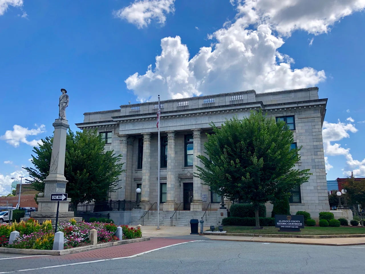

Alamance County, North Carolina
The name is supposedly a Native American word for the blue mud at the bottom of the creeks - though other accounts trace it to a word meaning "noisy river," and still others to the Alamanni region of the Rhineland that some early German settlers had left behind. Alamance County was carved out of Orange County in 1849, but the human history packed into its 434 square miles runs back centuries before that line was drawn. The Sissipahaw lived in the bottomlands along the Haw River. European farmers followed the trading paths in the late 1600s and put their farms on what they called the Haw Old Fields - bottomland the Sissipahaw had already cleared. The railroad came in the 1840s, and a textile boom followed that would shape the county for the next 150 years.
Where the Regulators Lost
On May 16, 1771 - five years before the Declaration of Independence - militia under royal Governor William Tryon crushed the Regulator movement on the banks of Great Alamance Creek. The Regulators were small farmers and frontiersmen who had organized against corrupt local officials and abusive taxation in the colony's western counties. Their defeat at Alamance is sometimes called the first battle of the American Revolution, though historians argue about that label. What is not in dispute is that the creek and the battle gave the county its name when it was finally split off from Orange in 1849. A decade later the place sent its soldiers to a different war - in March 1861 Alamance voted overwhelmingly against secession, 1,114 to 254, but North Carolina seceded anyway, and 236 men from the county would die in the four years that followed.
Wyatt Outlaw and the Kirk-Holden War
In February 1870, Wyatt Outlaw, a Black town commissioner in Graham, was lynched by the Ku Klux Klan and hung from a tree about thirty yards from the courthouse. A note pinned to his chest read "Beware! You guilty parties - both white and black." Outlaw was the president of the Alamance County Union League of America, an organizer for the new Republican Party, and an advocate for Black education. His specific offense, as the Klan saw it, was that Governor William Holden had appointed him a justice of the peace and he had accepted the appointment. In response, Governor Holden declared Alamance County in a state of insurrection on March 7, 1870, and Caswell County on July 8, 1870, and sent state militia under Union veteran George W. Kirk into both counties. Kirk's troops arrested 82 men in what became known as the Kirk-Holden War. An Alamance grand jury indicted 63 klansmen for felonies and 18 for Outlaw's murder. Democrats in the state legislature promptly repealed the law under which the indictments were brought; the charges were dropped; and a national Democratic "amnesty and pardon" program absolved everyone. There was no justice for Wyatt Outlaw. Governor Holden was impeached and removed by the legislature in 1871 for the militia action.
Plaids, Looms, and the Mills
By the 1840s the railroad was being threaded through Alamance as a link between Raleigh and Greensboro, and textile mills were already going up along the creeks. The county became famous for "Alamance plaids" - cheerful checked cottons used in everything from dresses to tablecloths - woven on power looms that were among the first in the South to dye cotton in color. Edwin Holt's mill on Great Alamance Creek was the pioneer; by the early 1900s the Holt family controlled mills across the Piedmont. The town of Burlington grew up around the railroad shops; Burlington Industries became one of the largest textile firms in the world. Then, in the late 20th century, the industry collapsed. The mills closed one by one. The mill villages became neighborhoods, the mill houses became real estate. The county shifted toward distribution, manufacturing for the Research Triangle, and the bedroom-community economy that runs along Interstates 85 and 40 today.
Quakers, Occaneechi, and the 21st Century
The Quaker meeting houses around Snow Camp and Spring Hill are still here, some of them older than the United States. The Occaneechi people, who left the area in the 1670s after disease and conflict pushed them out, returned to North Carolina in the 1780s and settled in Alamance instead of their old ground near Hillsborough. In 2002 the modern Occaneechi tribe bought 25 acres of their ancestral land and began the Homeland Preservation Project - reconstructing a village as it would have been in 1701, alongside a 1930s farming village. Alamance now has a population over 171,000 and is part of the Burlington Metropolitan Statistical Area, itself nested inside the larger Greensboro-Winston-Salem-High Point Combined Statistical Area of about 1.7 million. The county leans Republican but more narrowly than its suburban neighbors; in 2024 it gave Kamala Harris 45.2 percent of the vote, its highest Democratic share since Jimmy Carter carried it in 1976. Three of its sons - Thomas Holt, Kerr Scott, and Bob Scott - became governors. One, Kerr Scott, also went to the U.S. Senate, alongside B. Everett Jordan.
Flight Context
Alamance County is centered roughly at 36.04N, 79.40W, between Greensboro and Chapel Hill in the central Piedmont. From the air the county reads as rolling farmland and pine forest split east-west by Interstates 85 and 40 and north-south by NC 87, with the Haw River winding through the eastern half toward Jordan Lake. The Cane Creek Mountains rise to about 970 feet in the south-central part of the county near Snow Camp. Burlington-Alamance Regional (KBUY) is the local field; Piedmont Triad International (KGSO) is about 18 nm WNW of Burlington, and Raleigh-Durham (KRDU) about 38 nm ENE.
From the Air
County-center coordinates 36.04N, 79.40W; recommended viewing altitude 5,000-8,000 feet AGL to take in the whole county. Visual landmarks: I-85/40 corridor running east-west through Burlington, Graham, and Mebane; the Haw River winding south toward Jordan Lake; the Cane Creek Mountains rising near Snow Camp; the old mill villages along Great Alamance Creek. Nearest airports: Burlington-Alamance Regional (KBUY) in the county itself; Piedmont Triad International (KGSO) ~18 nm WNW; Raleigh-Durham (KRDU) ~38 nm ENE; Horace Williams (KIGX) at Chapel Hill ~22 nm E.
Nearby Stories
- William B. Umstead State Park 0.9 km away
- Battle of Guilford Court House 3.7 km away
- Caswell County, North Carolina 6.5 km away
- Granville County, North Carolina 21 km away
- North Carolina Aviation Museum 25 km away
- Martinsville Speedway 28 km away
- Deep River Camelback Truss Bridge 32 km away
- Staunton River State Park 35 km away