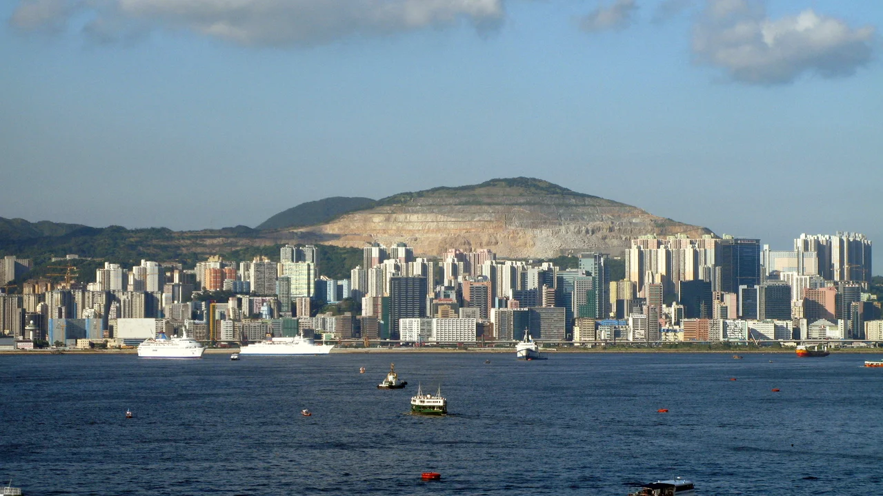

Beacon Hill (Hong Kong)
The hill got its name from soldiers enforcing a forced evacuation. Between 1661 and 1669, the Qing dynasty ordered every civilian out of the coastal areas of Kowloon — a sweeping decree known as the Great Clearance — to starve out the last loyalists of the fallen Ming. Military garrisons occupied strategic high ground across the peninsula, and the positions they held became known as beacons. The name stuck to this 457-metre rise long after the Ming cause was lost, long after the dynasty that replaced it was itself overthrown, long after Kowloon became part of a British colony and then part of the People's Republic. History accumulates on high ground.
A Dynasty's Last Signal Fires
The Great Clearance was one of the most violent demographic upheavals in South China's history. The Qing emperor, alarmed by coastal resistance movements still fighting in the name of the defeated Ming, ordered entire communities to abandon their homes and move inland, beyond a clearly demarcated coastal zone. Fishing villages were razed. Fields went unplanted. The population of the Kowloon peninsula shrank to almost nothing. On the higher ground, Qing soldiers maintained watchtowers and signal fires — beacons — to monitor the coast for Ming loyalist ships and to communicate between garrisons. The hill that overlooked northern Kowloon from a height of 457 metres was ideal for exactly this purpose. It commanded views across the bay, over the low-lying land stretching toward what would eventually become one of the most densely populated places on earth. The evacuation policy was eventually rescinded as the Ming resistance crumbled, but the garrison's memory persisted in the hill's name.
The 71st-Highest Hill in Hong Kong
Hong Kong counts its hills meticulously — a legacy of the terrain's significance for navigation, defense, and development. Beacon Hill ranks 71st in that long tally, which feels like a minor distinction until you stand on Kowloon's flat, built-over lowlands and look up at its mass. At 457 metres, it is tall enough to catch cloud and funnel mist down its northern face. The hill sits within Lion Rock Country Park, the green belt that runs along the spine of the Kowloon hills and provides one of the few meaningful barriers between the relentless urban grid below and the sky above. The park's boundaries protect the terrain from development, preserving the steep wooded slopes that make the hill a genuine wilderness just minutes from some of the most crowded streets in Asia.
What Lives on the Summit
At the top of Beacon Hill, out of sight to casual hikers, stands equipment belonging to the Hong Kong Civil Aviation Department. The installation is secured and closed to the public — it serves a practical modern purpose in a city whose airspace is extraordinarily congested. The irony is quiet but real: the same elevation that once allowed soldiers to signal with fire now helps manage the invisible corridors through which hundreds of aircraft move each day. The summit's restricted status means relatively few people see the view from the top, though the hill's trails through Lion Rock Country Park draw hikers who get most of the way there. The MacLehose Trail — Hong Kong's most celebrated long-distance walking route — passes through this landscape, threading between the peaks.
Granite, Ecology, and a Special Designation
The steep northern face of Beacon Hill has a formal scientific status that most visitors never know about. In 1979, the government designated this slope, together with a valley to the northeast of nearby Eagle's Nest, as a Site of Special Scientific Interest — a total area of 53.2 hectares. Such designations in Hong Kong are not given lightly; they reflect recognized ecological or geological significance. The terrain here is rugged granite, shaped by millennia of weathering into the kind of rocky, broken landscape that supports distinctive plant communities and provides habitat for wildlife pushed out of the lowlands by urbanization. The designation does not make the area accessible — it makes it protected. In a city where every flat surface has long since been claimed and built upon, a protected hill face counts as something close to a miracle of restraint.
From the Air
Beacon Hill sits at 22.3497°N, 114.1700°E, rising to 457 metres (1,499 ft) above the northern Kowloon peninsula. When approaching Hong Kong from the north or northwest, the Kowloon hills — including Beacon Hill and the adjacent Lion Rock — form a recognizable ridge running roughly east-west. The nearest major airport is Hong Kong International Airport (VHHH) on Lantau Island, approximately 25 km to the west-southwest. Recommended viewing altitude for the hill and surrounding Lion Rock Country Park is 600–800 metres MSL on a clear day. Kai Tak, the city's former airport whose checkerboard approach once threaded between these very hills, closed in 1998; its site is now a cruise terminal and development zone visible just southeast of the Kowloon hill line.
Nearby Stories
- Chapel of St. Francis Xavier 3.5 km away
- Cuiheng 4.1 km away
- 2015 Shenzhen Landslide 16 km away
- Shunde 31 km away
- Wanshan Archipelago 37 km away
- Nanxiong Formation 96 km away
- Heyuan 149 km away
- Checheng Fu'an Temple 629 km away