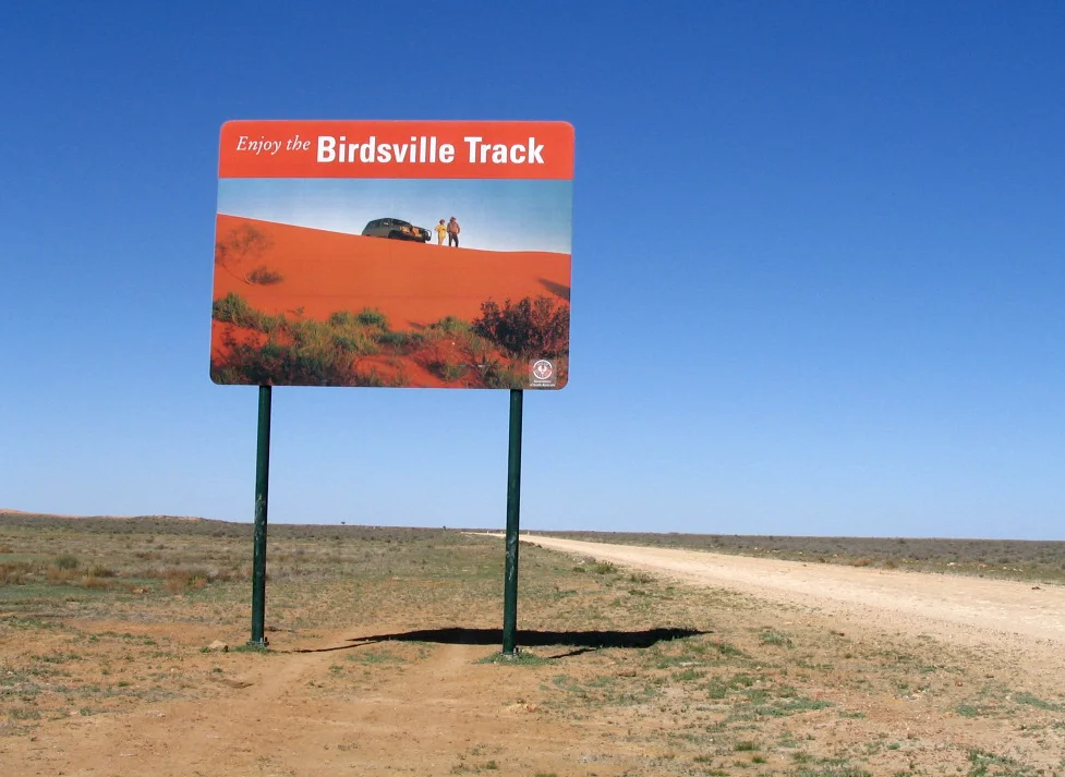

Birdsville Track
On New Year's Day, 1964, a charter pilot flying over the dry Coocherapoonie waterhole spotted five bodies lying beneath a coolibah tree. The Page family had left Marree just before Christmas, bound for Birdsville in a heatwave, and lost the track. Their car was found abandoned with a note: out of petrol, walking south. They never made it. The Birdsville Track has always demanded respect, and for more than 150 years it has not always granted mercy. Running roughly 520 kilometres between Marree in north-eastern South Australia and Birdsville in far-western Queensland, it threads a corridor between three deserts: the Strzelecki, the Sturt Stony, and the Tirari. This is some of the driest country on the continent.
A Road Made by Hooves
The track was never built so much as worn. In the 1860s, drovers began walking cattle south from the stations of northern Queensland and the Northern Territory toward the nearest railhead, where the herds could be loaded and sent to market. The pioneering drover credited with opening the route was Percy Burt. For decades, only stock and the strings of Afghan-led camel trains travelled it. The land offered little: average annual rainfall here is under 100 millimetres, and the bores that made droving possible drew bitter, mineral-laden water from deep beneath the Great Artesian Basin. To move a mob of cattle down this corridor was to gamble against thirst, heat, and distance, with the railhead at Marree as the prize at the southern end.
The Mailman
Esmond Gerald Kruse, known to everyone as Tom, turned the Birdsville Track into something close to myth. From the 1930s, Kruse hauled mail, fuel, food, and medicine from Marree to Birdsville and back, nursing a battered 1936 Leyland Badger truck through bulldust, flooded crossings, and drifting sand. When the truck bogged, he dug; when it broke down, he improvised. His fortnightly run was a lifeline for the scattered stations along the route. In 1954, filmmaker John Heyer captured Kruse and the track in the documentary The Back of Beyond, made for the Shell Film Unit, and the mailman became a national folk hero. Kruse, later appointed MBE and named an Australian Geographic Outback Legend, made his last regular mail run in 1957. He died in 2011, aged 96.
Crossing It Today
The Birdsville Track is now a graded dirt road, and in a dry season a well-prepared traveller in a sturdy vehicle can drive its length in a day. Cattle trucks still rumble along it, and tourists chase the romance of the outback. But the desert has not been tamed. Flash floods can wash whole sections away, sand drifts across the surface, and after rain the clay turns to grease. Roughly halfway along, at Mungeranie, a roadhouse and hotel offer fuel, cold beer, and a hot spring-fed pool, 204 kilometres from Marree and 313 from Birdsville. It is the only reliable refuge on the route. During the COVID-19 pandemic, the track saw a surge of traffic from drivers avoiding New South Wales quarantine, earning it the nickname the 'COVID highway.'
The Weight of the Distance
What makes the Birdsville Track unforgettable is not scenery in the conventional sense. There are no peaks, no waterfalls. There is space, more of it than most people ever stand inside. The gibber plains of the Sturt Stony Desert stretch in every direction, a pavement of wind-polished stones glinting under a sky that swallows sound. At night the silence is total and the stars are merciless in their brilliance. The Page family memorial, marked at last by a headstone erected by relatives in 2010, sits beside the road as a quiet reminder. People come for the legend of Tom Kruse and the thrill of the crossing. They leave understanding why the old drovers spoke of this country with caution, and why those who know it never take a single bore, a single tank of fuel, for granted.
From the Air
The Birdsville Track runs roughly north-south between Marree (29.65 degrees S, 138.07 degrees E) and Birdsville, Queensland (25.90 degrees S, 139.35 degrees E). From altitude, the track appears as a thin pale scar cutting across the gibber plains and red dunefields, with the white expanse of Lake Eyre visible to the west and Lake Frome to the south-east. Best viewed at 3,000 to 6,500 feet AGL in the clear, stable air typical of the region. The nearest airfields are Marree Airport (YMRE) at the southern end and Birdsville Airport (YBDV) at the northern end; Mungeranie Airstrip lies near the midpoint. Visibility is often exceptional, but watch for dust, heat haze, and sudden thunderstorm activity in summer, which can flood the track and reduce ground visibility.
Nearby Stories
- Ediacara Hills 31 km away
- Farina railway station 34 km away
- Anna Creek Station 58 km away
- Lake Eyre 82 km away
- Killalpaninna Mission 84 km away
- Olympic Dam mine 85 km away
- Arkaroola 92 km away
- Strangways Springs 100 km away