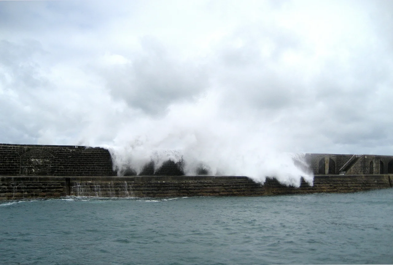

Braye Harbour
When the Admiralty laid out plans in the 1840s for what would become Braye Harbour, they meant for two stone arms to enclose the bay - matching breakwaters to shelter a Royal Navy fleet poised against the French Navy across the Channel. Only one arm got built. By the time relations with France warmed enough to make the eastern arm seem unnecessary, the western breakwater was already 4,827 feet long, the longest single-stone structure of its kind in the British Isles. Within a year of construction stopping in 1864, the sea took back 1,780 feet of it. What remains today is roughly 3,000 feet of stone walking out into the Swinge, and it still spends much of its life being repaired.
An Artificial Harbour in an Unforgiving Sea
Braye sits on the north coast of Alderney facing out into the Swinge, the tidal corridor between Alderney and the Casquets rocks where currents can run over six knots on springs. Before the breakwater, Braye Bay was simply a bay - sheltered enough on calm days, terrifying in winter. The pier extending east from the western side of the bay turned the bay into a harbour in 1859, when the artificial works were formally completed. The Hydrographic Office prescribed how ships should enter: two red leading lights at the head of the harbour, one set 25 feet above high water on a parapet wall, the other 55 feet up at the north-east corner about 370 yards away. Line them up and you had your fairway. Today five fairway buoys mark the channel - flashing green and red sequences down to the Commercial Quay and Little Crabby Harbour.
The Breakwater the Sea Will Not Leave Alone
Construction ran from 1847 to 1864. The single completed arm gives only partial protection: storms still drive heavy swells around its tip and into the anchorage, and big seas regularly scour out fresh damage that has to be patched the following season. Funding for that endless maintenance has been a small political story in itself. The UK paid for it until the 1980s, then handed responsibility to Guernsey in lieu of defence payments owed under the Bailiwick's status as a Crown Dependency. Walk the breakwater on a calm day and you can see why the structure became a paradox - a 19th-century military project that found its real purpose as the islanders' favourite seaside promenade. It is a walkway now, scenic and slightly perilous. It is also the only reason a freighter can tie up at Braye.
The Boom Across the Mouth
During the German occupation of Alderney from 1940 to 1945, the Wehrmacht treated Braye as a strategic chokepoint. They stretched a boom across the harbour entrance and worked a Luftwaffe rescue buoy into the chain - the same kind of yellow steel float-shelter that the German air-sea rescue service planted in the Channel for downed pilots to climb into. The civilian population had been evacuated before the occupation began. Braye became a military port, supplied by the sea route between Cherbourg and Saint Malo. The fortifications that defended the harbour are still visible from the water - concrete bunkers stitched into the cliffs around Fort Albert and the Mannez peninsula. They were part of the most heavily fortified section of Hitler's Atlantic Wall.
Tides, Anchor, Arrival
Modern Braye does what Victorian Braye was built to do, just smaller. Most of the island's freight comes in here. Container vessels berth at the Commercial Quay - on one recent occasion, two large containers came in simultaneously, with the Huelin Dispatch the largest yet. The anchorage in the middle of the bay is firm sand, with rockier ground nearer the entrance. The harbour dries at low water neaps, so the right time to enter is on a rising tide; spring tides can run a 6.9-metre range, big enough that the same berth at high water and low water can look like two different places. Saint Anne, the island capital, sits about a mile inland on the high plateau. Braye is functionally its harbour suburb - the place where the island meets its supply chain, and where, every now and then, a yacht crew steps off the breakwater knowing they just crossed one of the meanest stretches of tidal water in the Channel.
From the Air
Braye Harbour is on the north coast of Alderney at 49.725°N, 2.202°W. From cruise altitude the long stone breakwater is unmistakable - a single straight arm reaching northeast into the Swinge from the western edge of the bay. Alderney Airport (EGJA) is 1.5 nm southwest. Best low-altitude approach is from the east, descending past Fort Albert. Nearby airports: Guernsey (EGJB) 19 nm south, Cherbourg-Maupertus (LFRC) 23 nm east. The tidal race in the Swinge often shows from the air as broken, streaked water even on calm days.
Nearby Stories
- 1993 Cherbourg Incident 6.2 km away
- Channel Islands 7.4 km away
- Abbey of Saint-Sauveur-le-Vicomte 17 km away
- German Submarine U-672 21 km away
- HMS Formidable (1898) 38 km away
- HMS Affray 57 km away
- Needles Lighthouse 83 km away
- HMS Brisk (1851) 251 km away