
Bribie Island Second World War Fortifications
Push through the lantana behind the dunes at the northern end of Bribie Island and the war rises out of the scrub. A two-storey concrete gun emplacement, curved and open to the sea, still wears flecks of its original camouflage paint. On an interior wall, the faint marks of a duty roster survive where some forgotten gunner chalked the watch. A searchlight tower that once stood safely behind the first dune now sits stranded on the open beach, reachable by the high tide. This was Fort Bribie -- and it was built in a hurry, in fear, to stop an invasion that everyone in Queensland believed was coming.
The Doorway to Brisbane
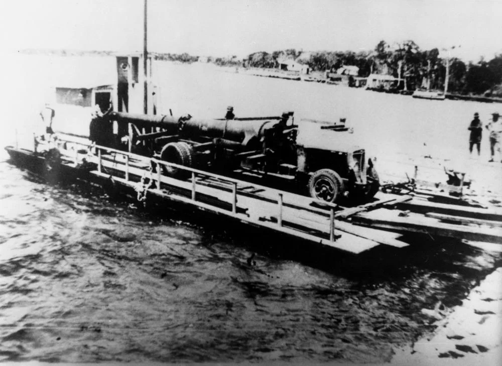
Bribie's northern tip guards the North West Channel, the deep-water entrance that ships used to reach the Port of Brisbane. From 1939 the army began fortifying it, and the work accelerated sharply after a terrible season. In December 1941 the Japanese struck Pearl Harbor, Malaya, Hong Kong, and Singapore in quick succession; in July 1942 they captured Kokoda in the Australian Territory of Papua, advancing to within striking distance of Port Moresby. Fear became concrete, literally. Fort Bribie's emplacements, costing about 55,000 pounds, were nearly finished by April 1942, mounting two six-inch guns that had once armed a First World War cruiser. Together with the forts on Moreton Island and the older works at Fort Lytton, Bribie formed one link in a ring of batteries thrown around the bay -- a coordinated wall of guns watching the only sea road into the city.
Listening for Submarines
The guns were only part of the system. Down at the waterline, the Royal Australian Navy ran a pair of squat concrete mine-control huts, now mostly swallowed by the first dune. Inside them, operators watched indicator loops -- long cables of wire laid across the channel floor. A submarine, or any large mass of metal moving overhead, would acquire a faint magnetic field and induce a current in the cable, betraying its passage. If a contact crossed a guard loop, the operator waited for a second swing on a mine loop, then sent a charge down the wire to detonate the mines below. It was patient, invisible work, conducted in the dark while the guns waited above. When the war ended and the bay's mines were recovered, six could not be found. One turned up at Tewantin in 1945.
What the Sand Keeps
Three groups of structures remain: Fort Bribie in the north, the Skirmish Point Battery near Woorim in the south, and the naval station between them. Erosion has been merciless. At Skirmish Point, the sea has taken almost everything -- the gun emplacements, the command post, the searchlights -- leaving a single observation post that has toppled onto its side in the sand. At Fort Bribie, eight reinforced concrete structures survive among the camp's ghostly foundations: slabs where the officers' mess and kitchen stood, the smashed remains of the latrines, a flagpole base. A second gun emplacement, gutted by fire, has collapsed in on itself. Graffiti now covers walls that once held secrets. The decay is part of the place's strange power; the heritage listing itself praises the isolation and the sense of discovery the overgrown ruins create.
A Fort Set Adrift
Listed on the Queensland Heritage Register in 1993, the fortifications are valued as some of the best-surviving examples of Australia's Second World War coastal defences. But the same sand that built Bribie cannot hold them. The northern dunes shift and the tides gnaw, so that structures no longer sit where their builders placed them; some now stand in the surf they were meant to command from cover. In December 2020 a king tide breached the island's northern tip, and on 2 January 2022 ex-Cyclone Seth tore a 200-metre passage clean through the spit. The fort that once guarded the channel is itself being separated from the island, foot by foot, by the sea it was built to watch.
From the Air
The Bribie Island Second World War Fortifications lie along the eastern, ocean-facing shore of Bribie Island, with Fort Bribie at the northern tip near approximately 26.86S, 153.12E and the Skirmish Point Battery further south near Woorim. From the air, Bribie reads as a long, thin north-south sand island about 35nm north of Brisbane, separated from the mainland by the narrow Pumicestone Passage. The northern fort sits behind the foredune amid scrub and is hard to pick out, though the recent breakthrough channel severing the northern spit is a clear marker, and the structures face the North West Channel into Moreton Bay. Moreton Island lies to the south-east and Caloundra to the north. Nearest airports: Caloundra (YCDR) approximately 8nm north-west, Caboolture (YCAB) approximately 18nm south-west, Brisbane (YBBN) approximately 32nm south. Watch for sea breezes and summer afternoon cloud along the coast.
Nearby Stories
- Abbey Museum of Art and Archaeology 8.2 km away
- Noosa National Park 18 km away
- Cressbrook Homestead 33 km away
- 2010-2011 Queensland Floods 68 km away
- Childers Palace Backpackers Hostel fire 148 km away
- Cape Byron 174 km away
- Cape Byron Light 204 km away
- HMS Porpoise (1799) 514 km away