
Carshalton
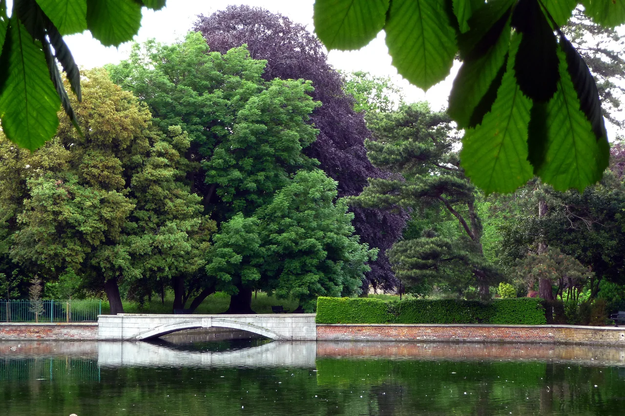
Two ponds sit in the middle of the village, fed by the chalk springs that gave Carshalton its name and its purpose. The River Wandle rises here, in the cup of land below All Saints Church, and the water that surfaces in the high street is the same water that runs north through the borough on its way to the Thames. The A232 thunders past the ponds, and yet you can stand on the wall above them and feel that you are not in London at all but in a slightly older country, where the village happens to be visited by buses.
Aultone, Domesday
When the Domesday surveyors wrote the village down in 1086 they called it Aultone, and noted that Geoffrey de Mandeville held three and a half hides, a church, ten ploughs, a mill, twenty-two acres of meadow and woodland sufficient for two hogs. Before the Conquest, five Saxon freemen had held five manors here. The springs that fed the mill have never stopped flowing. The 12th-century work in All Saints Church on the south side of the ponds — its tower thought to predate the Norman Conquest — sits on a site that has held a church since at least Norman times and very probably much longer. Just outside the churchyard wall, a spring rises that locals call Anne Boleyn's Well. The story is that her horse kicked a stone and the water appeared. The likelier explanation is duller: 'Boleyn' is a corruption of 'Boulogne', because the Counts of Boulogne owned this land in the twelfth century.
The Lavender Capital
From the eighteenth century until the early twentieth, the chalky free-draining soil of the North Downs made this corner of Surrey the centre of the world's lavender production. The Daily News reported in 1914 that blue fields stretched across Mitcham, Croydon, Wallington, Banstead, Carshalton and Sutton — an industrial-scale perfumed landscape, harvested for oils that supplied chemists across Britain and exporters as far as France. The fields are mostly gone. Houses replaced them. But two survive: a three-acre community-managed plot at Oaks Way, and a 25-acre commercial field called Mayfield at Croydon Lane, where in July the air still carries that astringent sweetness across half a mile and tourists come to walk the rows.
The Water Tower and the Bagnio
On the grounds of what is now St Philomena's School stands one of the strangest buildings in south London: a Grade II* listed Water Tower built in the early eighteenth century to pump water to Carshalton House. It is also an orangery, a saloon, and a bathroom. The bathroom — the 'Bagnio', from the Italian for bath house — still has its original Delft tiles, blue and white, set into a small chamber where the owner of a grand house could take what was then a startlingly modern fashion: a properly heated bath. The Folly Bridge in the garden, the eighteenth-century Hermitage that was restored in the 1990s, the eccentric mixture of practical machinery and aristocratic pleasure — all of it survives because someone in every generation has decided it should.
Honeywood and the Wandle
On the western edge of Carshalton Ponds stands Honeywood, a Grade II listed house whose seventeenth-century flint-and-chalk chequer fabric is hidden behind an Edwardian wing added between 1896 and 1903 by a London merchant named John Pattinson Kirk. It is now the Sutton borough museum, a tea room and a shop sit inside, and the refurbishment of 2012 brought in expanded displays on the Wandle itself — the river whose chalk-stream clarity once powered gunpowder mills, snuff mills, calico print works, and the watercress beds whose green carpets carpeted the floodplain between here and Mitcham. The Wandle was, by industrial standards, an astonishingly productive small river. It has been pulled back from near-death in the late twentieth century by volunteers, and brown trout now run in stretches that used to be dead.
The Names a Village Keeps
Carshalton produced its share of people who outgrew it. John Major, who became Conservative Prime Minister in 1990, spent part of his upbringing here. Cliff Richard attended Stanley Park Junior School. The artist Pauline Boty, one of the founders of British Pop Art, came from these streets. Three members of the glam-rock band Mud — Les Gray, Rob Davis, Dave Mount — grew up locally; the DJ Carl Cox spent his early years here too. The Olympic gold medallist Joanna Rowsell Shand was raised in the village. And tucked into the list is the more troubling fact that Mark Bridger, who murdered five-year-old April Jones in 2012 and is serving a whole-life order, also came from here — a reminder that village histories include everything, not just what we want to commemorate.
Bank Holiday Carshalton
On the August bank holiday Monday, Carshalton Park fills with 10,000 people for the Environmental Fair: a hundred stalls, three music stages, an open-air amphitheatre in what used to be the Hog Pit Pond, real ale and farmers' produce and folk and rock and poetry. Around Guy Fawkes the village stages charity fireworks. In July there's the Lavender harvest weekend. In November the Carshalton Charter Fair. The village manages to be both quietly residential and continuously festive, in the way that English places sometimes still can be when the planning department hasn't yet caught up with what made them worth living in.
From the Air
Carshalton sits at 51.37N, 0.17W, about nine and a half miles southwest of Charing Cross, in the valley of the Wandle. Biggin Hill (EGKB) lies about ten nautical miles east; Gatwick (EGKK) is further south. Heathrow (EGLL) is northwest, London City (EGLC) northeast. From the air the ponds in the village centre, the open green of Grove Park, and the lavender fields at Mayfield (depending on season) make orientation straightforward. Recommended viewing altitude 1,500-2,500 ft AGL — Carshalton Beeches railway station and the chalk uplands south of the village are clear visual references.
Nearby Stories
- Battle of Britain, Northfleet 1.1 km away
- Bayham Old Abbey 5.4 km away
- Catharine Macaulay 6.4 km away
- Hatfield rail crash 8.8 km away
- Chequers 8.9 km away
- Chelmsford Cathedral 10 km away
- Queen Victoria Hospital 13 km away
- Fishbourne Roman Palace 36 km away