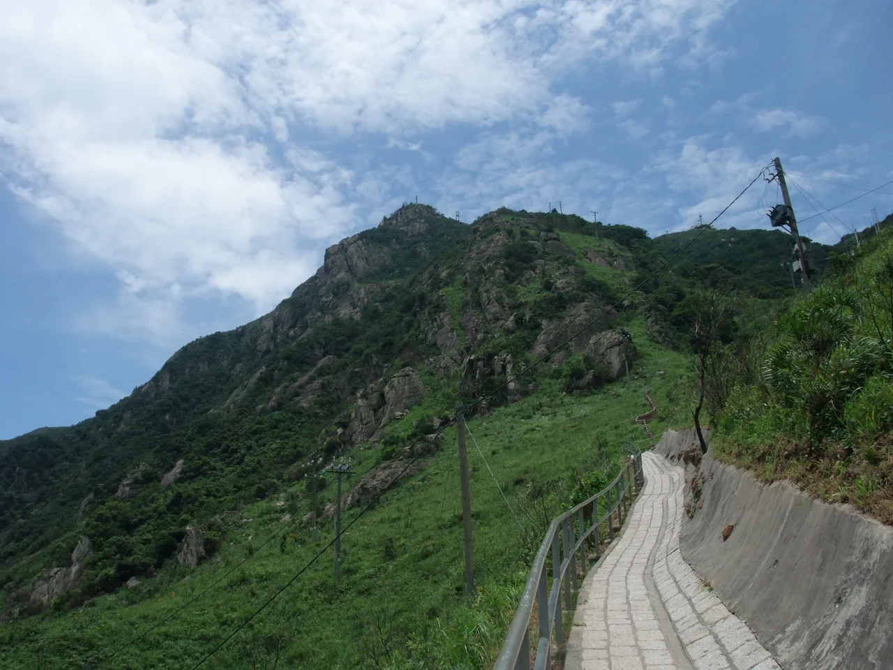

Castle Peak (Hong Kong)
The mountain has a name that means green hill in Chinese and another that refers to a castle that never existed. Tsing Shan — the green hill — stands 583 metres above the western New Territories, and in direct contradiction to its name, it is notorious for the severe loss of vegetation from its granite surface. The irony is baked into the landscape: a hill called green that is mostly bare rock, a summit called castle that has no fortification, a peak whose other name, Pui To Shan, belongs to a Buddhist monk who, according to legend, crossed the sea in a cup.
The Monk Who Crossed the Sea in a Cup
The name Pui To Shan derives from Pui To Sim Shi, a Buddhist monk whose story has been carried in Cantonese memory for centuries. In the Cantonese reading of his name, Pui means cup, To means water-crossing, and Sim Shi means Monk of Zen. The legend holds that he traveled across the water — miraculously, improbably, in a cup — and arrived at this peak. He climbed the hill and established a monastery on its slopes. That monastery became the Tsing Shan Monastery, which still stands today. Early records suggest the peak itself was once an island, known as Tuen Mun Island, and that its former channel with the neighboring Kau Keng Shan formed part of an important sea route through South China. Defense structures were built on both hills. The monk's improbable arrival by cup feels like exactly the kind of story that accumulates around a place that has always mattered.
The Granite Mountain That Sheds Its Skin
Castle Peak is the highest granitic hill in Hong Kong — a distinction that carries geological weight. Granite weathers differently from other rock types. It fractures along joints and exfoliates in sheets, shedding surface layers over time, which is exactly what has happened here. The severe loss of vegetation on the slopes is both cause and consequence of this process: without deep soil and plant cover to anchor the surface, erosion accelerates; erosion removes the material that soil needs to form. The result is a triangular peak — visually striking, almost geometric — with two companion summits to its north and south, at 539 metres and 517 metres respectively. From below, in Tuen Mun, the hill presents as a classic sharp peak. From the air, the bare granite surfaces catch light differently from the surrounding vegetated hills, making Castle Peak immediately identifiable.
Military Territory in the Hinterland
Below the summit, the hinterland of Castle Peak carries its own complicated status. Much of this rocky terrain is a designated firing range used by the People's Liberation Army and Hong Kong police forces — the Tsing Shan Firing Range. Warnings are issued before live exercises. The range is sometimes open to the public, but access requires checking Hong Kong Government press releases, typically published one week before each month's schedule. Generally, weekends and public holidays are open days. Within this restricted hinterland, sub-peaks including Kon Shan and Por Lo Shan attract hikers who compare the terrain to a miniature Grand Canyon — broken, layered, dramatic in a way that surprises people expecting soft Hong Kong countryside. The summit itself is not part of the firing range and is accessible daily, though certain routes from the north and west may be closed on exercise days.
One of the Three Sharp Peaks
Hong Kong's hiking community designates Castle Peak as one of the territory's Three Sharp Peaks — a distinction based not just on elevation but on the character of the ascent. The hike from Yeung Tsing Road in Tuen Mun, beginning just past the Tsing Shan Monastery sign, is essentially a staircase: a series of steps that climbs relentlessly to the 583-metre summit. The straightforward route is exactly that — up the stairs, then back down. But there are options into the hinterland that are steep, slippery, and should not be underestimated. At the top, on a clear day, the view extends across Tuen Mun and Castle Peak Bay to Lantau Island and the airport beyond. The same route the monk — if the legend is taken seriously — might have climbed after his crossing, a journey that ended in the founding of a monastery that has outlasted every dynasty that once claimed to govern this part of the world.
From the Air
Castle Peak (Tsing Shan / Pui To Shan) sits at 22.3833°N, 113.9500°E, rising to 583 metres (1,913 ft) at the western edge of the New Territories above Tuen Mun. Its bare granite summit is a distinctive navigation reference visible from a wide arc. Hong Kong International Airport (VHHH) on Lantau Island is approximately 12 km to the southeast; aircraft departing or arriving from the west often pass within visual range of the peak. Castle Peak Bay, immediately to the east of the summit, provides clear depth reference from altitude. The Tsing Shan Monastery is visible on the lower southwestern slopes. Recommended viewing altitude: 700–900 metres MSL to appreciate the triangular profile, the bare granite upper slopes, and the contrast with the urban Tuen Mun district below.
Nearby Stories
- Chapel of St. Francis Xavier 3.5 km away
- Cuiheng 4.1 km away
- 2015 Shenzhen Landslide 16 km away
- Shunde 31 km away
- Wanshan Archipelago 37 km away
- Nanxiong Formation 96 km away
- Heyuan 149 km away
- Checheng Fu'an Temple 629 km away