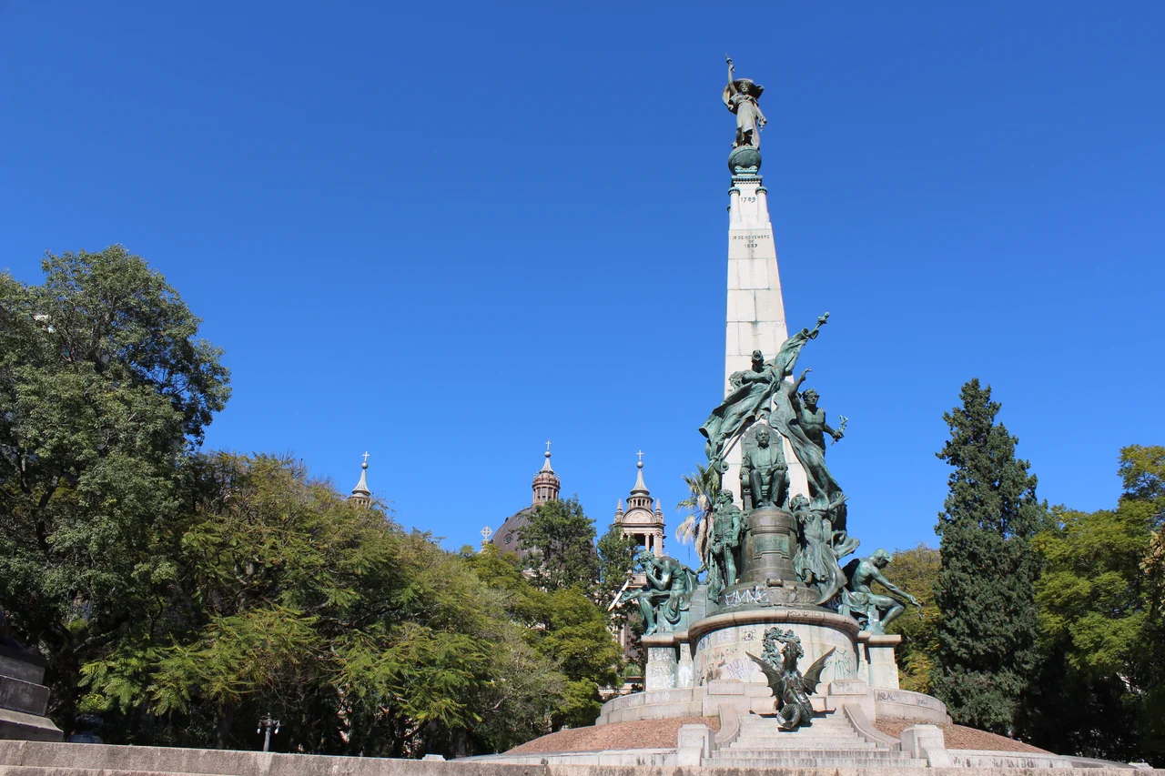

Centro Histórico, Porto Alegre
It started with a chapel made of mud and three hundred strangers from a chain of Atlantic islands. In January 1752, settlers from the Azores stepped off their boats onto a narrow peninsula jutting into Lake Guaíba, sent by the Portuguese crown to anchor the empire's southern edge. The tiny chapel of São Francisco das Chagas, raised a few years earlier, gave the cluster of houses a center to grow around. Nearly three centuries later, that same peninsula is the Centro Histórico of Porto Alegre, the oldest urbanized ground in the city and the stage on which the entire history of Rio Grande do Sul's capital has played out.
The Azorean Foundation
The settlement began informally around 1732, when a few families put down roots along the shore where the Rua da Praia promenade now runs. The deliberate colonization came two decades later. In 1750 the crown ordered Azorean couples sent south, and in 1751 sixty families, roughly three hundred people, were chosen for the journey. They arrived in January 1752, and surveyors marked off 141 hectares across the peninsula for a proper town. By 1774 the settlers had built the War Arsenal, the first Mother Church, and the Governor's Palace, and four years later they ringed the landward side with fortifications. Shipyards along the water were already building vessels to order for distant Rio de Janeiro.
A City Built on Reclaimed Water
Fortifications hemmed the center during the Ragamuffin War, and only after the rebellion ended in 1845 did the urban fabric break free and expand. The port had become the throat through which people and goods passed across the whole province, and the city began literally manufacturing new land, pushing successive landfills out into the lake. Fountains, modern street lighting, new cemeteries, a jail, a town hall, the São Pedro opera house, and an enlarged public market followed in quick succession. The peninsula was no longer just a foothold on the frontier. It was becoming a capital, and it was making room for itself one reclaimed meter at a time.
The Golden Age of Façades
From the late nineteenth century to the mid-1930s, Porto Alegre lived its architectural golden age. A prosperous German immigrant community set the taste, and the eclectic style it favored spread quickly among the elite raising new palaces. Three names recur on the grandest of them: the architect Theodor Wiederspahn, the engineer Rudolf Ahrons, and the decorator João Vicente Friedrichs, all of German origin, who together shaped the Piratini Palace, the Municipal Palace, the Public Library, and the Post Office. Their façades carried ethical and political symbolism in their allegorical sculpture. Rua da Praia became the elegant catwalk of the city, lined with cafés, patisseries, cinemas, and the unhurried theater of people seeing and being seen.
Decline, and the Long Argument Over Renewal
The 1950s were the peak; what came after was harder. In the second half of the twentieth century the center slid into decay, with population flight, deteriorating buildings, and crowded streets. Under the mayor Thompson Flores, who took office in 1969 amid the boom years of the Brazilian Miracle, the city threw up large viaducts, and in that zeal numerous old buildings of real historical worth simply disappeared. The physiognomy of the center was impoverished. Ever since, the Centro Histórico has been the subject of one revitalization plan after another, some of them genuinely successful, many still unresolved and surrounded by controversy. It remains, as it has always been, a place that argues with itself about what to keep.
What to Find There Now
For all its struggles, the district still holds an astonishing concentration of landmarks. The Praça da Matriz gathers the Metropolitan Cathedral, the Piratini Palace, the São Pedro Theatre, and the Casa da Junta around a single civic square. Down by the water stand the Public Market, the iron-and-stone bulk of the Gasômetro power station, and the Praça da Alfândega with the Rio Grande do Sul Museum of Art. The Casa de Cultura Mario Quintana, the State Public Library, and the buildings of the Federal University round out a neighborhood where, within a few blocks, you can trace every architectural phase the city has passed through since those Azorean families first came ashore.
From the Air
The Centro Histórico occupies the peninsula at roughly 30.0306 degrees south, 51.2280 degrees west, on the eastern shore of Lake Guaíba in Porto Alegre. From the air the district is unmistakable: a dense knot of high-rises and red-roofed historic blocks wrapped on three sides by the wide, pale water of the Guaíba, with the Gasômetro chimney marking the southwestern tip. The neighborhood spans about 228 hectares and is bounded by the lake and the surrounding districts of Cidade Baixa, Farroupilha, Bom Fim, Independência, Floresta, and Praia de Belas. The nearest field is Salgado Filho International Airport (ICAO SBPA), about six nautical miles to the north-northeast, with Canoas Air Base (SBCO) farther north. Recommended viewing altitude is 2,000 to 3,500 feet AGL to take in the full peninsula and waterfront. The clear, dry skies of the southern Brazilian autumn and winter give the best visibility across the lake.
Nearby Stories
- Itapuã State Park 22 km away
- Nova Petrópolis 37 km away
- Aparados da Serra National Park 77 km away
- Santa Cruz do Sul 77 km away
- Serra Geral National Park 111 km away
- 2009 Brasil de Pelotas Bus Disaster 161 km away
- Passo Fundo 176 km away
- Battle of the River Plate 446 km away