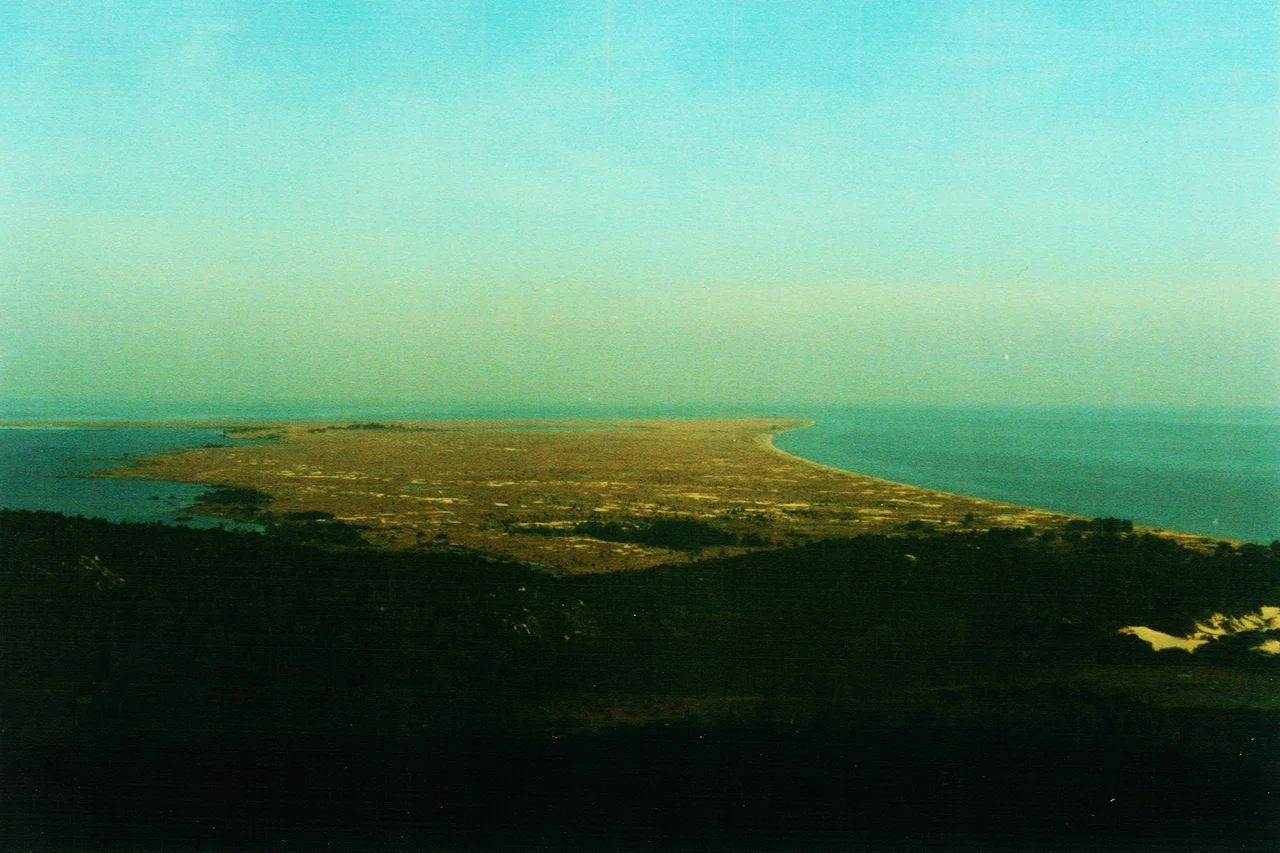

Itapuã State Park
There is a place south of Porto Alegre where two great bodies of water meet, and a lighthouse has marked the spot since 1860. To the west spreads Lake Guaíba; to the south and east, the vast Patos Lagoon. Between them juts a granite promontory the Guaraní named *Itapuã*, meaning "rocky point," and on it survives something that has nearly vanished everywhere else nearby: the original, untamed landscape of southern Brazil. That survival was not inevitable. It took decades of fighting to keep this ground wild.
Where the Waters Meet
Itapuã guards a promontory of hills, beaches, dunes, lagoons, and marshes in the municipality of Viamão, just 57 kilometers from the state capital. The park preserves one of the last remnants of the environment that once covered the entire Porto Alegre metropolitan region, a pocket of the pampas biome held between two enormous expanses of water. Frequent fog drifts across the point, softening the line between land and lake. The first European settlers arrived in 1733 and tried to farm; the land passed through many hands, at one point home to sixty families from the Azores, but it never proved fertile - and that stubborn poverty may be part of why so much of the original landscape survived. At the very tip, where Guaíba's waters slide into the Laguna dos Patos, the Itapuã Lighthouse has stood for more than a century and a half, a small white sentinel watching over the meeting of the two.
A Fight to Stay Wild
For much of the twentieth century, Itapuã was almost lost to the very governments meant to protect it. Land was expropriated in the 1950s, 70s, and 90s with grand plans attached - one decree in 1973 envisioned an "Itapuã Tourist Complex" of resorts and handicraft centers. Instead the state let quarries chew into the rock, allowed illegal summer homes to spread, and tolerated uncontrolled crowds. Scientists and environmentalists protested. In 1985 a coalition of civil society groups formed to fight for the place, the quarries and illegal houses were shut down, and researchers finally moved in to study what remained. The park was formally created in 1991, and authorities then closed it for more than a decade to let the wounded ecosystems heal. It reopened in April 2002.
Howlers, Otters, and Wings
What that recovery protected is a genuine refuge. The brown howler monkey lives in these forests, locally threatened with extinction, its deep calls carrying across the hills at dawn. Neotropical otters slip through the waterways, and the elusive margay, a small spotted cat, hunts in the canopy. The skies bring travelers from far away: the buff-breasted sandpiper, a long-distance migrant, and the tropical kingbird among them. Around 5,500 hectares of hills and shoreline give all of this room to exist, expanded over time to take in the dark waters of Lagoa Negra and, in 1993, the Pombas, Junco, and Ponta Escura islands. The scale is why the park caps visitors at 350 people per day. On busy Sundays, many who arrive are turned away at the gate. Itapuã's wildness is real precisely because access to it is rationed.
Relics of a Rebellion
History clings to the rocks as stubbornly as the howlers cling to the trees. Inside the park, a small museum displays weapons and boat parts left by combatants of the Ragamuffin War, the long Farroupilha rebellion that convulsed Rio Grande do Sul from 1835 to 1845. Relics from that conflict still lie at Morro da Fortaleza - Fortress Hill - and on Junco Island, alongside the old Ferraria dos Farrapos. Visitors who come to swim at the park's beaches, walk its ecological trails, or simply watch the fog roll off the lagoon are sharing ground with a near-vanished ecosystem and a nineteenth-century war at once. Itapuã holds both, on the same rocky point, where the two waters meet.
From the Air
Itapuã State Park occupies a promontory at 30.36°S, 50.98°W, about 57 km south of Porto Alegre at the point where Lake Guaíba empties into the Patos Lagoon. From the air the geography is unmistakable: a green wedge of hills and beaches thrusting out between two huge sheets of water, with the historic 1860 lighthouse marking the tip and Lagoa Negra (the Black Lagoon) set inland. Frequent fog can obscure the point, so the clearest views come on dry, stable days. The nearest major airport is Porto Alegre's Salgado Filho International (ICAO SBPA), a short distance north over the metropolitan region. The humid subtropical climate (Köppen Cfa) averages around 17.5°C with roughly 1,300 mm of annual rain. Note the park caps ground visitors at 350 per day and opens Wednesday through Sunday.
Nearby Stories
- Killing of João Alberto Silveira Freitas 5.4 km away
- Lagoa dos Patos 67 km away
- Santa Cruz do Sul 81 km away
- Aparados da Serra National Park 109 km away
- 2009 Brasil de Pelotas Bus Disaster 132 km away
- Torres, Rio Grande do Sul 139 km away
- Pelotas 173 km away
- Battle of the River Plate 409 km away