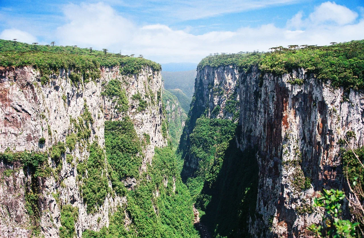

Aparados da Serra National Park
Walk across the grassy plateau of Cambara do Sul and you would never guess what waits at its eastern edge. The grass runs flat to a line, and then the world ends. At Itaimbezinho the ground falls away in sheer cliffs that plunge some 720 meters to a forested floor far below, a gorge nearly six kilometers long and in places two kilometers wide. Waterfalls leap from the rim and dissolve into mist before they ever reach the bottom. This is the centerpiece of Aparados da Serra, created in 1959 as one of Brazil's very first national parks for the single purpose of protecting the canyon - a place where the high country quite literally comes to an edge.
A Wound in the Lava
The rock here remembers a violence older than the Atlantic Ocean. Roughly 130 million years ago, as South America and Africa tore apart, vast floods of lava poured across the land in one of the planet's great volcanic events, leaving the layered basalts that geologists call the Serra Geral Group. Those flows stacked into the plateau, and their sheer mechanical strength is the reason Itaimbezinho exists in this dramatic form. Soft rock erodes into gentle slopes; this rock does not yield. A 2025 study of the Serra Geral basalts found that in landscapes no longer pushed up by tectonics, it is rock strength itself that governs how erosion carves the terrain - which is why the canyon walls stand as cliffs rather than crumbling into hills.
The Plateau and the Plain
The drama of Aparados da Serra is the drama of a boundary. The park straddles the line between two Brazilian states, Rio Grande do Sul and Santa Catarina, and more importantly the line between two worlds. Above sits the Campos de Cima da Serra, the cold high grassland near a thousand meters, swept by wind and dotted with araucaria. Below stretches the warm coastal plain, reached only by the vertiginous walls that drop away from the rim. Itaimbezinho is the most famous gap in that escarpment, but it is not alone - the park's 10,250 hectares also guard the Fortaleza, Malacara, and Indios Coroado canyons, each a separate breach where the plateau gives way to the lowlands far beyond.
Life on Both Sides
The vertical landscape sorts its wildlife by elevation. Up on the windy plateau live the red-spectacled amazon parrot, the maned wolf with its impossibly long legs, and the cougar ranging the open grassland. Down on the forested slopes, where the climate softens, the neotropical otter hunts the streams and the ocelot and the brown howler monkey move through the trees. It is a remarkable concentration of life across a short vertical distance - and a precarious one. Researchers from Duke University's Center for Tropical Conservation have warned that even with the adjoining Serra Geral National Park added, the protected area remains too small to safeguard a full, representative sample of each distinct environment it contains.
Visiting the Edge
The park guards itself by limiting the crowd. No more than 1,500 visitors are admitted on any single day, a deliberate ceiling on a place that could easily be loved to ruin. Those who come walk the rim trails that trace the canyon's lip, where a single step separates the firm grass of the plateau from a 720-meter drop. The most rewarding views arrive when the weather cooperates and the mist that so often fills Itaimbezinho lifts to reveal the full depth of the gorge. On those clear mornings the canyon shows its true scale, and the abstraction of numbers becomes the physical fact of standing at the precise place where southern Brazil's high plateau decides to end.
From the Air
Aparados da Serra National Park lies at roughly 29.19 degrees south, 50.10 degrees west, where the plateau rim sits near 1,000 meters and the canyon floor lies some 720 meters below it. From the air, Itaimbezinho is unmistakable: a long, sheer-walled gash slicing eastward into the edge of the forested escarpment near Cambara do Sul, with the Fortaleza and other canyons cutting nearby. The nearest major airport is Salgado Filho International at Porto Alegre (ICAO: SBPA, IATA: POA), roughly 180 km south; Hugo Cantergiani Regional Airport at Caxias do Sul (ICAO: SBCX, IATA: CXJ) is a closer regional field to the southwest. Highland weather is volatile and the canyon frequently fills with cloud - fly the rim in clear, calm conditions and respect the rapidly rising terrain along the escarpment.
Nearby Stories
- Canela, Rio Grande do Sul 22 km away
- Criciúma 41 km away
- São Leopoldo 57 km away
- Serra Gaúcha 61 km away
- Serra do Rio do Rastro 85 km away
- Laguna, Santa Catarina 116 km away
- Killing of João Alberto Silveira Freitas 117 km away
- Battle of the River Plate 500 km away