Chapada Diamantina National Park
The water falls 340 meters, and it never reaches the ground. Cachoeira da Fumaça - the Smoke Waterfall - drops off the edge of a flat-topped mountain deep in the interior of Bahia, and by the time the current reaches the floor of the canyon below, wind and sun have dissolved most of it into mist. Stand at the upper rim in the dry season, lean out over the ledge (carefully - there are no rails), and you are looking down through a column of disappearing water. This is Chapada Diamantina National Park, 400 kilometers inland from Salvador, and almost everything here works on that kind of slow, cinematic scale.
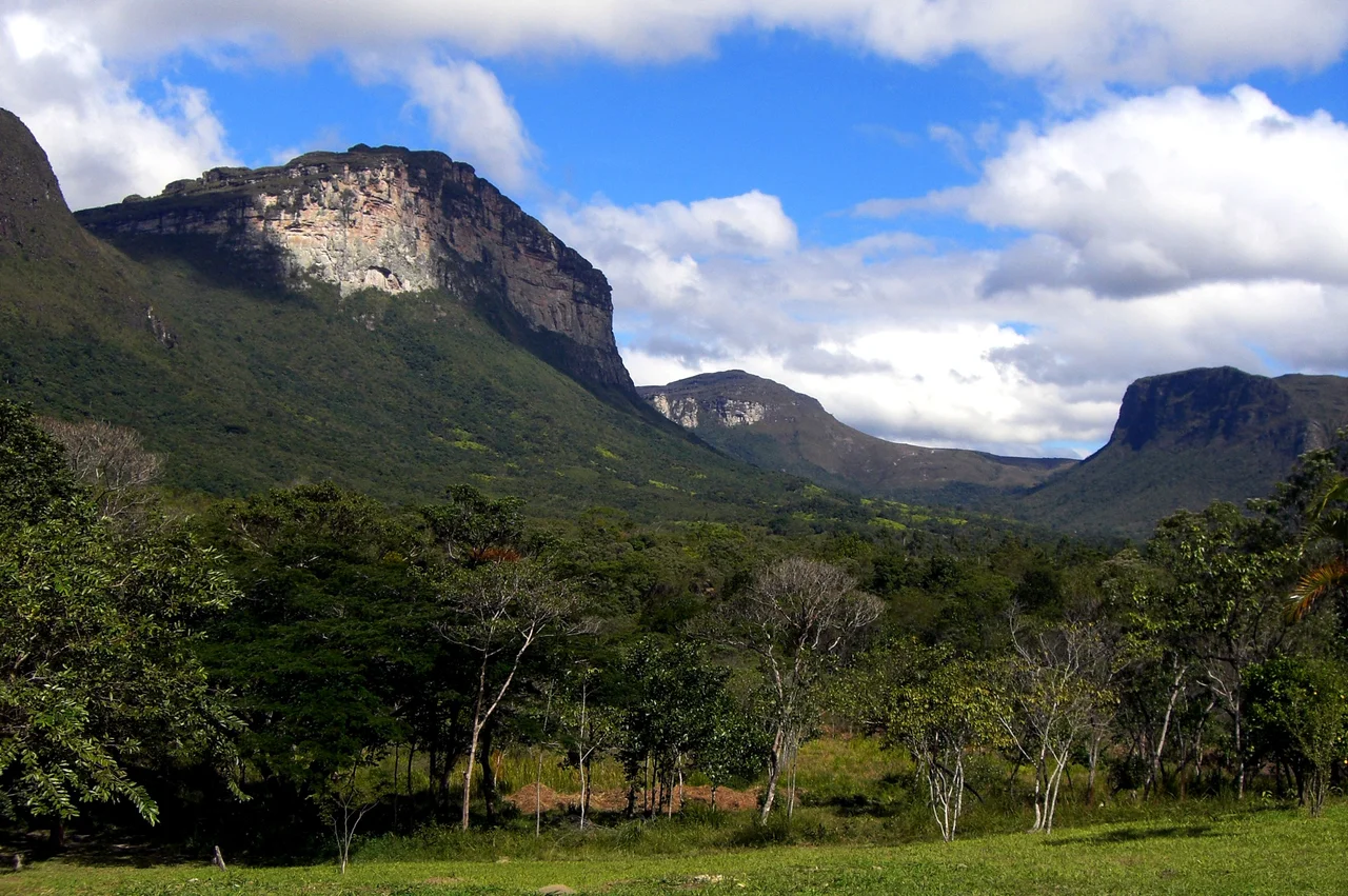
A Country at the Top of the Cliffs
The park protects the Sincorá Range, a north-south spine of eroded sandstone whose flat summits rise above 2,000 meters and catch the moisture coming off the distant Atlantic. The classic view from Morro do Pai Inácio looks out over an ocher plain studded with isolated mesas, each one a remnant of a plateau that weathered away everywhere else. The vegetation up top is strange and specific: rocky grasslands with twisted shrubs, endemic orchids hiding between stones, hummingbirds working the flowers. Below, rivers cut down through vertical walls and pool in canyons the color of strong tea, darkened by plant tannins. The park sits in the middle of the dry sertão, but because the cliffs force rising air to drop its rain, the plateau is a wet island in a thirsty landscape.
Lençóis and the Prospectors' Dish
Most travelers arrive at Lençóis, a cobblestoned town of pastel houses that grew rich on diamonds in the nineteenth century and never quite lost its swagger. From Salvador, the overnight bus run by Real Expresso carries you across the flat cattle country before climbing into the hills. The other gateway, Vale do Capão, is quieter and closer to the best trailheads - a jeep from Palmeiras will drop you there for a handful of reais. Eat the godó de banana while you are here. The dish comes from the first prospectors who inhabited the region: green bananas stewed with whatever meat was handy (usually sausage, dried beef and bacon), tomatoes and onions, a high-calorie meal built by people who needed it after a day in the diggings. Like the town itself, it tastes of improvisation made permanent.
Into the Valleys
The best of the park is earned on foot. A four or five day trek through Vale do Capão and Vale do Pati is widely considered the finest hiking in Brazil, and the ranking is not idle. You sleep in the homes of the last families of the Pati, who stayed behind when commercial agriculture and mining were banned and who now host trekkers for a living - basic accommodations, kerosene lamps, strong coffee at dawn. Shorter walks reach Cachoeira do Sossego, where a river tumbles between boulders into a cold plunge pool. Further south, the Poço Encantado and Poço Azul are sinkhole caves filled with water so clear and so blue that when shafts of sunlight slide through the openings above between April and August, the pools appear to glow from within.
Caves, Storms, and the Shape of Water
Water defines this place. Rivers carve the Lapa Doce and Pratinha cave systems through limestone beneath the sandstone caprock, widening chambers that dwarf the beams of your flashlight. Storms gather in the afternoons, especially in the wet months from November to March, and the cliffs catch the lightning. Flash floods can turn dry creek beds into fast water within minutes - local guides warn against camping close to rivers, and a few hikers have drowned over the years. The park remains formally incomplete: as of 2015 the administration had never been finalized, and no entrance fee is charged. It feels less like a ticketed attraction than a region - enormous, understaffed, largely informal, and all the more remarkable for it.
From the Air
Centered near 12.88 degrees south, 41.37 degrees west, in the Sincorá Range of central Bahia. Highest peak Pico do Barbado at 2,033 meters (6,670 ft MSL); the tableland averages roughly 1,000 meters. Best viewed from 8,000 to 12,000 feet in clear morning light when the mesas throw strong shadows. Nearest airports: Horácio de Mattos Airport at Lençóis (SBLE/LEC), Glauber Rocha Airport at Vitória da Conquista (SBQV/VDC) to the southwest, and Viracopos/Ruy Maia at Barreiras (SBRR) to the northwest. Convective storms build quickly on summer afternoons; VFR flight recommended in the morning.
Nearby Stories
- Sincura 8.1 km away
- Lençóis 14 km away
- 1798 Revolt of the Alfaiates 20 km away
- Manuscript 512 148 km away
- Pé de Serra 157 km away
- São João de Deus Hospital 200 km away
- Morro de São Paulo 203 km away
- Caminho dos Gerais State Park 244 km away