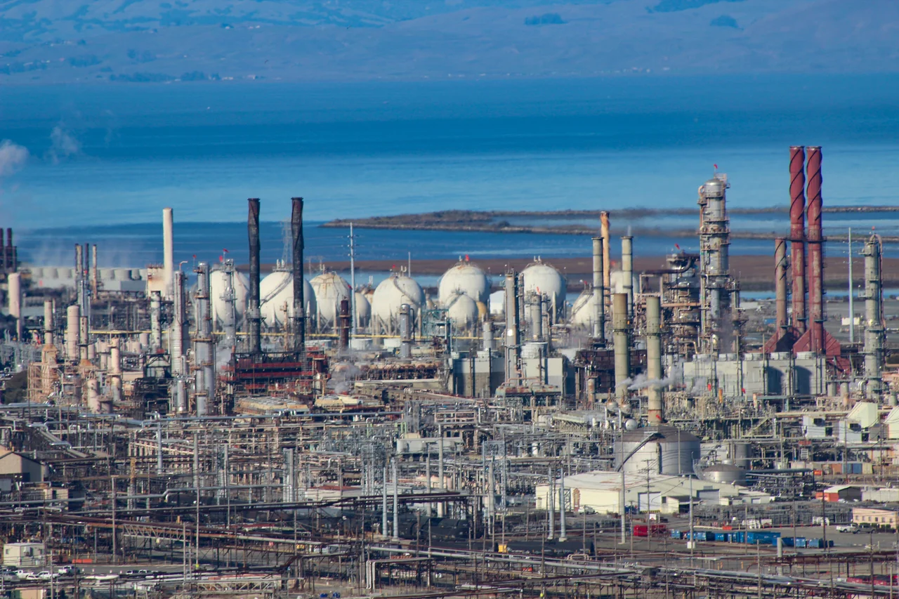
Chevron Richmond Refinery
At night, the Chevron Richmond Refinery looks like a city made of light. Thousands of floodlights illuminate a maze of pipes, towers, and storage tanks that covers 2,900 acres along the eastern shore of San Francisco Bay. By day, the refinery's stacks and distillation columns are visible from San Francisco, Oakland, and the bridges that span the bay. Operating since 1902, the Richmond refinery is the largest oil refinery in the Bay Area and one of the oldest continuously operating refineries in the western United States. It processes approximately 245,000 barrels of crude oil per day, converting it into gasoline, jet fuel, and other petroleum products.
A Century of Crude
Standard Oil of California established the Richmond refinery in 1902 on the bay shore north of Point Richmond, choosing the location for its deep-water access and proximity to California's oil fields. The refinery grew steadily through the 20th century, surviving two world wars, the breakup of Standard Oil, and the transformation of Standard Oil of California into Chevron. The industrial complex expanded from its original footprint to nearly 3,000 acres, making it one of the largest industrial facilities on the West Coast. The refinery's output has fueled California's automobile-dependent economy for over a century.
The Environmental Shadow
The Richmond refinery's relationship with its surrounding community has been contentious. The city of Richmond, historically a working-class community with a large African American population, has borne the environmental costs of hosting the refinery: air quality concerns, flaring incidents, and the 2012 fire that sent a plume of toxic smoke across the East Bay, sending 15,000 residents to hospitals. Environmental justice advocates have pointed to the refinery as a case study in how polluting industries are disproportionately sited in communities of color. Chevron's economic contributions -- jobs, tax revenue, community investment -- are weighed against health impacts that fall most heavily on those who live closest to the facility.
The Visible Contradiction
The Richmond refinery is visible from almost anywhere on San Francisco Bay, its flare stacks and cooling towers creating a skyline that contrasts sharply with the natural beauty of the surrounding landscape. Mount Tamalpais rises behind it. The bay spreads before it. The Golden Gate is visible to the west. This juxtaposition of industrial infrastructure and natural beauty captures a contradiction at the heart of the Bay Area's identity: a region that prides itself on environmental consciousness while depending on fossil fuel infrastructure that has operated continuously since the early 20th century.
From the Air
The Chevron Richmond Refinery is at approximately 37.93N, -122.37W on the eastern shore of San Francisco Bay in Richmond. The refinery's industrial complex covers nearly 3,000 acres and is one of the most visible industrial sites from the air in the Bay Area. Nearest airports: KOAK 10nm south, KSFO 18nm south.
Nearby Stories
- Rockaway Beach, Pacifica, California 2.1 km away
- The Sixpence in the Soil 4.5 km away
- Niles Canyon Railway 9.4 km away
- The Last Five-Cent Fare 12 km away
- From Ammunition Bunkers to Cattle Country 13 km away
- The Hole in the Head 18 km away
- Cordell Bank: The Invisible Island 35 km away
- ʻAkaka Falls State Park 3673 km away