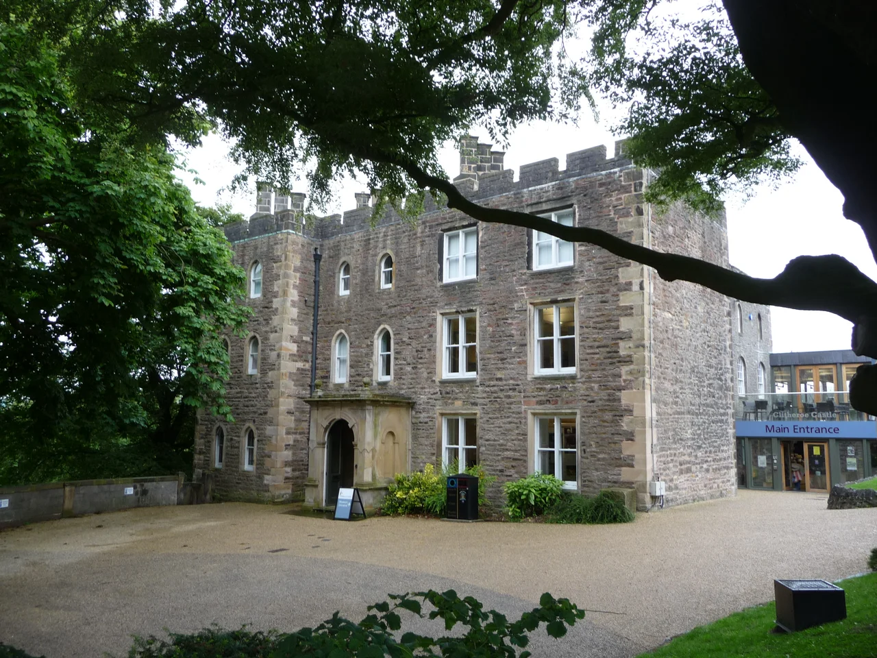

Clitheroe Castle
There is a hole in the southeast wall of the keep. It is roughly the shape of a cannonball strike, ragged at the edges, big enough to put your head through. Two stories explain it. The first is that the Devil, gathering rocks on Pendle Hill three miles east, slung a boulder at the castle in a fit of malice, missed, and dropped his apron-load near Pendleton instead. The second is that Oliver Cromwell, standing on the same Pendle Hill, fired a cannon and hit. The castle's guidebook deadpans: "It must have been a good cannon for the time to reach that far." The real cause is probably the slow widening of a Norman arrow loop through eight centuries of weather. But the legends are what people remember.
The Smallest Keep
Clitheroe's Norman keep is the second smallest stone-built keep surviving in England. It sits on top of Castle Hill - a 39-metre outcrop of pale grey limestone, identified geologically as a Waulsortian mudmound, the southwesternmost of a chain of fossil-rich reef-knolls in the Bowland Sub-basin. The hill is rich in crinoid ossicles, gastropods, and brachiopods deposited 340 million years ago when this was a tropical sea floor. On top of all that biology, sometime in the late 12th century, Robert de Lacy raised a square stone tower with walls 10 feet thick. The interior was so cramped that the great hall and other essential buildings had to stand elsewhere in the bailey - probably where the museum education suite is today.
Caput of an Honour
Clitheroe was the caput - the head - of the Honour of Clitheroe, a vast feudal estate sprawling along the western Pennines from the Ribble to the moors above Manchester. After the Norman Conquest the lands passed to Roger de Poitou, then to Robert de Lacy of Pontefract sometime during the reign of William Rufus. The castle stood at the centre of this lordship's administration for seven hundred years. A Scottish force harried the area in 1138 and won the Battle of Clitheroe somewhere nearby during the Anarchy. When Henry de Lacy died in 1311, the honour passed by marriage to Thomas, Earl of Lancaster, and when Thomas was beheaded in 1322 it escheated to the Crown. From 1351 it formed part of the Duchy of Lancaster, and the Hundred Court still sat in the castle's great hall, the steward acting as judge.
Civil War and Public Park
By 1602 a survey called the castle "very ruinous" - parts of the buildings were collapsing. In 1644 Prince Rupert briefly garrisoned it during the Civil War, only to abandon it after the Royalist defeat at Marston Moor. Parliament ordered it slighted in 1649. In 1660 Charles II gave the castle and its honour to George Monck, 1st Duke of Albemarle, as reward for engineering the king's restoration. Ownership eventually passed to the Dukes of Buccleuch and then to Lord Montagu of Beaulieu. In November 1920, public subscription raised £15,000 to buy the site - £9,500 for the purchase, the rest to lay out the grounds as a war memorial to the 260 Clitheroe men who died in the First World War. The stone soldier in the park, head bowed and arms reversed, was sculpted by Louis Frederick Roslyn.
What's There Now
The buildings on the castle site house Clitheroe Castle Museum, which reopened after a £3.5 million refurbishment in 2009. Inside the Steward's House are 5,000 social history objects, a geology collection with four type and figured specimens reflecting the limestone reef beneath the castle, archaeology recovered from on-site digs, and natural history from the surrounding Bowland fells. In the rose garden south of the keep stands a curious centrepiece: a stone turret from the Houses of Parliament, presented to Clitheroe in 1937 by its MP Sir William Brass to mark the coronation of George VI, salvaged from the mid-1800s rebuilding of the Palace of Westminster. Climb to the keep on a clear day and you see the same view Robert de Lacy saw - the Ribble Valley below, the moors of Bowland to the north, and the long ridge of Pendle Hill to the east, where the Devil reputedly stood and missed his throw.
From the Air
Clitheroe Castle sits at 53.871°N, 2.393°W, on a limestone outcrop in the centre of Clitheroe in the Ribble Valley. The keep tops out around 300 ft AMSL, on a 39 m natural knoll that makes the hill itself the most prominent point for miles. Best viewed VFR at 1,500-2,500 ft AGL. Nearest airports: Blackpool (EGNH) about 25 nm west, Manchester (EGCC) about 25 nm south. The castle stands on its bald hilltop in the middle of the town, immediately recognisable. Pendle Hill rises three miles east - the long whaleback ridge that dominates this corner of Lancashire. The Forest of Bowland AONB lies just north and west.
Nearby Stories
- Bury Art Museum 2.6 km away
- Silverdale, Lancashire 3.1 km away
- Siege of Lathom House 4.2 km away
- Leeds Bradford Airport 6.5 km away
- Preesall 11 km away
- Jervaulx Abbey 14 km away
- Wentworth Castle 19 km away
- Yorkshire Dales 19 km away