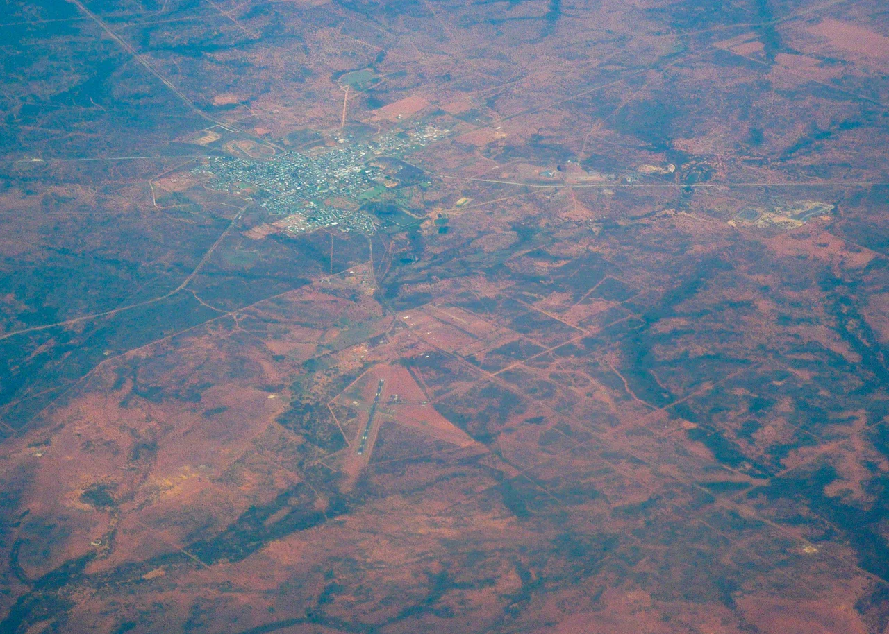

Cobar
The name tells you what mattered here long before the mines. "Cobar" comes from a Ngiyampaa word - written variously as gubarr, kuparr, or cuburra - for the red and burnt earth, the ochre that Aboriginal people quarried at a waterhole and ground into body paint for ceremony. The blue and green streaks of copper were part of that palette too. So when three thirsty bore-sinkers stumbled on those same streaks in 1870 and started a copper rush, they were, without knowing it, digging at a place that had been a quarry for tens of thousands of years already. The town that grew up here took its name from the paint.
A Town the Ore Built
Cobar was born in 1870 from a single outcrop of copper, and for half a century the mines were the town. At the peak of the Great Cobar copper mine, more than two thousand people worked the lodes, fed the smelters, and carted the endless firewood the furnaces devoured. Miners came from far away to work it - many from the copper districts of Cornwall, whose hard-rock expertise is written into the region's history, including the CSA mine just to the northwest, whose initials stand for Cornish, Scottish, and Australian. The boom did not last forever, and Cobar has weathered busts that hollowed out whole streets. Yet it never became a ghost town. It held on.
Living in the Heat
Cobar bakes. It sits in a hot semi-arid climate of long, fierce summers and short, cool winters, with rain that falls sparingly and spreads itself thinly across the year. The town logs more than 150 clear days and over 3,200 hours of sunshine annually, and the thermometer has reached a brutal 47.8 degrees Celsius - first in February 1889, then matched again in January 1939. Water has always been the constraint here, as it was at the waterhole that named the place. Today around 3,400 people live in Cobar, roughly one in seven of them Aboriginal or Torres Strait Islander, in a town that serves as the seat of its shire and the service centre for an enormous stretch of outback.
The Cobar Quid
Some towns talk about shopping local. Cobar mints its own money to make the point. Since 2003 the Cobar Business Association has run a local currency called the Cobar Quid - not paper but a struck medallion, produced by the Royal Australian Mint, in denominations of five, ten, twenty, and fifty dollars. Businesses buy the coins and accept them as payment; the shire council oversees the system that lets shops redeem them for cash. It is a small, stubborn act of self-reliance, the kind of idea that tends to take root in places far from anywhere, where keeping a dollar circulating in town can be the difference that keeps the lights on.
Still a Mining Town
The remarkable thing about Cobar is that its mining story did not end in the history books. It is still a working mine - in fact, several. Eleven kilometres northwest, the CSA copper mine drives down nearly two kilometres, one of the deepest underground mines in Australia and among the highest-grade copper mines in the country. The Peak and Tritton operations work the district too, and in 2025 the Endeavor silver-zinc-lead mine restarted after years idle. The town has produced its share of notable Australians along the way - among them Lilliane Brady, who served more than two decades as mayor, the longest-serving female mayor in the state's history. Cobar remains what it has always been: a place defined by what lies in the red ground beneath it.
From the Air
Cobar sits at approximately 31.50 degrees S, 145.83 degrees E in central-western New South Wales, where the Barrier Highway and Kidman Way meet in a sea of red mulga and saltbush. From the air, look for the town's grid against the surrounding scrub, the vast dark slag dump of the old Great Cobar mine on the southern edge, and the working headframes of the modern mines to the north and west. Cobar Airport (ICAO YCBA) lies about 5.6 km southwest of town with a sealed runway; Bourke (YBKE) and Nyngan (YNYN) are the nearest alternates. The semi-arid climate gives consistently clear skies and long visibility - over 150 clear days a year - though extreme summer heat brings turbulence and occasional dust.
Nearby Stories
- Mount Drysdale, New South Wales 19 km away
- Nymagee 47 km away
- Louth, New South Wales 87 km away
- Paroo-Darling National Park 123 km away
- Ivanhoe 147 km away
- Roxy Theatre and Peters Greek Cafe Complex 443 km away
- Bingara 454 km away
- Lake Burley Griffin 469 km away