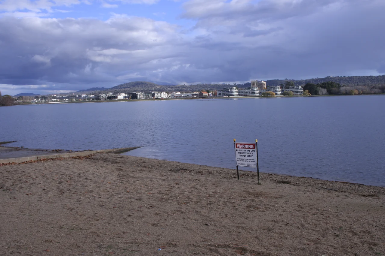

Lake Burley Griffin
For fifty years it existed only as a shape on a drawing. Walter Burley Griffin sketched a great ornamental lake at the centre of his 1912 plan for Canberra, its basins arranged so the city's axes would line up with the surrounding hills. But the water did not come. Through two world wars, the Depression, decades of political wrangling and Griffin's own departure in 1920, the Molonglo River wandered through farmland where the lake was meant to gleam, and Canberra was mocked as "several suburbs in search of a city." When the dam gates finally closed in September 1963, a drought refused to cooperate, and the basin sat stubbornly half-empty. Not until April 1964 did the rains arrive to fill it.
A Prime Minister's Obsession
The lake might never have happened without Robert Menzies. Australia's longest-serving prime minister had once regarded the unfinished capital as a national embarrassment, and over time his contempt curdled into a kind of crusade. He sacked two ministers he felt lacked intensity for the job. He created a powerful new development commission, blocked schemes that strayed from Griffin's intent, and denounced the "moaning" of the project's opponents. When the lake was at last inaugurated on 17 October 1964 amid fireworks and a flotilla of sailing boats, the obvious gesture would have been to name it for Menzies himself - and it was proposed. He refused. He insisted it carry the name of Griffin, the architect who had imagined it and never lived to see it fill.
Engineering an Ornament
Beneath its placid surface, the lake is a feat of engineering. It stretches 11 kilometres long and as much as 1.2 kilometres wide, holding some 33 million cubic metres of water against the 33-metre wall of Scrivener Dam - named for Charles Scrivener, the surveyor who chose Canberra's site in 1909 partly because the land could be flooded "for ornamental purposes at reasonable cost." The dam is built to withstand a flood of the kind expected once in five thousand years. Crews dug the entire lakebed at least two metres deep, both to clear boat keels and to discourage mosquitoes and weeds. In times of drought, water can be released from the Googong Dam upstream to keep the level steady. It is, in the end, an artificial body of water pretending convincingly to be a natural one.
The Shore of a Nation
Griffin wanted the lake to be the foreground of the capital, and so it became. Along its edges rose the institutions of the country: the National Library opened in 1968, the High Court and the National Gallery followed around 1980, and in 1988 the new Parliament House crowned Capital Hill behind them. On Queen Elizabeth II Island stands the National Carillon, originally fifty-three bronze bells given by Britain for the city's fiftieth anniversary and since expanded to fifty-seven, their music drifting across the water. The Captain Cook Memorial Jet can throw a column of spray more than a hundred metres into the air. Black swans gather on the East Basin in flotillas, and the murky water hides Murray cod and golden perch stocked to revive the river's depleted runs.
Twenty-Five Kilometres of Edge
To Canberrans the lake is less a monument than a backyard. A shared path runs almost the full 40-kilometre shoreline, broken into three loops by the two great bridges, so a runner or cyclist can take on the 3.7-kilometre "bridge to bridge" or the full circuit of roughly 32 kilometres. Rowers slice across the calm of early morning; sailors, paddleboarders and dragon-boat crews share the water on weekends. Each spring, Floriade - the largest flower festival in the country - blankets the lakeside Commonwealth Park in a million blooms. Swimming has grown rarer, discouraged by cold water and the blue-green algae that bloom in warm spells. Still, on a clear Canberra evening, the whole improbable, long-delayed vision finally makes sense.
From the Air
Lake Burley Griffin lies at the centre of Canberra, around -35.2933, 149.1139, at a surface level near 556 m above sea level. From the air it is the city's defining feature: an 11 km irregular sheet of water, widest in the west, narrowing through the Central Basin where the dead-straight land axis of Anzac Parade crosses it between the War Memorial and Parliament House. Scrivener Dam closes the western end; the Captain Cook Memorial Jet plumes from the Central Basin. Two bridges - Commonwealth Avenue and Kings Avenue - frame the Parliamentary Triangle on the south shore. Best viewed at 1,500-3,000 ft AGL. Note the restricted airspace over the Triangle and Canberra Airport's (YSCB / CBR) control zone about 5-6 km east. Black Mountain and its tower rise on the lake's northwest flank.
Nearby Stories
- Mount Kosciuszko summit trails 69 km away
- Hive shipwreck 79 km away
- Snowy Mountains Scheme 89 km away
- Wollongong 119 km away
- Murray River 179 km away
- Royal National Park 191 km away
- Warangesda Aboriginal Mission 250 km away
- 2003 Fiordland Earthquake 1800 km away