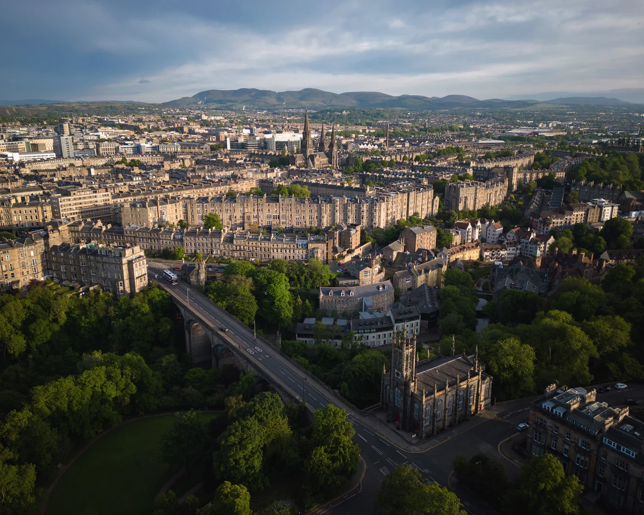

Dean Village
The Water of Leith runs quietly through the centre of Edinburgh, but most people never see it. The river travels in a shallow gorge that the city has built over and around for centuries, and you can walk above it for a lifetime without realising it is there. Then you take the steep curve down Bell's Brae, and suddenly the modern city is gone. You are in a tight cluster of red-pantiled cottages, sandstone warehouses, and a clock tower above an old well, the river curving past your shoulder. This is Dean Village, and for more than 800 years it was the place that ground Edinburgh's flour.
The Miller's Village
The first written mention of the Dene (from an old word for "deep valley") appears in King David I's founding charter of Holyrood Abbey, dated around 1145. The charter granted one of David's mills here to the abbey, which means there were already mills running. By 1535 the village was referred to as "the miller's village," and at its peak it supported eleven working mills, all driven by water diverted from the Water of Leith. The bakers, known in Scots as Baxters, were so closely associated with Dean Village that the Incorporation of Baxters built their Tolbooth (meeting chambers) here around 1675. You can still see the building at the foot of Bell's Brae. Stones bearing the Baxters' coat of arms are set into walls throughout the village, each one carved with sheaves of wheat, baker's peels, and the date of a long-vanished trade.
Decline and the Bridge Above
The Industrial Revolution slowly killed the village. Larger and more modern flour mills opened at Leith, downstream, where ships could load directly. Dean Village's tight gorge, once an advantage, became an obstacle. In 1826 John Learmonth bought the Dean estate, intending to extend the New Town northward. He needed a way to bypass the village entirely, and in 1832 Thomas Telford's Dean Bridge opened, vaulting 106 feet above the village floor and carrying the main road far over its rooftops. The bridge transformed access to the north and finished what Leith had started. For more than a century afterward, Dean Village became a half-forgotten pocket of poverty and decay, hidden in plain sight from the elegant city above. By 1960 it was at its lowest point.
Rediscovery
From the mid-1970s onward, Edinburgh began to look at Dean Village again. Workers' cottages, warehouses, and mill buildings were converted into homes. The Water of Leith Walkway, opened in 1983, runs from Balerno on the city's western edge through the village all the way to Leith, knitting the gorge back into the daily life of the city. Well Court, the tall picturesque tenement with the clock tower that appears in nearly every photograph of the village, was built between 1883 and 1886 by the newspaper proprietor John Ritchie Findlay as model housing for working people. The village is now one of the most photographed places in Edinburgh. Tourists climb the steep stairs to peer down at the river, residents close their shutters, and the Water of Leith runs on with the same slow patience it has shown for nine centuries.
What the Cemetery Holds
Above the village to the west lies Dean Cemetery, laid out in 1845 on the site of the demolished Dean House, the old tower-house of the Nisbet family. Seven panels of the painted ceiling from Dean House's great hall, painted between 1605 and 1627, survived the demolition and are now displayed at the National Museum of Scotland. The cemetery itself is unusual in Scotland because it is run as a non-profit charity trust, partly to prevent it being asset-stripped, and it contains the graves of the railway engineer Sir Thomas Bouch (whose Tay Bridge collapsed in 1879), the photography pioneer David Octavius Hill, and a long line of Victorian Edinburgh's intellectual aristocracy. The whole gorge, from cemetery to village to bridge, is one of Edinburgh's quieter masterpieces: a city remembering how to live with its river.
From the Air
Located at 55.9520°N, 3.2173°W in a deep wooded gorge of the Water of Leith, about 0.7 nautical miles northwest of Princes Street. The village sits 106 feet directly below Telford's Dean Bridge, which carries the A90 road overhead. From the air, look for the cluster of red-tiled roofs and the distinctive Well Court clock tower nestled in a green ravine, with the white arched line of Dean Bridge soaring above. Edinburgh Airport (EGPH) is about 5 nautical miles west. Best viewed from 1,500-2,500 feet AGL in clear weather.
Nearby Stories
- Ardoch Roman Fort 2.2 km away
- Craignethan Castle 3.1 km away
- Haddington 3.8 km away
- Balvaird Castle 4.3 km away
- Battle of Kilsyth 9.4 km away
- Siege of St Andrews Castle 9.9 km away
- Neidpath Castle 11 km away
- Melrose Abbey 15 km away