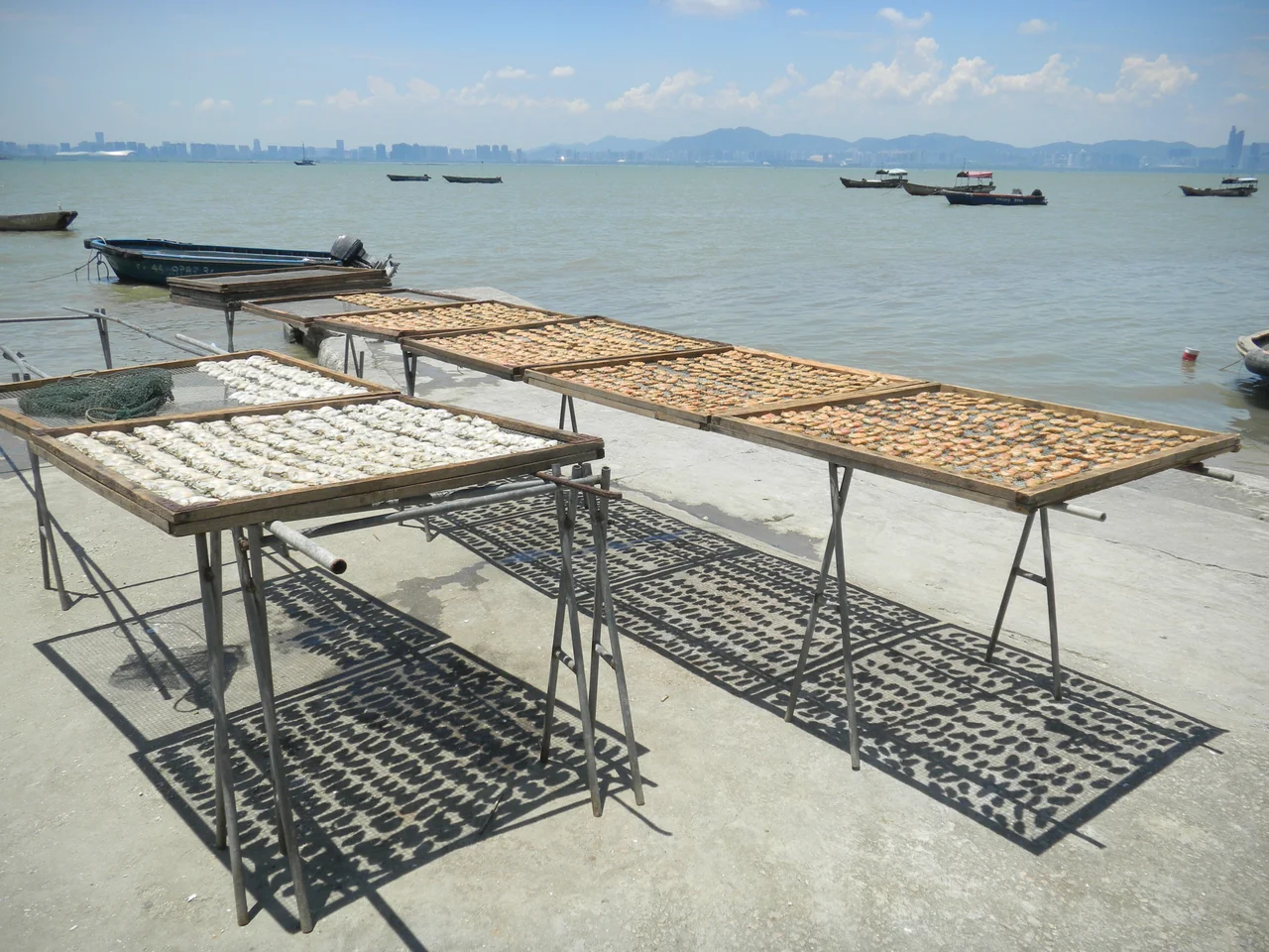

Deep Bay
The bay goes by three names depending on who you ask and when you're asking. In Cantonese it is Hau Hoi Wan — the back bay, facing away from the open sea, sheltered and enclosed. In mainland China it became Shenzhen Bay, a name that arrived with the Special Economic Zone in 1980 and gained currency after a hotel claimed it. On older English maps and in official Hong Kong usage, it remains Deep Bay. Three names, one body of water, and a border running through the middle.
A Bay in Two Jurisdictions
Deep Bay sits between Yuen Long District in Hong Kong's New Territories to the south and the city of Shenzhen in Guangdong Province to the north. The Hong Kong–Shenzhen Western Corridor bridge now crosses it at its western end, a physical manifestation of the connection the bay once marked as a boundary.
The Cantonese name carries a small linguistic curiosity: the character 后 (Hau) in 后海灣 is a homonym of 後, meaning "back" — and also the simplified form of a character meaning "queen." Some attribute the name to Tin Hau, goddess of the sea and seafarers, whose temples dot the Hong Kong coast. Whether the bay owes its name to geography or to divine patronage depends on which etymology you find more persuasive.
Where Fresh Water Meets Salt
Because the bay is largely enclosed by land, freshwater draining from the surrounding hills meets the tidal saltwater along a shallow, productive margin. That edge — neither fully marine nor fully terrestrial — creates one of the most biologically valuable habitats in the region. Mangroves establish themselves in the tidal zone. Fish use the shallow pools. Birds, in enormous numbers, stop here during migration.
Mai Po, along the bay's southern shore under Hong Kong's jurisdiction, is one of the most important bird-staging areas in East Asia. It is also the site where the Mai Po bent-wing firefly (Pteroptyx maipo) was first discovered. The northern shore tells a different story: as Shenzhen transformed from a small market town into a major city after 1980, its waterfront was reclaimed for development. Well-intentioned conservation efforts were complicated when foreign mangrove species were introduced, inadvertently threatening the indigenous mangroves they were meant to complement.
Oysters, Shrimp, and a Living Bay
The bay has long sustained human life, not just wildlife. Lau Fau Shan, on the Hong Kong side, has been famous for oysters within the territory for generations. From Lau Fau Shan to Mai Po, villagers cultivated fish in pools adapted from former tidal flats, a technique that shaped the landscape as much as it depended on it. A by-product of that cultivation — greasyback shrimp (基圍蝦) — became a local delicacy with a devoted following in Hong Kong markets and restaurants.
The bay remains rich in marine life, though both its ecology and the communities that depend on it face pressure from development on both sides of the border and from rising sea levels that threaten the root systems of the mangroves that protect the shoreline.
The Crossing
Before 1949, movement between Hong Kong and the mainland was largely unrestricted. After the establishment of the People's Republic, the Hong Kong government introduced border controls and residency registration to manage the flow. People still crossed — because the bay offered what borders rarely do: a seam where enforcement was hardest.
Deep Bay became the primary crossing point for those making the journey without documentation. The water was shallow, the distance manageable, and once ashore, the roads to Hong Kong's urban centres were within reach. Lau Fau Shan was the main landing point. The scale of the crossings over subsequent decades was substantial, shaping the demographics and social character of the communities on both sides of the water. The bay was never just ecology or commerce. It was also, for many people, the most dangerous and most hopeful journey of their lives.
Protected, Partly
In 1986, a 1,036-hectare section of Inner Deep Bay was designated a Site of Special Scientific Interest under Hong Kong law — formal recognition that the wetlands, the birds, and the tidal ecology of the southern shore warranted legal protection. The designation covers the Mai Po area and the intertidal mudflats that feed the migration cycle.
The protected zone does not cover the whole bay, and the pressures it faces are not solely within Hong Kong's jurisdiction. The contrast between the largely intact southern marshes and the heavily developed northern shore is visible from the water and from the air: on one side, grey-green mangrove and open mudflat; on the other, the edge of one of China's fastest-growing cities.
From the Air
Deep Bay is located at approximately 22.499°N, 113.970°E, straddling the Hong Kong–Shenzhen border. From the air at 3,000–6,000 feet, the bay's distinctive shape — shallow, enclosed, with mudflats visible at low tide — is clear, and the contrast between the developed northern (Shenzhen) shore and the greener southern (Hong Kong) shore is striking. The Hong Kong–Shenzhen Western Corridor bridge is visible at the bay's western end. Hong Kong International Airport (VHHH) lies approximately 15 km to the south on Lantau Island. The Mai Po wetland reserve is identifiable as a mosaic of ponds and open water along the southern shore.
Nearby Stories
- Chapel of St. Francis Xavier 3.5 km away
- Cuiheng 4.1 km away
- 2015 Shenzhen Landslide 16 km away
- Shunde 31 km away
- Wanshan Archipelago 37 km away
- Nanxiong Formation 96 km away
- Heyuan 149 km away
- Checheng Fu'an Temple 629 km away