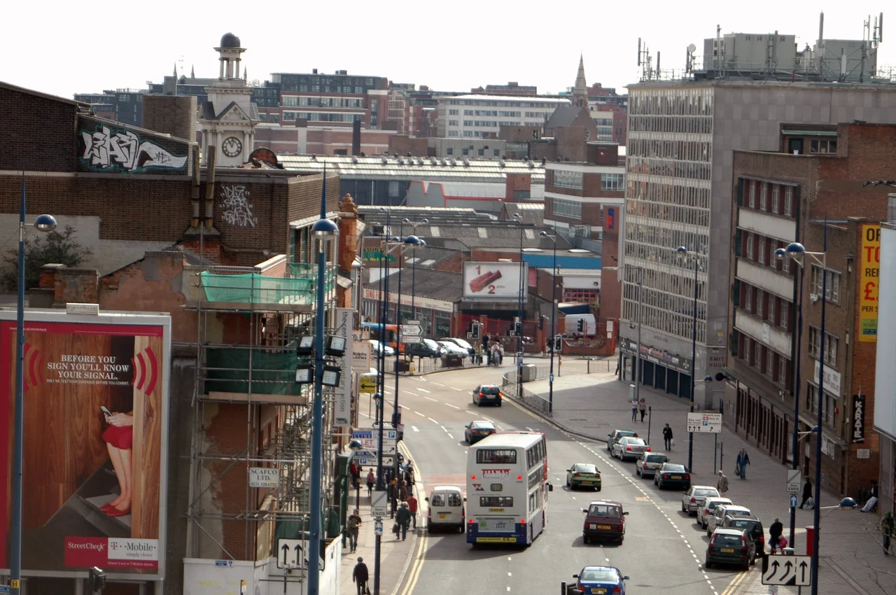

Digbeth
Steven Knight announced in February 2022 that he was building a film studio in Digbeth, the same Birmingham district where his television series Peaky Blinders had set its fictional version of the same district. The decision closed a loop a hundred years wide. The real Peaky Blinders had been a loose Birmingham street-gang label from the 1880s to the 1920s - young men from the working-class quarters known for assault, pickpocketing, and extortion. The popular story that their flat caps held sewn-in razor blades is, according to historian Carl Chinn, almost certainly apocryphal; safety-razor blades did not arrive in Britain until 1908, well after the gang's name was already in the newspapers. The fictional version turned into the most internationally successful British drama of the 2010s, and now it would be filmed on the streets it had mythologised. Digbeth has always been good at reinventing itself, sometimes by accident.
Dig Path or Duck's Bath
The first settlement here dates to the seventh century. The land west of the River Rea was historically part of Birmingham parish; the land east of it was Deritend, part of the much larger parish of Aston. The Old Crown, Birmingham's oldest secular building, stands in Deritend - half-timbered, fourteenth-century, still pulling pints. The name Digbeth itself comes from 'dig path,' or possibly 'duck's bath,' a reflection of the natural springs and the marshy ground that the river kept making and unmaking. The springs are why the industry came. The Rea is now hidden underground - covered, culverted, mostly forgotten - but its water once turned the watermill at Heath Mill Lane that ground corn for the parish since at least the sixteenth century. Henry Bradford donated land on Bradford Street in 1767 to anyone willing to set up a trade there. The street prospered. It had over twenty pubs at its peak. Two remain: The White Swan and The Anchor.
An Italian Quarter, Then Internment
In the second half of the nineteenth century an Italian community grew up around Fazeley Street. Immigrants from villages in southern Italy made their lives here, opened cafes and ice-cream shops and grocery stores, attended Catholic Mass at St Peter's. The community had begun to feel established when the Second World War arrived. Italy declared war on Britain in June 1940. Many of Digbeth's Italian residents were classified as enemy aliens and held in internment camps for the duration of the conflict. The Luftwaffe bombing of Birmingham damaged or destroyed many of the family buildings; some of the people detained never returned to the street. The Italian quarter was effectively dispersed by 1945. A few descendants stayed; the visible community did not. The episode is rarely mentioned today. It is one of the war's smaller, sadder local histories - the kind that does not fit the national story of plucky resilience and is easier to leave out of the brochures.
An Irish Quarter, Built and Rebuilt
The Irish community has had deeper roots and more continuity. Significant Irish immigration to Birmingham began after the Great Famine of the 1840s, with most arrivals from County Roscommon, County Galway, and County Mayo. Further waves came during and after the Second World War, drawn by the work of rebuilding bombed cities and running the buses and trams. Midland Red's recruiting office in Dublin attracted more Irish workers than any other transport department in Britain. In 1957 the Irish Welfare and Information Centre opened on Moat Row. In 1967 the Irish Development Association founded the Irish Community Centre on Digbeth High Street - the focal point for the diaspora for decades. The Centre was sold, renamed, and finally demolished in 2020. The Saint Patrick's Day parade, which began in central Birmingham in 1952 and went on hiatus in 1974, returned to Digbeth in 1996. It now draws up to 100,000 people, making it the largest such parade in Britain and the third largest in the world after New York and Dublin.
Railways That Stopped Short
Digbeth's industrial geography was shaped by Victorian railway ambition that did not always finish what it started. The Great Western Railway built a mainline viaduct through Digbeth out of Staffordshire blue brick, leading into Snow Hill station via the Snow Hill Tunnel. As Snow Hill filled up, Moor Street station opened to handle the overflow, with a goods shed serving the markets. Near Bordesley, the mainline viaduct meets the Duddeston Viaduct, which was meant to link the Birmingham and Oxford Junction Railway to Curzon Street station. About two-thirds of the way through construction, the engineers worked out that the trains they planned to run would not actually be able to reach Curzon Street. The viaduct stopped. It has been standing unused since the mid-1800s, an enormous brick fragment leading nowhere. Bridges over the streets have been removed. There are now plans to convert the top into an elevated park, modelled on New York's High Line. After a hundred and seventy years of going nowhere, the viaduct may finally get a use.
The Creative Quarter Now
Three things define modern Digbeth. The Custard Factory, redeveloped from the Bird's Custard works starting in 1992, now hosts about four hundred small businesses, mostly in tech, digital, and creative trades. The BBC announced in August 2022 that it would move its Birmingham regional operations into the disused Typhoo Tea factory complex, with work starting in February 2024. And the Digbeth Loc Studios began filming there in 2024, hosting MasterChef, the Peaky Blinders film, and the BBC drama This Town, with UB40 also moving in. A West Midlands Metro extension is being built from Bull Street through the new HS2 Curzon Street station to Birmingham Coach Station. The area has two formal conservation zones - Digbeth, Deritend and Bordesley High Streets, designated 2000, and Warwick Bar, designated 1987. The Sunday Times called Digbeth the coolest neighbourhood in Britain in 2018. The label was a little patronising, like most such labels. The neighbourhood was busy at the time, and it has not got any less busy since.
From the Air
Digbeth sits at 52.4764 degrees north, 1.8908 degrees west, immediately southeast of central Birmingham. From cruising altitude in clear conditions, look for the canalside red-brick industrial cluster including the Custard Factory and the Typhoo Tea factory, with the silver discs of Selfridges visible at the Bull Ring to the northwest. The Grand Union Canal and Digbeth Branch Canal thread through the district. Birmingham Airport (EGBB) lies about seven miles east-southeast; Coventry Airport (EGBE) is about eighteen miles southeast. Best viewing altitudes are 1,500 to 3,000 feet.
Nearby Stories
- Shepshed 8.5 km away
- Battle of Evesham 11 km away
- Hixon rail crash 12 km away
- Battle of Cropredy Bridge 12 km away
- Wenlock Priory 15 km away
- RAF Shawbury 16 km away
- Market Bosworth 17 km away