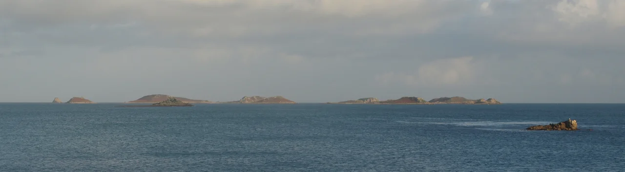

Eastern Isles
Look down at the Eastern Isles at low tide and the archipelago momentarily reveals what it once was: a single low plain, exposed when the boulder ridges and sandy bars between the small hills run dry, and twelve separate islands when the water returns. During the Roman occupation of Britain, these twelve hills were genuinely one piece of land, a plain stretching between St Mary's and St Martin's. The sea has been rising and the people have been leaving ever since. What remains are Bronze Age burial cairns, Iron Age field systems, a Roman shrine on Nornour, and a roll call of small islands with old Cornish names: Great Ganilly, Menawethan, Innisvouls, Nornour, Hanjague.
Twelve Islands, One Drowned Plain
The Eastern Isles are scattered to the south-east of St Martin's, twelve uninhabited islands totalling around 36 hectares between them. They range from Great Ganilly at 13.83 hectares down to Hanjague, a 0.30-hectare sea stack at the easternmost edge of the entire archipelago. Between them are Great, Middle, and Little Arthur, Menawethan, Little Ganilly, Great and Little Innisvouls, Great and Little Ganinick, Nornour, Ragged Island, and Guther's. The underlying rock is coarse-grained Hercynian granite, the same stone that built the Cornish mainland, topped here by wind-blown sand. The islands are less exposed to gales than the Western Rocks because St Martin's shelters them, so their soils receive less salt spray and remnant habitats of coastal grassland and maritime heath have survived where elsewhere the sea would have stripped them off.
Nornour's Shrine
Of all the Eastern Isles, Nornour is the strangest. The 1.64-hectare island holds the remains of prehistoric stone buildings, and inside their upper layers excavators found something that should not have been there: coins ranging from the late first to the late fourth century AD, glass, miniature pots, and pieces of small clay Gallic figurines. The dates span four centuries, which rules out a shipwreck deposit; people were leaving votive offerings here over many generations of Roman Britain. Nornour was almost certainly a shrine, a place where mariners passing the western edge of the empire stopped to leave something for whatever local deity or saint or sea-spirit watched these waters. The island was already old when the Romans found it. The buildings they re-used were prehistoric. The shrine layered another four hundred years of meaning onto a hilltop that had already been meaningful for centuries.
Botanists and Pseudoscorpions
Because no botanist resides on the Eastern Isles and recording plant species on uninhabited rocks is difficult, the floras of these islands have been surveyed only intermittently. The 1971 Flora of the Isles of Scilly by J.E. Lousley, based on fieldwork by him and J.D. Grose and Mr and Mrs J.E. Dallas in 1938 and 1939, was the first comprehensive list. He recorded 111 species. By 1999, follow-up surveys found a similar number, 114. The Dallases found an oak tree on Great Gannick, which sounds unremarkable until you remember these are wind-scoured islands where almost nothing taller than bracken can grow. They also found possible ancient woodland indicators on Great Gannick, including butcher's-broom, wood spurge, and wood small-reed. The nationally rare orange bird's-foot grows on the northern slope of Great Ganilly. A nationally scarce pseudoscorpion was recorded in 1927 on the rock called Mouls, just north-east of Little Innisvouls. The species lists keep growing because most of these islands have only been visited by scientists a handful of times in a century.
Hanjague and the Edge
At the far east end of the archipelago sits Hanjague. It is the easternmost island in all of Scilly, a sea stack rising bare from the Atlantic, 0.30 hectares with no vegetation and only birds for tenants. From the air it looks like a misplaced fragment, a chip of cliff that wandered too far from the coast and got stuck. The next stop east is Cornwall, 28 nautical miles away. Ragged Island has two unexpected plants: Chilean hard-fern and borage, neither recorded by Lousley in his 1971 Flora. Chilean hard-fern had earlier been noted at Higher Town on St Martin's in 1936, suggesting spore drift across a kilometre or so of open water. Guther's, accessible from St Martin's by foot at exceptional low tides if you are careful not to be cut off, hosts black-backed and herring gulls and shags. All the land of the Eastern Isles SSSI is owned by the Duchy of Cornwall. None of it is inhabited. Looking down on the twelve islands from cruising altitude, you can almost trace the older outline beneath them, the drowned plain that the sea is still slowly finishing.
From the Air
Located at 49.95N, 6.26W, south-east of St Martin's, Isles of Scilly. Best viewed at 1,500-3,000 ft AGL to see the full scatter of twelve islands. Nearest airport is St Mary's (EGHE) 2 nm south-west. Land's End (EGHC) is 28 nm east on the Cornish mainland. At low spring tides the islands appear linked by exposed boulder ridges; at high tide they become twelve separate dots. Hanjague at the eastern edge is the most distinctive landmark, a bare sea stack standing alone on the Atlantic horizon. No landings are permitted on most of the islands.
Nearby Stories
- Penlee lifeboat disaster 5.8 km away
- SS Georgia (1890) 18 km away
- Great Wheal Charlotte 28 km away
- 1979 Fastnet Race 37 km away
- Wheal Coates 66 km away
- SM U-27 93 km away
- HMS Affray 151 km away
- Tower of Hercules 719 km away