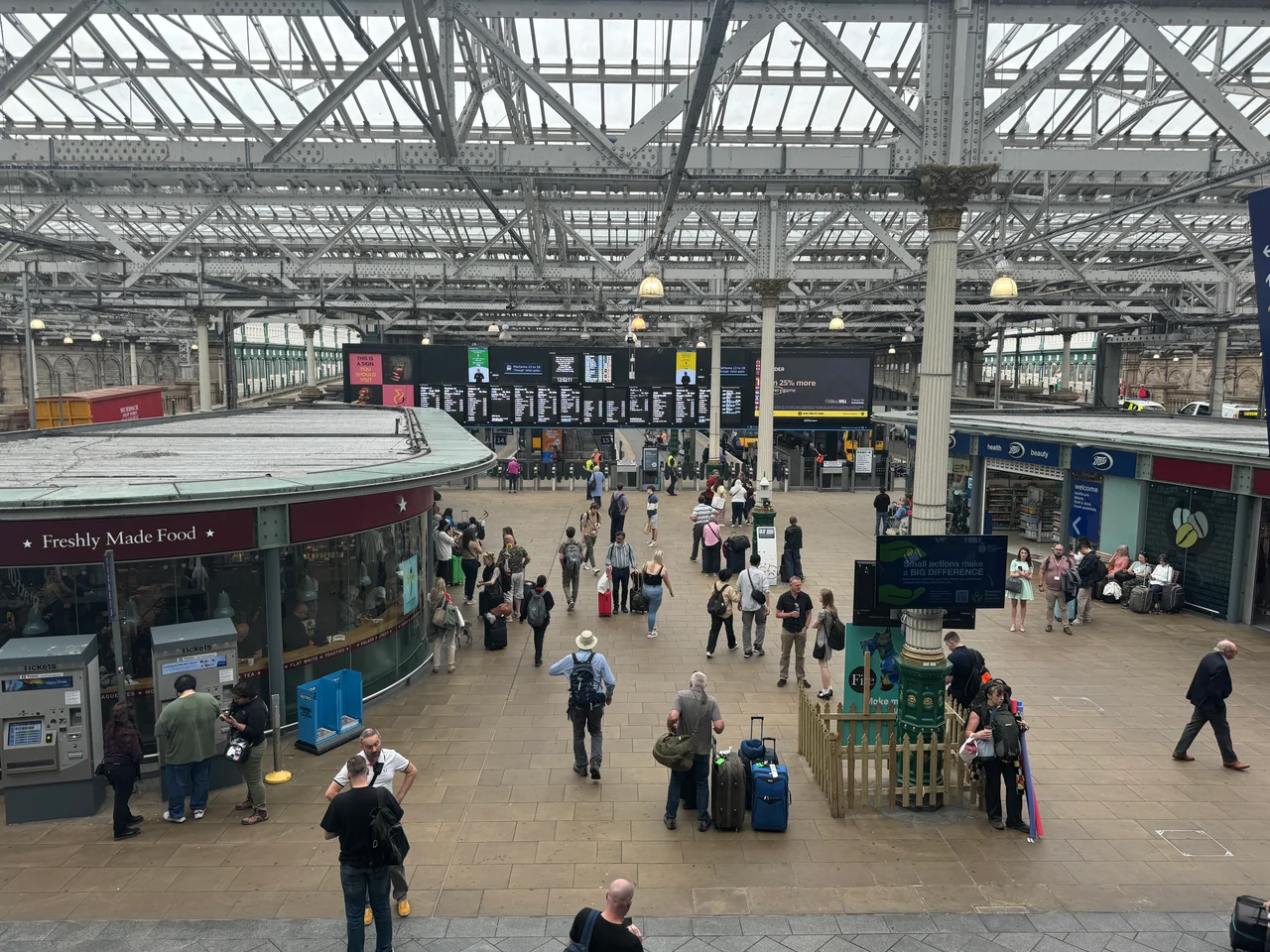

Edinburgh Waverley
Most cities build their railway stations on the edge of town and let them spread sideways. Edinburgh tucked Waverley into a glacial trench between the Old Town ridge and the Georgian New Town, sealed it under a 34,000-square-metre glass roof, and made a solemn legal promise that no one would ever be allowed to extend it upward. The reason for that covenant is a hill. Arthur's Seat must remain visible from Princes Street. The trains keep running below the skyline, and the skyline keeps its volcano.
A Loch, a Bog, a Bridge
Where the platforms now stretch, there was once a loch. The Nor Loch lay along the northern flank of Edinburgh's ridge, a sheet of stagnant water described by the eighteenth-century town councillors as a noxious lake and a filthy and offensive bog. The 1750s plans for the New Town required spanning it. The North Bridge was built from 1766 onward, the loch was drained, and the wealthy began moving into Princes Street with their unobstructed view south. When railway promoters arrived in the 1830s with proposals to run trains right through those gardens, the Princes Street Proprietors fought them in Parliament. A compromise emerged in 1844: walls, embankments, a cutting deep enough that the trains would be almost invisible, and almost £2,000 in compensation. Waverley would always be a station that hides.
Named for a Novelist
Three separate railways opened terminal stations on the same patch of valley floor within months of each other. The North British Railway's terminus came first on 22 June 1846. The Edinburgh and Glasgow Railway's General station opened on 17 May 1847, alongside the Canal Street station of the Edinburgh, Leith and Newhaven Railway - the latter served by a rope-hauled tunnel under the New Town that still survives. From around 1854, when a through route to Carlisle opened, all three were grouped under one collective name, taken from the Waverley Novels of Sir Walter Scott. Scotland's most celebrated novelist had died in 1832, and the city was still naming things after him. The North British Hotel rose at the corner of Princes Street and North Bridge in 1902, its tower a clock that famously runs a few minutes fast so travellers do not miss their trains.
The Glass Roof and the Covenant
Today Waverley covers about twenty-five acres, an island of platforms surrounded by tracks on all four sides, with twenty numbered platforms arranged clockwise from the northeast. The central booking hall is cunningly hidden inside the massive sandstone pier of North Bridge, which crosses high overhead in three iron spans rebuilt in 1897. Between 2010 and 2012, every one of those 34,000 square metres of roof glass was replaced with new strengthened panels as part of a 130-million-pound upgrade, transforming the station from a gloomy cavern into something almost luminous. The covenant against any vertical extension still stands. Network Rail's 2019 masterplan envisages a new mezzanine concourse above the platforms enclosed in plate glass to provide panoramic views over the Old Town, but the station will keep its promise to Arthur's Seat.
Lines Out in All Directions
Waverley is the northern terminus of the East Coast Main Line, 393 miles from London King's Cross, but most trains do not stop there. LNER and Lumo services run south to London. Avanti West Coast trundles through Birmingham. CrossCountry climbs to Aberdeen via Dundee. ScotRail fans out across Scotland to Glasgow, Stirling, Perth, Inverness via Aviemore, Fife via the Forth Bridge, North Berwick, and Tweedbank in the Borders. The Caledonian Sleeper rolls in overnight from London Euston, splitting into Highland and Lowland portions that wake their passengers in different parts of Scotland. The new Lumo service to London started running in October 2021. The masterplan envisages passenger demand growing through 2048. So far it shows no sign of slowing.
What the Station Sees
Step off a train at Waverley and you emerge into a geography that explains itself instantly. South are the Waverley Steps, recently covered by escalators, rising up to Princes Street and the Georgian terraces beyond. North is the medieval cliff face of the Old Town, the High Street and the Royal Mile cresting above you. West, the parkland of Princes Street Gardens fills the former bed of the Nor Loch. East is St Andrew's House, the Art Deco home of part of the Scottish Government, and beyond it the green volcanic mass of Calton Hill. No other British station opens onto so much theatre. The trick the engineers managed in 1846 was not just to build a railway through the heart of Edinburgh. It was to do it without anyone really noticing.
From the Air
Edinburgh Waverley sits in a glacial trench at 55.952N, 3.189W, between the Old Town ridge to the south and the New Town to the north. From the air the station is identifiable by its large glass roof spanning the valley between Princes Street Gardens and the medieval cliff. Key visual references: Edinburgh Castle on its volcanic plug at the western end of the ridge, the Scott Monument on Princes Street, Calton Hill with the National Monument and Nelson Monument to the east, Arthur's Seat 1.5 nm southeast. Edinburgh Airport (EGPH) is 9 nm west. Best viewing altitude 2,500-4,000 ft. Approach from the Firth of Forth for the classic skyline shot.
Nearby Stories
- Ardoch Roman Fort 2.2 km away
- Craignethan Castle 3.1 km away
- Haddington 3.8 km away
- Balvaird Castle 4.3 km away
- Battle of Kilsyth 9.4 km away
- Siege of St Andrews Castle 9.9 km away
- Neidpath Castle 11 km away
- Melrose Abbey 15 km away