Erkelenz
Pesch was the first to empty. The easternmost village in the Erkelenz borough, founded centuries ago like every other place around here, lost its last inhabitants in 2010. They had not chosen to leave. They had been bought out and resettled, along with the residents of nine other villages, because the ground their houses stood on was needed for a hole. The hole is Garzweiler II, an open-cast brown-coal mine operated by RWE Power that is scheduled to keep grinding westward toward Erkelenz until 2045. Over five thousand people have moved so far. New villages with names like Immerath (neu) and Borschemich (neu) have been built on the western side of town for the displaced. This is a town more than a thousand years old. What is being done to it is one of the largest legal evictions in postwar Germany.
A Roman Estate, Probably
Erkelenz first appears in the documentary record on 17 January 966, when St. Mary's Abbey in Aachen received the settlement - then spelled 'herclinze' - in an exchange with the Lotharingian Count Immo, confirmed by Emperor Otto the Great at an imperial assembly in Aachen. The dominant theory of the name is that it descends from a Gallo-Roman estate called fundus herculentiacus, the property of someone named Herculentius. Whether anyone actually lived continuously here from Roman times into the Frankish period is harder to prove - the archaeology shows Old and New Stone Age sites scattered across the borough, urn graves of the early Frankish period, a Roman Jupiter column dug up at Kleinbouslar in 1906, a 7,100-year-old wooden well at Kuckhoven dating to about 5,100 BC that is among the oldest wooden structures in the world. Layers of settlement, sometimes overlapping, sometimes not.
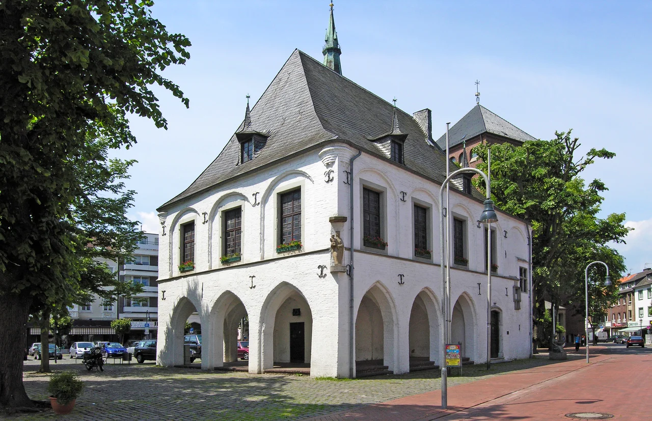
A Town of Guelders
Erkelenz received town rights from Count Reginald II of Guelders in 1326, or perhaps over a longer process that did not have a single fixed date. By 1331 there was a jury seal, and by 1343 the town was attending the Guelders urban diet. Built within the town walls before they were a town at all, the castle gave shelter; the Brueck Gate was built in 1355 on the Cologne Military Road, the strongest of the gates that defended the medieval brick fortifications. Erkelenz was repeatedly fought over. The plague almost depopulated it in 1580. Dutch troops sacked it in 1607 during the Spanish-Dutch War. In 1674 it was finally taken on the fourth assault by Louis XIV's army allied with the Archbishop of Cologne, using newly invented cannon to break the gates - that day, the attackers reportedly lost 400 dead, the defenders only six. The townspeople were then forced to breach their own walls. From 1816 to 1972 Erkelenz was a Prussian district town. In 1972 it lost county-town status to Heinsberg and absorbed eleven surrounding municipalities.
Industry, Pins, Weavers
The Industrial Revolution arrived modestly. Andreas Polke from Ratibor founded a pin factory here around 1825 - by 1841 he employed 73 workers, of whom 36 were children under fourteen. Pins were made in Erkelenz until about 1870. In 1852 the town was connected to the Aachen-Monchengladbach railway. Mechanical weaving mills opened: I.B. Oellers's Rockstoff factory in 1854, Karl Mueller's plush weavers in 1872, the Halcour Textile Factory on Neusser Strasse in 1897. The same year the real industrial leap came, when the engineer Anton Raky moved the head office of the International Drilling Company - locally known simply as the Bohr - to Erkelenz, drawn by good rail links to the Ruhr and the Aachen coalfield. For a while the Bohr made Erkelenz a small player in the world of oil exploration drilling.
Garzweiler II
And then, in the twenty-first century, the eastern half of the borough started to disappear. The Garzweiler II open-cast brown-coal mine, operated by RWE Power, was approved in 1995. Beginning in 2006 the eastern parts of the Erkelenz borough were cleared so the pit could expand westward. Pesch, Immerath, Borschemich, Holzweiler, Keyenberg, Kuckum, Lutzerath, Berverath, Westrich, Unterwestrich - ten villages on the resettlement list, more than five thousand people relocated. Houses were emptied, churches deconsecrated and demolished, graves exhumed and moved. The neo-Romanesque Immerath cathedral, called the Immerather Dom, came down in 2018 in scenes broadcast across Europe. The nearby Hambach Forest, just south of here, became the focal point of one of Germany's longest-running environmental protests - activists living in treehouses to slow the cutting, repeated police evictions, court rulings. Lutzerath, on the immediate edge of the pit, became a flashpoint in 2023 when police cleared the last protesters from the village. In the wake of Germany's accelerated coal phase-out, some of the originally condemned villages - Keyenberg, Kuckum, Berverath, Unterwestrich, Oberwestrich - were eventually saved. Others were not. The pit walls now stand within sight of Erkelenz's old town.
What Stays, What Goes
The town of Erkelenz proper is still here, with more than 44,000 inhabitants, the old market square preserved, the original street grid largely intact. The coat of arms still shows the gold lion of Guelders above a red medlar - the rose of Geldern - the symbols of a town that took its identity from a duchy that ceased to exist in 1500. The new villages built to receive the displaced sit in tidy regular grids on the borough's western edge, with churches built to replace the ones bulldozed, street names that try to honour the old places. Whether a village can be moved - whether what you carry to the new ground can really be the same place - is a question Erkelenz has been answering, painfully, for almost two decades. The people who left Pesch in 2010 know that no one really knows the answer.
From the Air
Erkelenz lies at 51.08 N, 6.32 E in North Rhine-Westphalia, about 15 km south-west of Monchengladbach and roughly 40 km north-east of Aachen. From altitude, the most striking feature is not the town itself but the immense pit of Garzweiler II just to its east - a vast rectangular wound in the landscape several kilometres across, with terraced sides where bucket-wheel excavators work the seams. The town centre sits in gently rolling farmland on the loess plateau of the Julich Borde. Nearest airports: Dusseldorf (EDDL) 35 km east, Monchengladbach (EDLN) 15 km north-east, Maastricht-Aachen (EHBK) 30 km south-west.
Nearby Stories
- Tegelen 1.9 km away
- Eilendorf (Aachen) 2.4 km away
- Duisburg-Hochfeld Railway Bridge 9.9 km away
- Tongeren 12 km away
- Geldrop Castle 12 km away
- Zons 13 km away
- Genk 14 km away
- F.L.Y. 14 km away