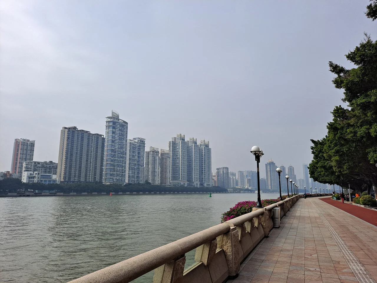

Ersha Island
The Pearl River splits around Ersha Island the way a sentence splits around a parenthetical thought — the main current of the city continues on either side, and the island itself becomes a pause. For the British in the nineteenth century, that pause was strategic: the island they called Napier Island sat at a chokepoint in the river approach to Canton, ideal for a fort. Today, the guns and earthworks are gone, replaced by concert halls and galleries and small parks where people walk in the evenings. The transformation from military outpost to arts district is one of the more complete reinventions in Guangzhou's landscape.
Named for a Man Who Never Quite Arrived
Lord Napier — William Napier, 9th Lord Napier — was dispatched to Guangzhou in 1834 as Britain's first official trade envoy to China. The mission did not go well. Chinese authorities refused to recognise his credentials, declined to receive him through official channels, and eventually blockaded the foreign ships until he withdrew. He died in Macau shortly afterward. The fort on the eastern end of this island bore his name nonetheless, a semi-circular structure of stone masonry mounting 35 guns and built to command the passage on both sides of the island. Whether the naming was meant as commemoration or irony is not recorded. The fort exists now only in historical accounts; the island that carries the memory of his failed mission has moved on entirely.
Two Opium Wars, One Island
Ersha Island's position at a narrows in the Pearl River made it a recurring point of contest. During the First Opium War, British forces seized Napier's Fort and used it as part of the advance on Canton in March 1841. Before the war ended, Chinese authorities rebuilt the fort and added three more nearby, mounting nearly 200 guns in total — the cluster became known as the Barrier Forts, blocking the river approach. At the start of the Second Opium War, in October 1856, British forces again captured this stretch of river with what the records describe as only slight opposition during the Battle of Canton. In November 1856, American forces separately attacked and captured the same Barrier Forts — an action driven by American grievances over vessels fired upon in the area. The island passed between occupying forces like a toll station on a disputed road.
The River Reshapes What It Touches
Water defines Ersha Island in ways that go beyond geography. The Pearl River splitting around it made the island militarily valuable and then, once the era of river fortifications had ended, made it something else: a place slightly apart from the urban density of Guangzhou, quieter, more contained. That quality of separateness is why the Guangdong Museum of Art and the Xinghai Concert Hall ended up here. The museum holds one of southern China's primary collections of fine art; the concert hall, completed in 1998 and named for the composer Xian Xinghai, is the main venue for orchestral music in the city. Several small parks occupy the remainder of the island's green space — Chuanqi, Hong Cheng, Ershadao Sports Park, and Guangzhou Fazhan Park — each suited to the unhurried pace the river setting encourages.
A School Island, Too
Ersha Island is also, somewhat unusually, a node of international education. The elementary campus of the American International School of Guangzhou occupies part of the island, alongside Guangzhou Yuexiu Yucai Experimental School. A French international school, the École Française Internationale de Canton, was previously located here as well. The presence of international schools alongside a concert hall and an art museum gives the island a particular demographic character — residents who are either local professionals or expatriates drawn to the combination of cultural institutions and relative quiet. In June 2025, Ersha Island station opened on Line 12 of the Guangzhou Metro, connecting the island to the wider city without dismantling the sense of enclosure the river provides.
From the Air
Ersha Island sits at approximately 23.113°N, 113.300°E, a visible stripe of green land in the Pearl River in the Yuexiu District of central Guangzhou, about 10 km south-southeast of Guangzhou Baiyun International Airport (ZGGG). From 2,000 feet AGL the island's elongated shape is clearly distinguishable as the river divides around it. Canton Tower is roughly 2.5 km to the east and serves as the primary visual anchor for the area. The river bends offer reliable navigation references on approach from ZGGG.
Nearby Stories
- Shunde 12 km away
- 2015 Shenzhen Landslide 15 km away
- Mount Luofu 23 km away
- Qingyuan Maglev Tourist Line 32 km away
- Kaiping 56 km away
- Heyuan 90 km away
- Chikan, Kaiping 92 km away
- Erlitou Site Museum of the Xia Capital 1257 km away