
Fanling
The name Fanling is a shortening — Fan Pik Leng compressed into something faster, the way a place that handles a lot of through-traffic tends to shed syllables. The town in Hong Kong's northeastern New Territories has always been a crossroads. The East Rail line passes through. Castle Peak Road cuts across. Sheung Shui lies to the northwest; Tai Po to the southeast. Fanling itself sits in the middle, part of the Fanling–Sheung Shui New Town that grew from a cluster of market settlements and walled villages into one of Hong Kong's larger suburban centres. But the old Luen Wo Hui marketplace and the walled village of Fanling Wai are still here, inside a landscape that has changed enormously around them.
Market Village, Then New Town
Before urban development transformed it, the Fanling area was anchored by Luen Wo Hui — the local marketplace where farmers and traders from surrounding villages came to sell. It was the kind of place that defined the rhythm of rural New Territories life: periodic markets, agricultural goods, the social glue of regular exchange. Urban development arrived in force from the 1970s onward, as Hong Kong built its ring of New Towns to house a rapidly growing population. Fanling absorbed waves of public housing estates, private residential developments, and infrastructure — the Cheung Wah Estate and Wah Ming Estate among the public ones, a long list of private developments filling the lowlands with towers. The Luen Wo Hui market still operates, though the town around it has multiplied many times over. At Wo Hop Shek, uphill from the main settlement, a large public cemetery holds generations of those who lived here.
Villages Inside the Town
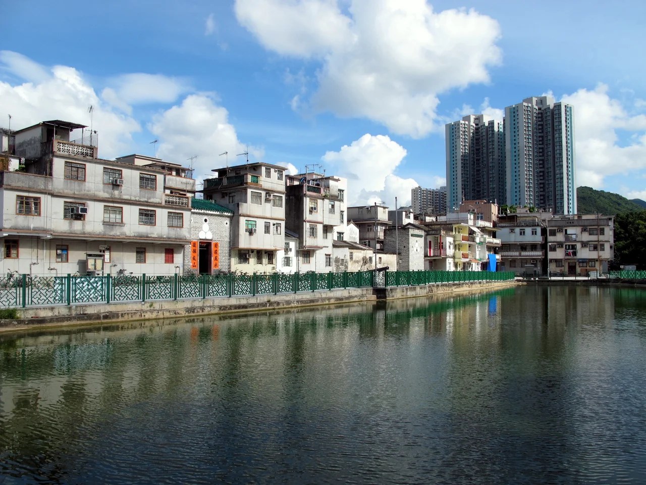
What surprises visitors who look past the housing blocks is how many old villages remain embedded in Fanling. The area contains dozens of them: Fan Leng Lau, Fu Tei Pai, Hok Tau Wai, Hung Leng, and many more. Lung Yeuk Tau is the largest and most celebrated cluster, encompassing several distinct walled settlements — San Uk Tsuen, San Wai, Wing Ning Tsuen, Wing Ning Wai, Ma Wat Tsuen, Tung Kok Wai, and Lo Wai — all connected by the Lung Yeuk Tau Heritage Trail, which leads walkers through landscapes of ancestral halls and fortified gateways. Fanling Wai, the old Pang Clan stronghold, is the most prominent individual village. Together these settlements represent continuities of settlement that predate the British colonial presence in the New Territories by centuries. The towers of the new estates rise above them; the old walls and ancestral halls persist below.
Temples, Trails, and a Relocated Museum
Fanling's sights reflect the layering of its history. The Fung Ying Seen Koon Taoist temple, founded in 1929, sits on a hillside commanding views over the town — its orange-tiled double roof visible for some distance. The Lung Yeuk Tau Heritage Trail offers a self-guided walk through the walled village cluster. The Tao Heung Foods of Mankind Museum, which once operated in Fanling, relocated to Fo Tan in 2008. These are not grand tourist monuments but modest, functional presences: a working Taoist institution, a heritage walk through lived-in villages, a museum that moved when it needed more space. Fanling is a town, not a theme park, and its historic fabric is embedded in a place where people go about ordinary business around it.
Fanling North and the Next Wave
Fanling's growth is not finished. Fanling North is one of three major new development areas planned for Hong Kong's North District, alongside Kwu Tung North and Ta Kwu Ling. The plans are substantial: new residential and commercial districts, infrastructure investment, population growth on a significant scale. The proximity to the Shenzhen border — and the economic integration that Hong Kong's northern metropolitan strategy envisions — makes this part of the New Territories strategically important in ways that go well beyond housing capacity. Whether the old villages and heritage buildings can be preserved within that development is the kind of question Hong Kong has been negotiating, imperfectly, for decades. In Fanling's case, the Antiquities Advisory Board's decisions about nearby Fanling Lodge and the Pang Ancestral Hall offer some precedent for protection.
Fanling from the Air
The East Rail line is the best visual guide to Fanling from altitude: follow the corridor south from Lo Wu, and Fanling station appears in the middle of the town grid at around 22.4918°N, 114.142°E. From 3,000 feet, the density of development contrasts sharply with the open agricultural land and fish ponds that still survive nearby. The Shenzhen skyline is visible to the north on clear days — a dramatic reminder of the border that shapes this entire region. The forested hills of Pat Sin Leng Country Park rise to the southeast. Hong Kong International Airport (VHHH) lies approximately 50 kilometres to the west. Fanling overflights are most rewarding in the cooler months, when winter air clears the haze that settles over the New Territories in summer.
From the Air
Coordinates: 22.4918°N, 114.142°E. Recommended viewing altitude: 2,500–4,000 ft. Fanling station on the East Rail line is the main visual anchor. The Shenzhen border runs a few kilometres to the north; Pat Sin Leng Country Park rises to the southeast. Nearest airport: Hong Kong International (VHHH), approximately 50 km to the west. Clear winter days offer the best visibility.
Nearby Stories
- Chapel of St. Francis Xavier 3.5 km away
- Cuiheng 4.1 km away
- 2015 Shenzhen Landslide 16 km away
- Shunde 31 km away
- Wanshan Archipelago 37 km away
- Nanxiong Formation 96 km away
- Heyuan 149 km away
- Checheng Fu'an Temple 629 km away