.jpg)
Farroupilha Park
The name on the gate is a promise the city made to itself. Long before it became Porto Alegre's beloved green heart, this ground was the Várzea do Portão, a flooded lowland by the old gate of town where cattle were penned, leather was laid out to dry, and municipal garbage was dumped. Then, in 1884, the city changed the street's name to Campos da Redenção, the Fields of Redemption, to mark something that had just happened nearby: the freeing of hundreds of enslaved people in a district of the capital, a full year before Brazil freed the elderly and four years before slavery ended across the country. A dumping ground had been renamed for one of the proudest acts in the city's history.
The Commons That Refused to Be Sold
The land was set aside early and defended often. On February 23, 1807, the City Council asked the provincial governor, Paulo José da Silva Gama, to donate the lowland for public use and as a holding ground for the herds that supplied the town. For more than a century afterward, government officials and private speculators tried repeatedly to carve it up for other purposes, and time after time the attempts were blocked. During the Ragamuffin War the várzea lay outside the city's defenses, and an inspection after the conflict found fences encroaching and even a mansion built at its center, all of it promptly torn down. The people of Porto Alegre kept insisting this ground belonged to everyone.
From Mud to Garden
The transformation came in stages. In 1870 the lowland got its first official name, Campo do Bonfim, after the chapel rising on its northern edge, and in 1872 a military base was authorized in the southeastern corner, the seed of today's Military School of Porto Alegre. Real landscaping began only in 1927, when the Jardim Paulo Gama was laid out and the old parade of carts and herds was banned the following year. The decisive year was 1935. For the centenary of the Revolução Farroupilha, the entire southern field was drained, flushed, and urbanized to the designs of the French architect Alfred Agache, and the place took the name it still carries: Parque Farroupilha.
Sunday Belongs to the Brique
On Sunday mornings the park becomes the city's living room. From nine o'clock the Brique da Redenção unfolds along Avenida José Bonifácio, stalls of crafts, art, souvenirs, food, and antiques stretching down the avenue while families stroll and pass the gourd of mate from hand to hand. Saturdays bring their own rhythm, with an eco-fair of organic produce and a crafts fair of some sixty exhibitors. It is a democratic kind of place, a magnet for candidates at election time and for movements and causes of every description. On a sunny morning the lawns fill with people doing the simplest thing a park is for: being unhurried, together, in public.
Monuments, Boats, and Borrowed Worlds
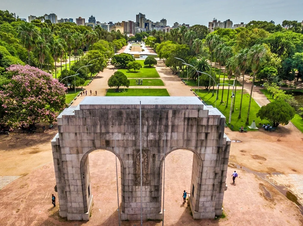
Agache's design scattered surprises across the grounds. A little lake holds an island Belvedere reached by a bridge, where you can rent paddle boats, some shaped like swans, from a wharf renovated in 2004. Rising over the Avenue of the States is the Monument to the Expeditionary, a granite double arch 12.5 meters tall, inaugurated in 1957 to honor the gaúcho soldiers of the Brazilian Expeditionary Force who fought the Axis in Italy; it shelters the Pira da Pátria, lit on national holidays. Elsewhere the park borrows whole landscapes: an Oriental garden built around a dragon-shaped lake, with arched bridges, a pagoda, and a Buddha, sits a short walk from a European garden with its fountain and Roman pergola, near the Araújo Viana auditorium opened in 1964.
From the Air
Farroupilha Park sits at 30.0367 degrees south, 51.2158 degrees west, just east of Porto Alegre's historic center and close to the shore of Lake Guaíba. From the air it is one of the clearest landmarks in the city: a large green wedge of lawns, tree canopy, and a small lake, framed by José Bonifácio, João Pessoa, Luiz Englert, Setembrina, and Osvaldo Aranha avenues, with the bright granite arch of the Expeditionary Monument catching the eye on a sunny day. The nearest field is Salgado Filho International Airport (ICAO SBPA), about five to six nautical miles to the north-northeast, with Canoas Air Base (SBCO) farther north. Recommended viewing altitude is 1,500 to 2,500 feet AGL, where the park's geometry and the silver sheet of the Guaíba just to the west make easy reference points. Visibility is typically excellent during the dry southern Brazilian autumn and winter.
Nearby Stories
- Itapuã State Park 22 km away
- Nova Petrópolis 37 km away
- Aparados da Serra National Park 77 km away
- Santa Cruz do Sul 77 km away
- Serra Geral National Park 111 km away
- 2009 Brasil de Pelotas Bus Disaster 161 km away
- Passo Fundo 176 km away
- Battle of the River Plate 446 km away