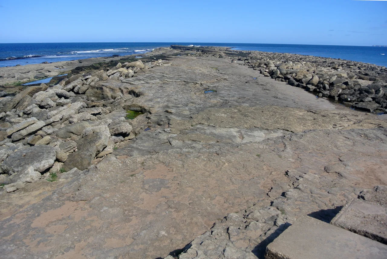

Filey Brigg
The story the Filey fishermen tell goes like this: the Devil was building a bridge across the North Sea when he dropped his hammer into the water. He reached down to grab it, but instead caught a fish. He exclaimed, in surprise and disgust, 'Hah! Dick!' - and that, according to local folklore, is how the haddock got its name. The marks of his grasping fingers can still be seen, the story claims, in the long ridge of rock that juts a mile out into the sea north of Filey: the Brigg. It is, by any folkloric standard, a particularly Yorkshire explanation - practical, irreverent, and only slightly committed to making sense.
A Finger of Stone
Filey Brigg is a long narrow peninsula about a mile north of the town of Filey, on the East Riding coast. The landward end, called Carr Naze, rises in twenty-metre cliffs of mixed sandstone and limestone. From there, the rock thins into the Brigg proper: a low, level ridge running northeast into the North Sea, exposed at low tide and submerged at high. The structure exists because of a geological accident. The rock on the south side of the Brigg slipped down sometime in deep time, leaving the overlying clay sitting at or below sea level. The sea ate the clay, forming the gentle sweep of Filey Bay. The hard rock on the north side stayed put, and the sea has been picking at it ever since. The result is a coastline that looks almost designed: a sandy bay scooped out to the south, a finger of rock pointing northeast to the open sea.
The Roman Signal Station
In 1857 a Filey antiquarian named Dr Cortis - one of those Victorian doctor-amateurs who made half the archaeological discoveries of their century - began excavating the headland at Carr Naze. A local painter named Wilson had been finding Roman pottery, bone fragments, and charred wood in the area, and Cortis followed up. The excavation produced five large stones, possibly altars or column bases, one carved with a dog chasing a stag. Near one of them was a fragmentary inscription: CAESAR S E / Q V A M S P E. The site was a Roman signal station, part of a chain that ran along the Yorkshire coast in the late fourth century, designed to spot Saxon raiders and warn the garrison towns inland. The signal stations were small fortified watchtowers, manned by a handful of soldiers and burned down with depressing regularity by the raiders they were meant to spot. Carr Naze was one of the last lookouts of Roman Britain.
Erosion in Progress
The Brigg continues to come apart. In 1869 a major landslip carried several hundred metres of Carr Naze into the sea, taking part of the Roman site with it. Smaller slips happen regularly: the soft clay cliffs face the prevailing weather and slump after rain, and the wave action picks at the foot of the cliff at every high tide. Country Park status from the early 1970s preserved the top of the headland for walkers and picnickers, but the cliff edge itself is anyone's guess from one decade to the next. The Brigg is also a Site of Special Scientific Interest - the rock pools at low tide hold a particularly rich invertebrate fauna, and the geology exposes a clear cross-section of Jurassic strata for anyone willing to scramble down the cliff path at the right state of the tide.
The Dragon and the Parkin
The Devil and his haddock are not the only legend attached to the Brigg. Another local story holds that the rocks are the bones of a dragon that once terrorised the area. The townspeople, the story runs, knew that the beast loved Yorkshire parkin - a sticky, gingery cake made with oatmeal and treacle - and they tricked the dragon into eating great quantities of it. The parkin got stuck in its teeth, so badly that the dragon waded into the sea to wash its mouth out. While diving for cleaner water, it drowned. The Brigg is what remains. As folkloric explanations go, this one has the virtue of being entirely about Yorkshire food and Yorkshire problem-solving: feed your enemy the local cake until they are at a disadvantage, then let geography do the rest.
From the Air
Coordinates 54.2173°N, 0.2673°W. Filey Brigg juts northeast from the coast about 1 nm north of Filey town, on the boundary between North Yorkshire and the East Riding. From the air the finger of rock is distinct: a narrow ridge extending into the sea, exposed at low tide as a curved line of dark rock, with Carr Naze rising to 20-metre cliffs at the landward end. Filey Bay sweeps south to the white cliffs of Bempton and the great chalk headland of Flamborough Head, about 7 nm to the south-southeast. Best viewed 1,500-3,000 ft in clear conditions, ideally at low tide to see the full ridge. Nearest airports: Humberside (EGNJ) about 30 nm south-southwest, Durham Tees Valley (EGNV) about 40 nm northwest, Leeds Bradford (EGNM) about 50 nm west-southwest.
Nearby Stories
- Mulgrave Castle 0.2 km away
- Pickering Castle 5.3 km away
- Raid on Scarborough, Hartlepool and Whitby 6.3 km away
- Burton Constable Hall 17 km away
- Yorkshire Air Museum 18 km away
- Breagh Gas Field 24 km away
- 2025 North Sea Ship Collision 26 km away
- Runswick Bay 37 km away