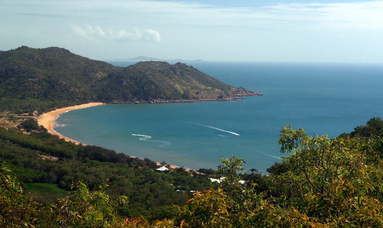

Fort Complex, Magnetic Island
The guns fired exactly once, and they fired at a friend. Sometime during the war, a United States Navy PT boat slipped into Cleveland Bay after dark without signalling, and the gunners on Magnetic Island sent a warning shell across its bow - the only shot these batteries are ever believed to have fired in the entire conflict. That single round captures the strange truth of the place. Two big coastal guns were dragged up a mountainous granite headland, concrete command posts and a searchlight tower and a radar station were poured into the boulders, hundreds of men lived and watched and waited here for a Japanese fleet that never appeared. Today the same path that supplied those gunners climbs through dry hoop-pine forest to the observation post on the ridge, and the most likely thing to ambush you is a koala, asleep in the fork of a gum, indifferent to the war it slept through.
Why the Guns Came
In 1942 the war was moving south fast, and Townsville sat squarely in its path. The town had become the major Allied supply depot for the southwest Pacific and a staging post funnelling troops north into the fighting. A working harbour like that needed protecting, and the granite hills of Magnetic Island - guarding the approaches to Cleveland Bay - were the obvious place to do it. Construction of the battery began on 28 September 1942 and finished a little over nine months later, on 10 July 1943, the work carried out by the Queensland Main Roads Commission using local labour. The guns themselves had a history before they arrived. They were 155 mm GPF pieces - a French Grande Puissance Filloux design, manufactured in the United States - and had been bound for the defence of Bataan in the Philippines until that peninsula fell to Japanese forces. Redirected in a hurry, they ended up aimed out over the Coral Sea instead.
Anchored in the Boulders
What makes the Forts so unusual is how completely they are wedded to the landscape. There was no levelling a site here, no clearing a tidy parade ground. The engineers anchored everything into the existing granite, threading concrete between car-sized boulders on a steep, heavily timbered point between Horseshoe Bay and Arcadia. Building a battery on a rugged headland like this, and lifting guns weighing tonnes into position above the sea, was a genuine feat of wartime engineering. The remains are scattered along the ridgeline like a puzzle half-returned to the bush: a command post with a commanding outlook, a searchlight emplacement, the ammunition store, signal and radar stations, the concrete pads where the guns once swung. Lower down, flat slabs in the trees mark where the soldiers slept. The structures were never glamorous, and seventy years of monsoon and root and lichen have softened every edge.
The Invasion That Never Came
History decided the guns were not needed. The feared push down the coast was blunted in the air and at sea - in the Coral Sea, over the Owen Stanley Range, in the long grind of New Guinea - and the front rolled north and away. The shells stayed in the magazine. When the war ended the guns were handed back to the American forces, the fort was stripped of its fittings, and the whole installation was simply abandoned to the weather. For decades it crumbled quietly. There is something honest in that. No decisive battle was fought here, no monument was raised in triumph; what survives is the unglamorous infrastructure of vigilance, the concrete evidence of a country bracing for a blow it never had to absorb.
A Walk Through History
When Magnetic Island National Park was established, the Queensland parks service took the ruins under its wing, ran signs and pathways through them, and turned a derelict battery into one of the island's best-loved walks. The Forts Walk is now a roughly 3.8-kilometre return climb, moderate enough for families, that delivers a double reward. There is the human story - the command post, the gun sites, the long views these gunners scanned for an enemy fleet, the same blue sweep of Cleveland Bay and the granite-and-pine hills. And there is the wildlife. Magnetic Island carries one of the largest wild koala populations in the country, and the gums along the ridge are a reliable place to find them, dozing low and sun-drunk while rock-wallabies forage in the boulders and kookaburras and cockatoos clatter overhead. The heritage of the place was formally recognised in 1992, when the Fort Complex was added to the Queensland Heritage Register - listed alongside the wartime defences at Kissing Point and Pallarenda as rare survivors of the months when this coast prepared, in earnest, for war.
From the Air
The Fort Complex sits on the eastern side of Magnetic Island near 19.123 degrees south, 146.871 degrees east, on a granite headland between Horseshoe Bay and Arcadia, overlooking Cleveland Bay and the Coral Sea. Recommended viewing altitude is 2,000 to 3,500 feet, which frames the whole island - the hoop-pine ridges, the string of east-coast bays, and Townsville on the mainland eight kilometres to the west. The hilltop observation post is the most visible landmark; the rest of the battery is hidden under tree canopy. Nearest airport is Townsville (YBTL / TSV), about 10 nautical miles southwest, a busy joint civil-military field; the Great Barrier Reef lies offshore to the east. Conditions are generally clear and bright in the dry season (May to October); expect afternoon cumulus and tropical haze in the wet.
Nearby Stories
- Stewart's Creek Gaol 7.4 km away
- Great Palm Island 22 km away
- Ayr 29 km away
- SS Yongala 42 km away
- Hinchinbrook Island 64 km away
- Cardwell UFO Festival 93 km away
- Porcupine Gorge 225 km away
- Samarai 980 km away