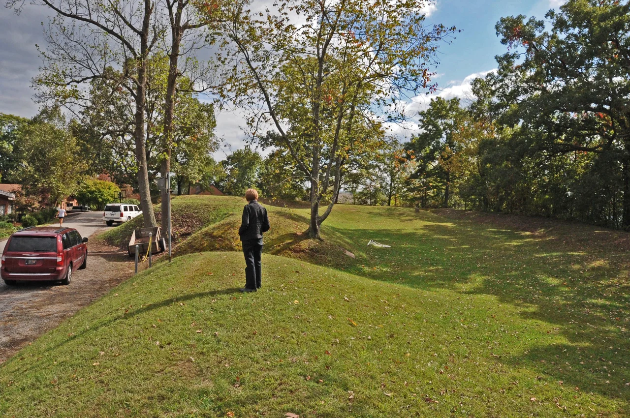

Fort Scammon
When the Union army retook Charleston in October 1862 - reoccupying the town that Confederate General William W. Loring had captured the previous month - the federal command came away with one clear lesson: control of the city depended on control of the ridge above it. Within a few months of the recapture, Union engineers began fortifying the hilltop that locals had used during the September fighting as an artillery position. By March 1863 they had laid out an elliptical earthwork on the ridge known then as Fort Hill, named the position Fort Scammon after Brigadier General Eliakim Scammon, and stationed troops there for the remainder of the war. The earthworks are still there today. They are the most visible Civil War archaeological feature in the Kanawha Valley.
The Hilltop That Mattered
Fort Scammon sits on a ridge rising about three hundred feet above the south bank of the Kanawha River, directly across from downtown Charleston. From the summit, the entire river valley is visible: the long flat of the Kanawha bottoms to the east, the confluence with the Elk River to the west, the surrounding bottomlands where the town was built. The position dominates the river and the principal road - then the James River and Kanawha Turnpike, today U.S. Route 60 and Interstate 64. Whoever held this hill could observe and bombard any movement through Charleston. Confederate artillery had used the ridge during Loring's September 1862 attack on the city, dropping shells onto the Union positions along the Elk River. When the Union returned, the federal command was determined that the next attacker would not get to use the same trick.
Building the Earthwork
Construction began in March 1863. The work was earthwork rather than masonry - the standard nineteenth-century field fortification, built quickly with shovels and basket gangs and reinforced with timber. The layout was elliptical, with the long axis running roughly east-west along the contour of the ridge, sized to enclose a battery of artillery and a supporting infantry garrison. The walls were thrown up from earth excavated from a surrounding ditch, with embrasures cut for cannon and firing steps built up behind the parapet for infantry. The fort was named for Eliakim Parker Scammon, a Maine-born brigadier general who had commanded the federal Kanawha District. Camp White, the supporting infantry encampment, sprawled down the south slope. Together the position garrisoned several thousand Union troops through the closing years of the war. No Confederate force attempted to take the fort after it was completed. The mere existence of fortified artillery on the ridge was sufficient to discourage another attempt on Charleston.
What the Earth Held
After the war ended, the fort had no further military purpose. The garrison left. The earthworks were not demolished but simply abandoned to weather and vegetation. The ridge they sit on was eventually subdivided as residential lots became valuable. Some of the earthwork was disturbed by twentieth-century construction. But a substantial portion of the elliptical wall and ditch system survives - close enough to the original profile that the layout can still be traced on foot through the trees. The fort was designated an archaeological site rather than a building, because what remains is the shaping of the land itself: a low rampart of earth, a corresponding ditch, and the outline of an ellipse atop a ridge. There are no surviving structures - no powder magazine standing, no barracks - just the bones of the earthwork itself, preserved in the soil and the angle of the slope.
On Foot, Today
Fort Scammon was added to the National Register of Historic Places in 1976. The site sits within a small neighborhood park accessible from the south side of Charleston. Visitors can walk the perimeter of the original earthworks, follow what remains of the parapet around the elliptical outline, and look out over the valley toward downtown Charleston much as Union artillerymen would have. The fort is not a developed historic site in the conventional sense - no museum, no major interpretive signage, no reenactments. It is closer to the way most of America's Civil War earthworks survive: as a piece of altered topography that the local community knows about and that occasionally gets a visit from a Civil War enthusiast. The view from the fort, even with modern buildings filling the valley below, is still the same view that mattered to two armies in 1862 and 1863. That, at least, has not changed.
From the Air
Fort Scammon sits on the ridge known as Fort Hill above the south bank of the Kanawha River in Charleston, West Virginia at 38.35 degrees north, 81.66 degrees west, about a mile south of downtown. Best viewed at 3,000 to 5,000 feet AGL: look for the wooded ridge rising directly south of the Kanawha River across from downtown Charleston, with the elliptical earthwork at the summit largely hidden under tree cover. Yeager Airport (KCRW) is about four miles northeast on its distinctive flat-topped ridge. The Kanawha River and the state capitol dome are reliable orientation landmarks.
Nearby Stories
- Mystery Hole 6.5 km away
- West Virginia Colored Children's Home 9.4 km away
- Clay, West Virginia 13 km away
- Staats Mill Covered Bridge 14 km away
- Hobet Coal Mine 23 km away
- Appalachia 23 km away
- Fred M. Vinson Museum and Welcome Center 30 km away
- Ponn Humpback Covered Bridge 43 km away