
Ftelia
The windsurfers skimming across Ftelia bay have no idea what lies beneath the sand they launch from. The wind that draws them, a near-constant gale off the north of Mykonos, is the same wind that scoured this shore seven thousand years ago, when a small village of farmers built their houses of granite rubble on what was then a fertile coastal plain. The sea has risen ten metres since, drowning their fields, and the place lay forgotten until 1992. What the excavations found here rewrote part of the story of how civilisation began in the Aegean.
A Village Older Than Memory
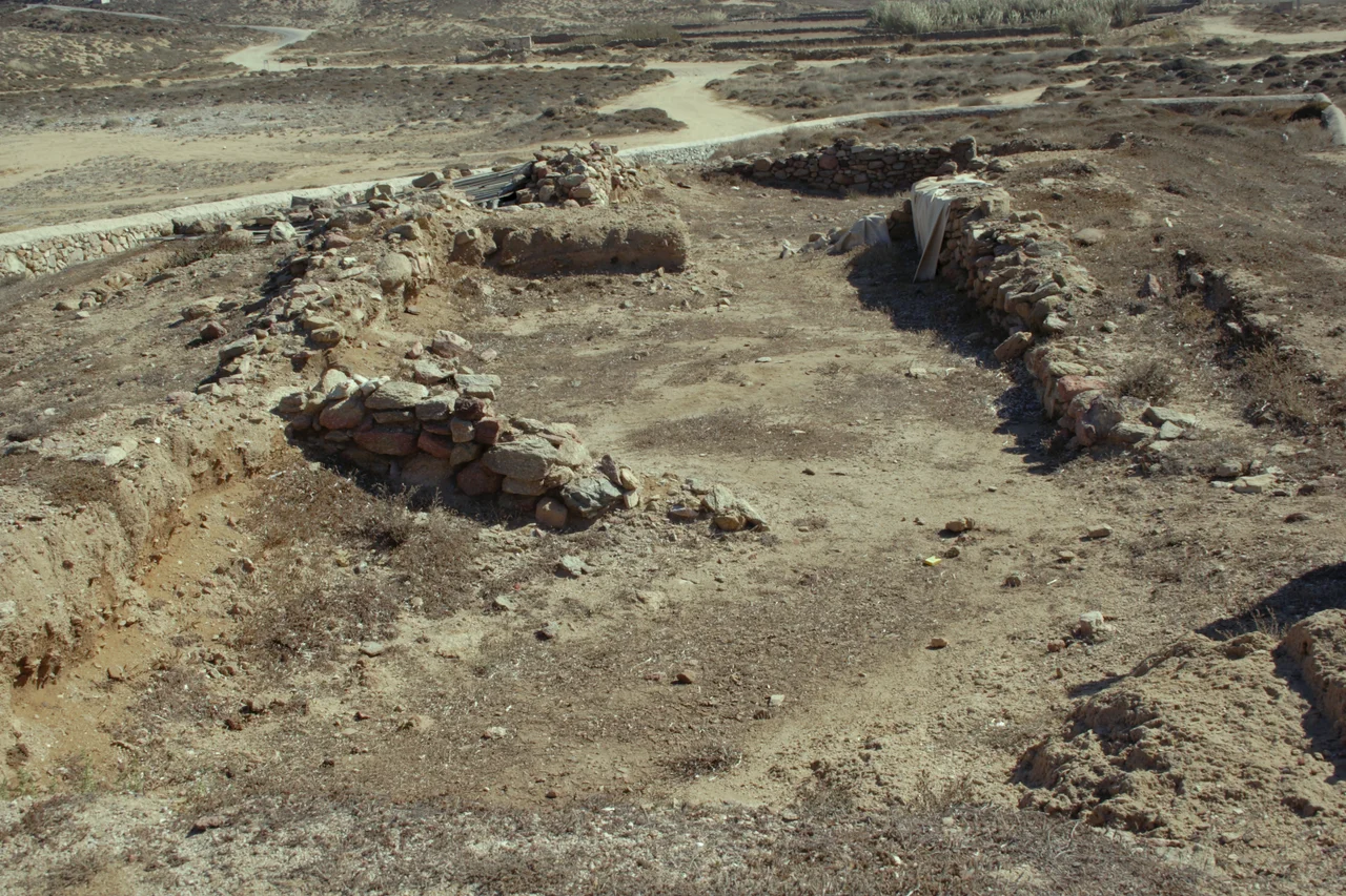
The settlement at Ftelia belongs to the Saliagos culture of the early Final Neolithic, and radiocarbon dating places it between roughly 5000 and 4500 BC. Discovered in 1992 and excavated from 1995 onward, the site has given up wall foundations, mountains of pottery sherds, stone tools, and traces of metalworking. The building foundations show several phases of construction, which tells archaeologists this was no temporary camp but a permanent home occupied across generations. The size uncovered so far suggests a population of perhaps 150 to 200 people, a real community living and dying on this exposed northern shore, almost always under wind.
The Earliest Gold in the Aegean
The most startling find was metal. The metalworking at Ftelia has been dated to the early fifth millennium BC, possibly the earliest in the Aegean. A gold artefact, copper objects, and at least one example of copper ore came from the earliest building phase. One small circular gold object has been dated to the first half of the fifth millennium BC, making it the earliest securely dated gold object in the entire Aegean. It was first mistaken for silver, then clarified in the laboratory. To hold such a thing is to touch the very inception of metalwork, made by people who had only recently learned that certain stones, when heated, ran like water and could be shaped into something that gleamed.
Farmers Who Brought the Mainland With Them
These were farmers first. More than half of all the food remains found here come from grass pea, their staple, followed by lentils, with barley the only grain they grew. They kept sheep and goats, knew pigs and cattle, and supplemented their diet by hunting deer. The strange part is what they barely ate. Despite living on a beach, they left almost no traces of fishing, no hooks, no harpoon points, few seafood remains. Archaeologists read this as a kind of cultural stubbornness: the settlers carried their mainland methods of food production across the water and simply kept doing things the way they always had, declining to adapt to the sea at their doorstep.
A Hub Between Worlds
For a small village on a poor island, Ftelia reached remarkably far. It is now considered the most important known Late Neolithic settlement in the Cyclades, ahead even of Saliagos itself, and its position made it a hub for the exchange of techniques and materials, especially obsidian, the volcanic glass prized for blades. Spondylus shell beads found here match those from the Theopetra Cave far away in Thessaly, evidence of a two-way trade with the north. Among the finds were nineteen stone figurines, thirteen of people and six of animals, the small handmade images of a vanished world. In later ages, long after the village was gone, legend held that this very shore was the tomb of Ajax the Locrian, the Homeric hero, so that even myth could not leave Ftelia entirely to silence.
From the Air
Ftelia sits at approximately 37.46°N, 25.38°E, on the north coast of Mykonos at the head of a broad bay open to the meltemi wind. From the air it appears as a wide sandy beach on the island's exposed northern shore, often flecked with windsurfers' sails. The archaeological site itself is low and easily missed from altitude. Mykonos Island National Airport (LGMK) lies a few kilometres to the south. The persistent northerly wind that defines the bay makes it one of the windier spots on an already windy island; visibility is generally excellent in summer.
Nearby Stories
- Andros 5.1 km away
- Chalandriani 5.7 km away
- Kouros of Apollonas 11 km away
- Ikaria 15 km away
- Archaeological Museum of Sifnos 38 km away
- Emporio, Chios 44 km away
- Archaeological Museum of Andros 49 km away
- Astypalaia 83 km away