Gaya Island
The British thought they had found the perfect capital. In 1882, the North Borneo Chartered Company planted its flag on Gaya Island, envisioning a hub of colonial trade and administration just off the coast of what is now Kota Kinabalu. They built jetties and warehouses, rows of shops roofed with nibong palm and rumbia thatch. But the island fought back -- sweltering heat, shallow waters that frustrated shipping, and soils too poor to sustain a garrison. Then, on 9 July 1897, resistance leader Mat Salleh burned the settlement to the ground, and the British never rebuilt it. Today, Gaya Island is the largest landmass in the Tunku Abdul Rahman Park, a 1,483-hectare knot of dense virgin tropical forest surrounded by coral reefs. It is also home to an estimated 30,000 people, the vast majority of whom arrived as undocumented immigrants from the Philippines starting in the 1970s -- a fact that makes Gaya one of the most layered and contested islands in all of Southeast Asia.
The Rebellion That Shaped a Capital
Before Europeans arrived, the Bajau people inhabited Gaya Island, fishing its waters and living along its shores. The North Borneo Chartered Company saw strategic potential: a natural harbor close to the mainland, sheltered by ridges rising to 300 meters. By 1882, administrative buildings lined the waterfront. But explorer John Whitehead, visiting in 1893, described an outpost struggling against its own geography -- extreme heat, difficult anchorage, and no reliable freshwater. When Mat Salleh's forces razed the settlement four years later, the British abandoned the island entirely. They briefly considered Gantian on the mainland, but its mangrove swamps proved unsuitable for rail construction. In 1899, they founded Jesselton -- named for company manager Charles Jessel -- as the permanent replacement. The island that was meant to be a capital became a forest reserve instead, gazetted in 1923.
A Park Born from Rising Seas
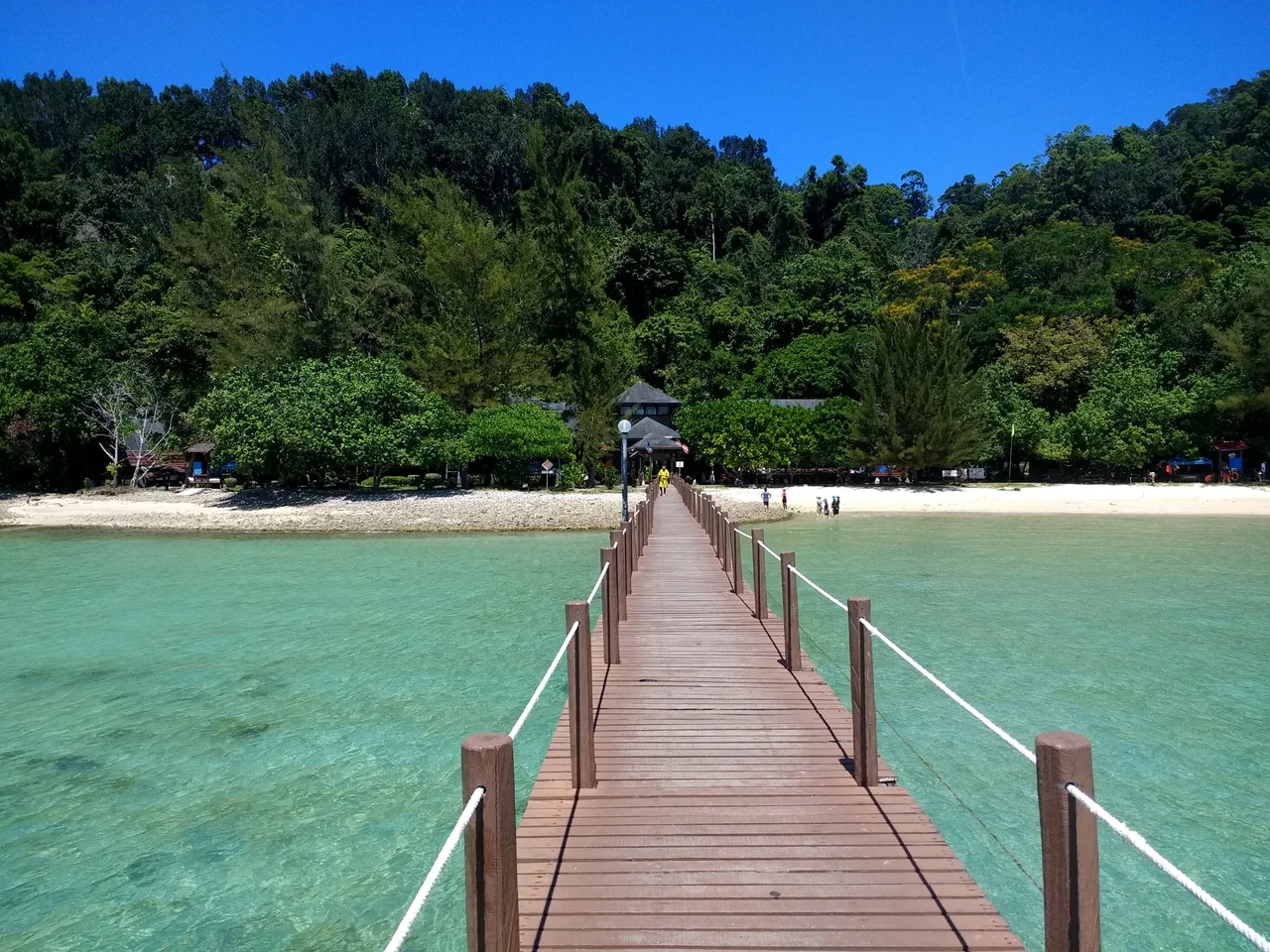
About a million years ago, melting ice reshaped the coastline and severed five chunks of land from the Borneo mainland. Gaya, Sapi, Manukan, Mamutik, and Sulug became islands, each developing its own ecological character. In 1974, the Malaysian government gazetted Gaya and Sapi as the Tunku Abdul Rahman Park -- Sabah's second national park after Kinabalu. Five years later, the remaining three islands joined, expanding the park to nearly 5,000 hectares, two-thirds of which is ocean. Beneath the surface, coral gardens shelter black-blotched porcupinefish and two-lined monocle bream. Above the waterline, Gaya's forests harbor oriental pied hornbills, collared kingfishers, and the rare Philippine megapode. Proboscis monkeys, those pot-bellied, long-nosed primates found only on Borneo, are monitored through the Gaya Island Resort Wildlife Centre. The resort's marine centre runs coral reef restoration and turtle rescue programs in partnership with Reef Check Malaysia.
The Stilt Village on the Eastern Shore
The eastern face of Gaya Island tells a very different story from the pristine forests of its interior. Here, the settlement known as Kampung Lok Urai sprawls across the water on wooden stilts, its houses connected by weathered plank walkways. Beginning in the 1970s, largely Muslim Filipino migrants arrived in waves, building homes that spread steadily seaward with little infrastructure or sanitation. Three devastating fires -- in 1994, 1998, and 2014 -- destroyed nearly half of the adjacent Pondo Village, but the settlement persisted. Of Gaya's approximately 30,000 residents, only about 1,000 are original island inhabitants. The Sabah state government has struggled for decades to address the situation, proposing relocations to the mainland town of Kinarut with modern housing. These plans met fierce opposition from Sabahan citizens concerned about the broader implications. The tension between conservation, human settlement, and plans to develop Gaya as a tourism hub remains one of Sabah's most pressing and sensitive challenges.
Between Monsoons
Gaya's tropical rainforest climate keeps temperatures between 25 and 32 degrees Celsius year-round, but two monsoon seasons define the rhythm of island life. From March through early September, calmer seas make conditions ideal for snorkeling, diving, and paddleboarding. The November-to-February monsoon brings heavy rainfall and rougher waters, turning the crossing from Kota Kinabalu into an adventure of its own. A zip line connects Gaya to neighboring Sapi Island, and guided treks wind through the old-growth interior. In 2025, Kota Kinabalu City Hall opened a new tourist jetty to improve access to the park. Proposals for a cable car linking the island to the city center have surfaced periodically, part of a broader vision to transform Gaya into an urban-adjacent island destination. For now, the island remains what it has been for more than a century -- a place where ambition and wildness compete for the same ground.
From the Air
Gaya Island sits at approximately 6.02°N, 116.04°E, visible as the largest landmass in the Tunku Abdul Rahman Park chain just off Kota Kinabalu's waterfront. From 3,000-5,000 feet, the contrast between the forested western shore and the stilt settlements on the eastern shore is striking. Kota Kinabalu International Airport (WBKK) is approximately 8 km south. Mount Kinabalu provides a dramatic backdrop to the northeast in clear conditions.
Nearby Stories
- Quailey's Hill Memorial 15 km away
- Nunuk Ragang 18 km away
- De Fontaine Memorial 20 km away
- The Chimney of Labuan 66 km away
- Tip of Borneo 79 km away
- The Battle of Labuan 97 km away
- Balambangan Island 129 km away
- Tango Maru 160 km away