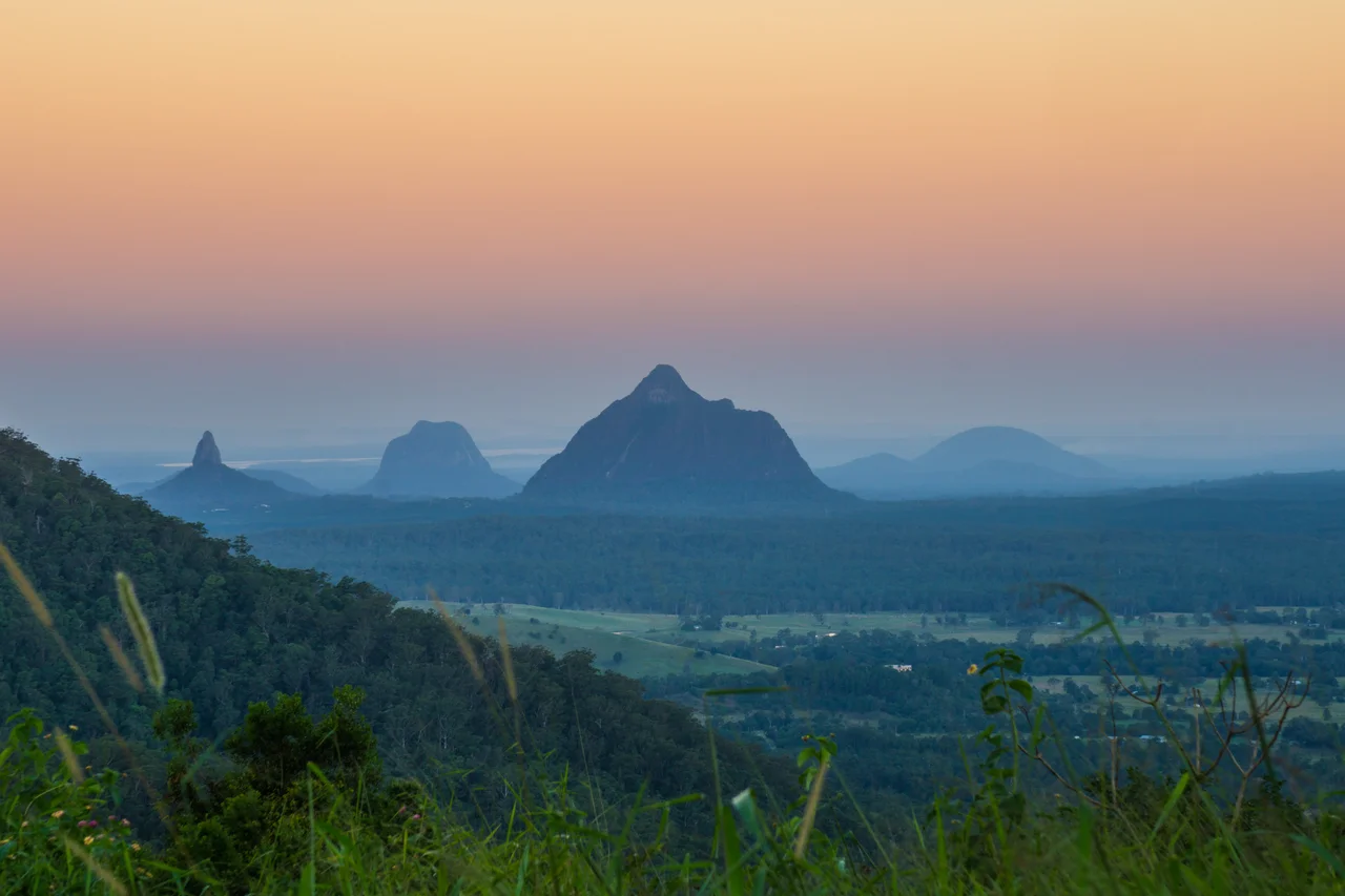

Glass House Mountains National Park
To the Jinibara and Kabi Kabi peoples, these mountains are a family. Tibrogargan is the father, gazing forever out to sea. Beerwah is the mother, the largest of them all, heavy with child. Their many children stand scattered across the plain -- and the eldest, Coonowrin, hangs his head in shame, his neck bent crooked, weeping tears that run down to the ocean. The story explains why the peaks stand as they do, and it has been told here for thousands of years. Long before geologists named the rhyolite or Captain Cook reached for a comparison to glass furnaces, this jagged skyline rising from a flat coastal plain was already sacred ground, alive with meaning.
The Family in the Stone
The Dreaming tells it this way. One day Tibrogargan saw the sea beginning to rise, and called to his eldest son Coonowrin to help his mother Beerwah to safety, for she was again with child. But when the father looked back, he saw Coonowrin running off alone, leaving his pregnant mother behind. Enraged, Tibrogargan struck his son with such force that Coonowrin's neck was twisted, and it has never straightened since. Asked why he had abandoned his mother, Coonowrin answered only that Beerwah, the biggest of them all, could surely take care of herself. Tibrogargan turned his back and vowed never to look at his son again. To this day the father stares out to sea, the mother stands swollen and silent, and the eldest child bows his crooked head and cries. These peaks are not scenery to the Traditional Owners. They are kin, and they are holy.
Cores of Dead Volcanoes
The geology tells a story almost as strange. Between 25 and 27 million years ago, molten rock pushed up beneath this coastal plain and cooled hard inside the throats of volcanoes. The softer pyroclastic cones that once surrounded them have long since weathered away, leaving only the rhyolite and trachyte plugs -- the solid cores -- standing exposed like the stumps of a vanished range. There are more than a dozen of them. Mount Beerwah, the mother, is the tallest at 556 metres, its flank scored by a sheer cliff of columnar rock known as the Organ Pipes. Mount Tibrogargan, the father, is the most recognisable, presenting from certain angles the unmistakable profile of a face turned toward the sea. The mountains are visible from the Scenic Rim on the New South Wales border and far out into the Coral Sea.
The Name from a Northern Furnace
On 17 May 1770, sailing north up the eastern coast in HM Bark Endeavour, Lieutenant James Cook looked west and saw the peaks. Something in their shape and the way light caught them reminded him of the tall glass furnaces -- the glasshouses -- of his native Yorkshire, and so he wrote the name into his log. Cook was the first European to record them, but far from the last to be struck. In 1799 Matthew Flinders reported on the peaks and camped among them, climbing one to survey the country. John Oxley, Allan Cunningham, Andrew Petrie, and Ludwig Leichhardt all passed this way. For mariners and overland explorers alike, the mountains were an irreplaceable landmark, readable from land and sea -- the same quality that made them sacred made them useful.
Walking Lightly Here
The national park was declared in 1994 and later expanded, protecting a landscape on both the Australian National Heritage List and the Queensland Heritage Register. Walking tracks climb several of the peaks, and lookouts open onto the volcanic skyline that has drawn painters and photographers for generations. But access here carries an obligation. Mount Coonowrin -- Crookneck, the shamed eldest son -- has been closed to climbers since 1999 after rockfalls killed and injured people on its crumbling faces. And out of respect for the Traditional Owners, for whom these are living ancestors, climbing the sacred peaks, Mount Beerwah among them, is discouraged. The most fitting way to meet this place may simply be to stand on the plain at dawn, watch the light move across the family of stone, and listen.
From the Air
The Glass House Mountains National Park lies at approximately 26.85S, 152.95E, about 60nm north of Brisbane on the Sunshine Coast hinterland. The peaks are one of the most dramatic and recognisable terrain features in south-east Queensland: a scatter of more than a dozen steep-sided volcanic plugs erupting from an otherwise flat coastal plain. Mount Beerwah (556m) is the tallest, with Mount Tibrogargan and Mount Coonowrin (Crookneck) also prominent. These plugs are genuine obstacles -- maintain safe terrain clearance and be alert for orographic cloud and turbulence forming on and downwind of the peaks, especially in afternoon sea-breeze conditions. The mountains are visible from great distance and make an excellent visual navigation reference. Nearest airports: Caloundra (YCDR) approximately 12nm east, Caboolture (YCAB) approximately 15nm south, Sunshine Coast (YBSU) approximately 20nm north-east, Brisbane (YBBN) approximately 55nm south.
Nearby Stories
- Abbey Museum of Art and Archaeology 8.2 km away
- Noosa National Park 18 km away
- Cressbrook Homestead 33 km away
- 2010-2011 Queensland Floods 68 km away
- Childers Palace Backpackers Hostel fire 148 km away
- Cape Byron 174 km away
- Cape Byron Light 204 km away
- HMS Porpoise (1799) 514 km away