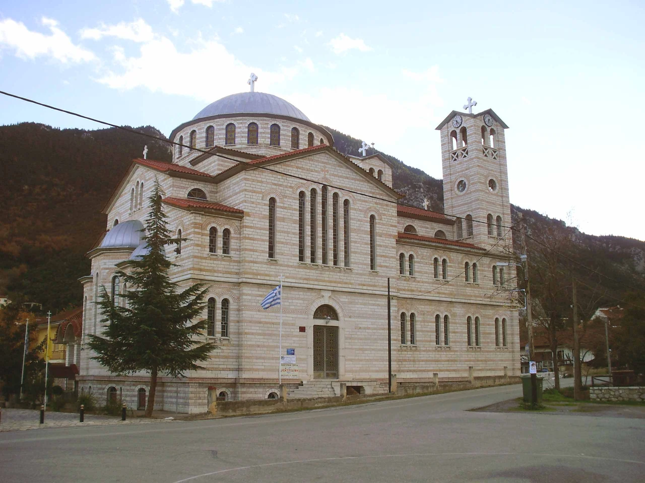

Gravia
Every local sports club needs a name, and in Gravia that name is Androutsos — not a saint, not a color, but a man who held a roadside inn for a day and changed the course of a revolution. In May 1821, the Ottoman commander Omer Vryonis was moving south toward the Peloponnese with a large army, intending to crush the Greek uprising before it took hold. The road ran through Gravia, and the road ran past a stone inn. Odysseas Androutsos and a small band of fighters — accounts vary on the exact number — locked themselves inside and held off the advance. When night fell and they slipped away through the dark, the engagement had cost Omer Vryonis a day he could not afford. The village remembers.
Mountain Passage
Gravia sits in the foothills where Mount Giona and Mount Parnassus converge, a place where the terrain has always dictated movement. The municipal unit — now part of the broader Delphi municipality since the 2011 Kallikratis administrative reform — covers 161.651 square kilometers of valley and slope, the northeastern portion running into the western end of the Cephissus River valley, where farmland opens between the ridges. Greek National Road 27 connects the village to Itea, Amfissa, and Lamia; it follows roughly the same logic as older roads through the same passes. To the north and northeast, the unit borders Phthiotis Prefecture. The landscape is neither dramatic nor forgettable — green foothills, agricultural terracing, a river valley that travelers have been moving through for millennia.
A Slavic Name and a Crusader Castle
The name Gravia is Slavic in origin, pointing to settlement of the area some time after the 6th century AD. It was originally the name of a local river — now called the Koukouvistianos — and later transferred to a castle about five kilometers northwest of the modern village, above the acropolis of an ancient settlement called Pindus. The castle was most likely built by Crusaders in the early 13th century. It enters the written record in 1259, when William II of Villehardouin, Prince of Achaea, crossed the pass on his way to the Battle of Pelagonia. By 1275 the castle had changed hands again: the ruler of Thessaly, John I Doukas, ceded it to the Duchy of Athens as part of the dowry of his daughter Helena Angelina Komnene. After a brief mention in 1304, the castle's history goes quiet. The stone structure above the old acropolis kept watch over the same road travelers still use today.
The Day at the Inn
The Battle of Gravia Inn on May 8, 1821, is the event that has defined the village ever since. Odysseas Androutsos, one of the most capable military commanders of the Greek War of Independence, gathered a small force — sources place the number at around 120 fighters — and took up a defensive position inside a stone inn along the road. The Ottoman force under Omer Vryonis numbered in the thousands. Androutsos's fighters used the thick stone walls and narrow windows to hold the building through the day, inflicting casualties on the attackers while sheltering from return fire. The Ottoman assault failed to break the position before dark. Under cover of night, Androutsos led his men out and withdrew. Omer Vryonis, unable to continue his march south on schedule, was delayed at a critical moment in the early months of the revolution. The engagement became one of the founding stories of Greek independence.
After 1821
Gravia's reputation rests on that single engagement, but the village kept going. The local football club, Androutsos Gravia, carries the fighter's name — an unusual kind of civic monument, present at every match rather than gathering dust in a square. The inn where the battle was fought still stands, preserved as a historical site, along the road that passes through the village. Modern Gravia is a small community, administratively absorbed into the Delphi municipality in the 2011 reforms but retaining its municipal unit status. Visitors sometimes come specifically for the battlefield site; others pass through on the road between Amfissa and Lamia, following the same route that Omer Vryonis was attempting when Androutsos stopped him for a day in May.
From the Air
Gravia lies at approximately 38.67°N, 22.43°E, in the foothills between Mount Giona and the Parnassus massif in northeastern Phocis. From altitude, the village appears as a cluster in a green valley east of Giona's high ridgeline and south of the Cephissus valley floor. The nearest major airport is LGRX (Araxos), about 130 km to the southwest; LGAV (Athens Eleftherios Venizelos) is roughly 165 km to the southeast. Flying at 8,000 feet, you can trace National Road 27 threading through the pass — the same route the battle was fought to control. The Parnassus massif rises to over 2,400 meters to the east, and Mount Giona's summit reaches 2,510 meters to the west; both landmarks are unmistakable from the air on a clear day.
Nearby Stories
- Rio Castle 1.7 km away
- Hyampolis 5.6 km away
- Karpenisi 7.2 km away
- Ypati 7.8 km away
- French Cruiser Châteaurenault (1898) 7.9 km away
- Thermos (Aetolia) 12 km away
- 1981 Gulf of Corinth Earthquakes 13 km away
- Free and Real 20 km away