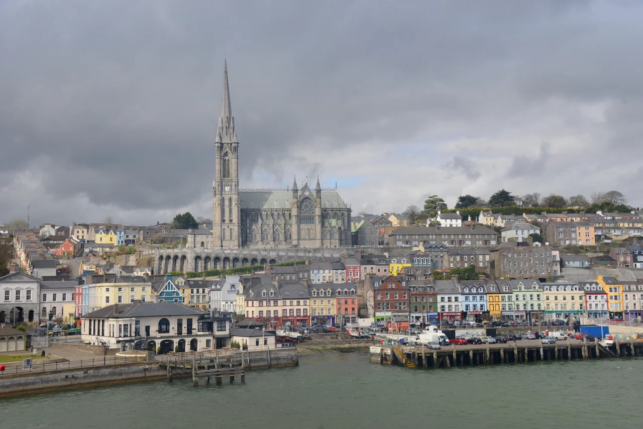

Great Island
In October 2017 Storm Ophelia knocked down trees across the only road bridge to Great Island, and 12,000 people were stranded. Ferry and rail services shut. For most of a day, the island that holds Cobh and Cork's deep-water cruise port had no way on or off. The reason is geographic: the Belvelly Bridge, built in 1803 at the narrowest part of the channel, is the only road in. A railway crosses through Fota Island to reach Cobh and Rushbrooke. A small ferry runs from near Carrigaloe to Passage West on the mainland. That's it. Ireland's second-largest island - after Achill - is one storm away from being an actual island whenever the wind gets serious.
The Great Island of the Barrys
The ancient name was Ard-Neimheadh - the 'high' or 'important' island of Neimheadh, the legendary leader described in the 11th-century Lebor Gabala Erenn as having led a group of prehistoric invaders to the area. The archaeology supports a long settled past: ringforts, fulacht fiadh, holy wells and bee boles all recorded on the National Monuments Service register. By the early 13th century the Anglo-Norman Hodnett family controlled the island. The Barry family, later Earls of Barrymore, took it from them and held it for several centuries, and the island became Oilean Mor an Bharraigh, 'Great Island of the Barrys.' Their tower houses still dot the surrounding harbour - Barryscourt, Belvelly, others - but it is the Barry name itself that survives most clearly on the modern map, in Barryscourt, Ballymore, and a dozen other settlements.
Cobh and the Sea
Cobh - called Queenstown from 1849 to 1920, in honour of Queen Victoria - is the only sizeable town on Great Island and the reason most visitors come. The deepwater harbour and proximity to the open Atlantic made it Britain's most important southern Irish naval base for two centuries, the last port of call for Titanic in April 1912, and the embarkation point for hundreds of thousands of Irish emigrants to America. The 19th and early 20th centuries built the cathedral-on-the-hill silhouette that still defines the Cobh waterfront. Shipping, ship-building and naval activity drove the island's economy through both world wars. The Verolme Cork Dockyard at Rushbrooke later built vessels for the Irish Naval Service, including the LE Eithne. Most of those heavy industries have closed. A few smaller boatbuilders carry on at Cobh.
The Cruise Ships
Tourism replaced what shipbuilding lost. The Port of Cork's berthing facilities at Cobh form the only dedicated cruise-ship berth in the Republic of Ireland - cruise lines that want a southern Irish stop come here. As of 2019, the port company was pursuing a redevelopment of the deepwater quay to handle more cruise and cargo traffic, a plan that produced significant conflict with local resident groups over what they saw as the privatisation of public land. The Cobh Right of Way campaign argued for protected public access along the waterfront. The dispute is unresolved. Behind it sits a larger question for many coastal Irish towns: whether the tourism economy that replaced industry has merely substituted one set of external owners for another.
Marshes, Whales, and Kingfishers
Great Island is not just towns and dockyards. Cuskinny Marsh Nature Reserve, managed by BirdWatch Ireland on the eastern shore, holds kingfishers, cormorants and dozens of other species across its tidal habitats. Marlogue Wood, operated by Coillte, covers part of the south. The Great Island Channel Special Area of Conservation, overseen by the National Parks and Wildlife Service, proposes aquaculture limits and habitat protections across the salt marshes that fringe the island. Bottlenose dolphins, harbour porpoises and seals show up in the channel regularly. Between June and August 2001 a pod of three killer whales took up residence between Cuskinny Bay and Cobh's Holy Ground, sometimes within a hundred metres of the shore - they would hunt in the lower harbour during the day and return to the bay at night. For a populous island in a working port, the wildlife still finds room.
A Single Bridge
The Belvelly Bridge was built in 1803, at one of the narrowest crossings in the Cork Harbour channels. It has carried the only road traffic onto the island for more than two centuries. Belvelly Castle stands beside it - the 14th-century Hodnett tower house that watches the crossing. The railway line from Cork to Cobh crosses through Fota Island, then onto Great Island, with stations at Carrigaloe, Rushbrooke and Cobh terminus. A ferry connects Carrigaloe to Passage West. After Storm Ophelia stranded the island in 2017, there were renewed calls for the kind of emergency-access designation Achill and other Irish islands already enjoy. For now, Great Island remains what it has been since 1803: a populous, prosperous, working island held to the mainland by a single 200-year-old bridge.
From the Air
Located at 51.87°N, 8.27°W in Cork Harbour, the largest island in the harbour and second largest in Ireland after Achill. From altitude Great Island reads as a substantial landmass at the mouth of the River Lee, with Cobh's distinctive cathedral on its hilltop the most obvious landmark on the southern shore. The Belvelly Bridge at the north-west corner connects to Fota Island; the small Carrigaloe ferry crosses to Passage West. Cork Airport (EICK) is about 14 km west; the open Celtic Sea opens to the south-east. Best viewed at lower cruising altitudes when the bridges, channels and the cathedral are clearly visible.
Nearby Stories
- St. Declan's Monastery 0.8 km away
- Aghavrin House 2.4 km away
- Mitchelstown Castle 7.4 km away
- Clonakilty 9.5 km away
- Inislounaght Abbey 16 km away
- Walter Siepmann 23 km away
- Newcastle West 33 km away
- SM U-27 110 km away