
Gullane
The medieval church at the west end of Gullane stands roofless against the Firth of Forth wind. In 1612, Lord Erskine of Dirleton petitioned the Scottish Parliament for permission to abandon it. His stated reason was that the building was being engulfed by drifting sand - 'continewallie overblawin with sand,' the petition complained. The likelihood of his claim has since been questioned by historians; the church may simply have been in the wrong place for the eastward shift of parish life. But the sand has done other work here. The same dunes that may or may not have buried a Norman church have made Gullane one of the finest stretches of golfing land in the world - the home of Muirfield, the Honourable Company of Edinburgh Golfers, and three eighteen-hole links courses laid out on a grassed-over volcanic plug.
Golyn
The village sits on the southern shore of the Firth of Forth in East Lothian, twenty-two miles east of Edinburgh. There has been a church here since the ninth century. The etymology of the name is genuinely uncertain. It may derive from the Scottish Gaelic Gualainn, meaning shoulder - but East Lothian sat largely outside the Gaelic-speaking sphere even at its medieval peak. The village was historically known as Golyn. A more plausible derivation runs through Brittonic (probably Cumbric) lyn or linn, cognate with the Welsh llyn for lake, possibly referring to a now-drained piece of water near the old parish church. Another candidate is the Middle English gōl, meaning boundary or limit - Golyn parish was once among the most northerly outposts of Anglo-Saxon influence in Britain, since anything north of the Firth of Forth was Pictish or Gaelic territory. Whatever the origin, the people of the time may well have considered themselves Anglo-Saxon, or English, rather than Scottish.
St Andrew's Kirk
The roofless ruin of St Andrew's Kirk stands at the west end of the village, just north of Main Street. The earliest stone church on the site seems to date from 1150-1200, most likely built by the de Vaux family. The ruin today consists of a nave and chancel, with a late medieval chapel projecting to the north. The west end is lost, but most walls stand to eaves height. The finest surviving architectural feature is the Romanesque chancel arch, decorated with chevron moulding - though only the outer band can be seen from the nave, the rest blocked by later cross walls. After 1612 the church was abandoned. In 1827 the Yule family took over the chancel as a private family burial ground, walling off the arch in the process and possibly extending the chancel structure. In 2010 a full record of the church remains was made, followed by consolidation works to stabilise what survives.
Lutyens and Jekyll
On the eastern edge of the village stands Greywalls, built in 1901 to a design by Sir Edwin Lutyens. The gardens were laid out by Gertrude Jekyll. The Lutyens-Jekyll partnership produced some of the most influential country house gardens in early twentieth-century Britain, and Greywalls is one of their finest collaborations - a low, sheltering building of grey stone wrapped around walled gardens. Today it is a hotel. Gullane has other architectural traces: Gullane War Memorial, designed by Sir Robert Lorimer and erected in 1914, was an unusually early war memorial - put up in response to the immediate emotional impact of the war as much as to commemorate the dead. Names were added as the war continued. Notable residents of the village have included the comedian Ronnie Corbett, the crime novelist Quintin Jardine, and the ceramicist Ann Stokes, born here at the manse in 1922.
Three Courses on a Volcanic Plug
The Gullane Golf Club has three eighteen-hole links courses that straddle Gullane Hill - a large grassed-over volcanic plug that gives the courses both their character and their views. A composite course drawn from the three has hosted the Scottish Open and Ladies Scottish Open. From the top of the hill on each course, you can see across Aberlady and Aberlady Bay toward Edinburgh and the Forth Bridge, with the Fife coast on the far side of the firth and the Lomond Hills behind. The internationally acclaimed artist Frank W Wood painted this view in 1933. Abutting the third Gullane course is the Luffness Golf Club course, and beyond that, on its own private land, Muirfield - home of The Honourable Company of Edinburgh Golfers and one of the venues in The Open Championship rota. The whole stretch of coast here is golf country: the same windswept dunes that may have driven the medieval congregation inland to Dirleton are perfect links land, sandy and free-draining, springy underfoot.
Fly Past
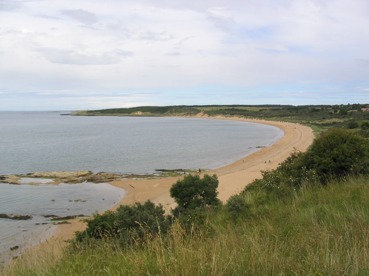
Gullane sits at 56.0371 degrees north, 2.8265 degrees west, on the southern shore of the Firth of Forth in East Lothian. From above, the most distinctive features are Gullane Hill - the grassed-over volcanic plug rising in the village - with three eighteen-hole golf courses laid out around its slopes, and Muirfield's distinct two-loop layout immediately to the north. Gullane Bents is the broad sandy beach backed by dunes on the village's north side. Best viewed from 2,000 to 3,500 feet for the relationship between hill, courses, beach, and the firth. Nearest ICAO airport: Edinburgh (EGPH) ~22 nm west. Edinburgh itself is visible to the west on clear days, with the Forth Bridge to the north-west. North Berwick Law - another volcanic plug - rises sharply 5 nm to the east. The Fife coast is visible across the firth; the Lomond Hills rise behind it.
From the Air
Located at 56.0371°N, 2.8265°W on the southern shore of the Firth of Forth, East Lothian. Recommended viewing altitude 2,000-3,500 feet. Visual landmarks: Gullane Hill (grassed-over volcanic plug); three eighteen-hole links courses around its slopes; Muirfield's distinct two-loop layout to the north; broad sandy Gullane Bents beach; ruined St Andrew's Kirk at the village's west end. Nearest ICAO airport: Edinburgh (EGPH) ~22 nm west. North Berwick Law (volcanic plug) ~5 nm east. Forth Bridge visible north-west; Fife coast and Lomond Hills across the firth to the north.
Nearby Stories
- Blackness Castle 2.2 km away
- Skateraw Lifeboat Station 2.8 km away
- RAF Charterhall 5.6 km away
- Ochil Hills 6.3 km away
- Innerleithen 12 km away
- Falkland Palace 14 km away
- New Lanark 18 km away
- Bell Rock Lighthouse 21 km away