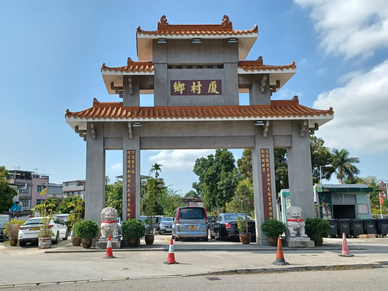

Ha Tsuen
Six hundred years ago, two brothers left their clan's stronghold at Kam Tin and walked west to the coast. Tang Hung-wai and Tang Hung-chi were looking for salt flats and fish markets, and what they found at Ha Tsuen — the name means 'Lower Village' — became the seed of an entire world. Today that world still exists, compressed into a corner of Yuen Long District in Hong Kong's New Territories, where walled villages, an ancestral hall declared a protected monument, and the faint outline of a former port coexist with container yards and suburban roads.
Two Brothers and a Dynasty
The Tang clan's arrival in Ha Tsuen dates to the Hongwu era of the Ming Dynasty, between 1368 and 1398. The two founders built the first settlements — Tseung Kong Wai, originally called Sai Tau Lei, and Tung Tau Tsuen, once known as Tung Tau Lei. As the clan grew through the following centuries, the settlement multiplied: Hong Mei Tsuen, Lo Uk Tsuen, San Wai, Sik Kong Tsuen, Sik Kong Wai, and others formed a network of villages linked by kinship and trade rather than roads. The word 'wai' in several village names is significant — it means 'walled enclosure,' a form of defensive architecture common in the New Territories where clan compounds were surrounded by thick walls and narrow gateways. Several of Ha Tsuen's walled villages survive today as declared historical buildings.
The Hall of Friendship and Respect
In 1749, the Tang clan of Ha Tsuen began constructing a building to honour the memory of Tang Hung-wai and Tang Hung-chi, the two founders who had arrived three and a half centuries earlier. The Tang Ancestral Hall — formally known as Yau Kung Tong, meaning 'Hall of Friendship and Respect' — was completed the following year, in 1750. It has since been designated a declared monument of Hong Kong, one of the territory's highest protections for historic structures. The hall is not a ruin or a museum piece; it remains a functioning ancestral hall, a place where the clan's descendants gather for ceremonies that connect the present community to the founders' decision to leave Kam Tin and head for the coast. Walking through its interior, past the altar tablets and the layered incense smoke, the Ming-dynasty journey feels less like history than like a still-living obligation.
Salt, Fish, and the Economics of a Port
Ha Tsuen's location was its primary asset. Lying at the western edge of what is now Yuen Long, close to the shallow tidal flats and the waterways that once connected the New Territories to the broader Pearl River Delta, it drew the Tang clan precisely because of its potential as a market and production site for fish and salt. For centuries, waterborne trade defined the place. Ha Tsuen was a port — not in the dramatic sense of deep harbours and large ships, but in the practical sense of a landing point where smaller vessels brought goods in and took them out, where fishermen sold their catch and salt merchants weighed their product. The salt business was significant enough to attract the To clansmen during the Ming Dynasty, who migrated to nearby Tuen Mun and developed commercial ties throughout the region. The water is mostly gone now, replaced by land reclamation and container logistics, but the market character of Ha Tsuen lingered in the district well into the twentieth century.
A Village Landscape That Persists
Ha Tsuen today is a patchwork — fifteen or more villages within the broader heung, ranging from the walled Tseung Kong Wai and Sik Kong Wai to open settlements like Hong Mei Tsuen and Lo Uk Tsuen. The (*) notation in historical records of these villages designates which are officially recognised as walled villages under Hong Kong law, a status that carries legal implications for land use and inheritance. The paifang gateway at Ha Tsuen, visible in photographs from recent decades, marks the formal entrance to the area in the manner typical of major clan territories in the New Territories. Children in the district attend schools within Primary One Admission School Net 72, which serves the broader Yuen Long corridor. For a place that began as an entrepreneurial venture by two men from another clan's home ground, Ha Tsuen has proved remarkably durable — its villages still bearing names assigned centuries ago, its ancestral hall still hosting the ceremonies its founders could not have predicted but would likely have understood.
From the Air
Ha Tsuen lies at approximately 22.45°N, 113.99°E, on the western margin of the Yuen Long plain in the New Territories. From Hong Kong International Airport (VHHH) on Lantau Island, the approach northeast toward Yuen Long passes almost directly over the area at low altitudes. The tidal flats of the Deep Bay shoreline — Ha Pak Nai, Pak Nai — are visible to the northwest, and the flat agricultural and industrial land of the Yuen Long plain extends eastward. The Mai Po Marshes nature reserve sits to the north. Flying at around 1,000–1,500 feet, the grid of walled village enclosures can be distinguished from the surrounding suburban development.
Nearby Stories
- Chapel of St. Francis Xavier 3.5 km away
- Cuiheng 4.1 km away
- 2015 Shenzhen Landslide 16 km away
- Shunde 31 km away
- Wanshan Archipelago 37 km away
- Nanxiong Formation 96 km away
- Heyuan 149 km away
- Checheng Fu'an Temple 629 km away