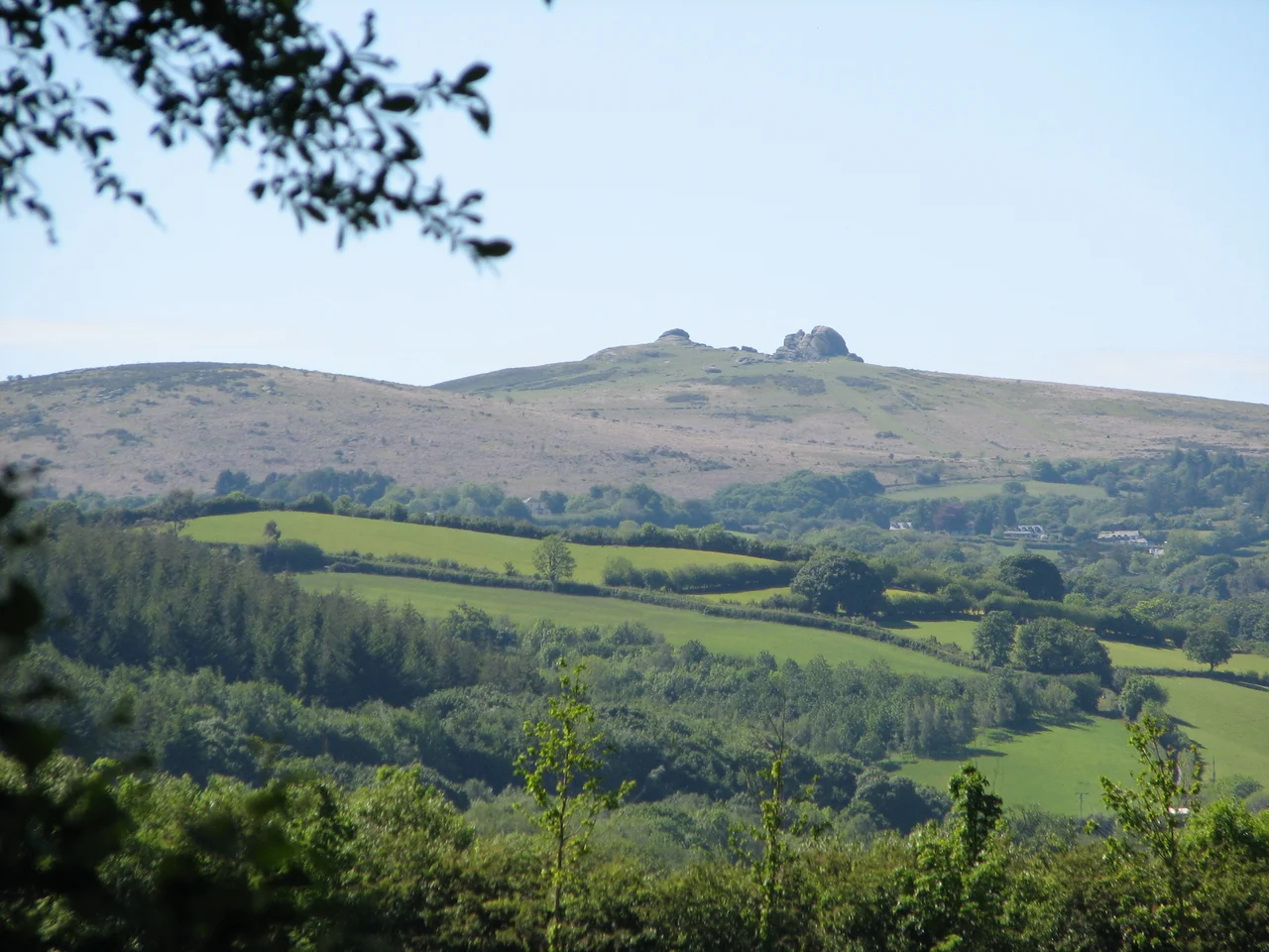

Haytor
In 1851 a Dr Croker complained, in print, that someone had installed a metal handrail on the summit of Haytor. The rail was there, he objected, "to enable the enervated and pinguedinous scions of humanity of this wonderful nineteenth century to gain the summit." Pinguedinous. Greasy or fatty. He was calling Victorian day-trippers too soft and chubby to climb a rock. The handrail came down in the 1960s when rust got the better of it, leaving only the stumps of the uprights embedded in the granite where they remain today. It is, as complaints go, the most quotably Victorian thing ever said about a tor. Haytor draws this kind of response. It always has.
Idetordoune to Haytor
The name has drifted. Idetordoune in 1566. Ittor Doune in 1687. Idetor by 1737. Eator Down in 1762. Itterdown by 1789. Haytor itself is comparatively modern, probably a corruption of the older name and that of the Haytor Hundred, the administrative district that covered the coastal land between the rivers Teign and Dart. The Hundred itself was named for a lost village somewhere between Totnes and Newton Abbot - a village that has vanished, that has taken its name with it, and yet has left its name attached to the most famous granite outcrop on Dartmoor. The tor stands on the eastern edge of the moor, near Haytor Vale in the parish of Ilsington. Its two main rock piles, separated by a weathered "avenue," make a silhouette you can identify on the skyline from twenty miles away.
The Stone That Crossed an Ocean
The granite of Haytor is coarse-grained, full of large feldspar crystals. The granite beneath the tor is finer, easier to dress, better suited to building. Quarries opened here in 1820, served by the unique Haytor Granite Tramway whose rails were carved from granite blocks. The stone went down the moor to the Stover Canal, then by barge to Teignmouth, then by sea to London - where it became, among other things, the cladding of the new London Bridge that opened in 1831. When that bridge was sold to American developer Robert McCulloch in 1968 and dismantled, the granite went with it. The bridge was reassembled at Lake Havasu City, Arizona in 1971. So Haytor stone now stands in the Sonoran Desert. The last block quarried at Haytor was cut in 1919 and used for the Devon County War Memorial in Exeter. Then the quarries closed, the moor reclaimed them, and the silence returned.
King Arthur on Dartmoor
In 1953 the MGM production of "Knights of the Round Table," starring Robert Taylor and Ava Gardner, descended on Haytor. Crews built what one source called "an elaborate and impressive castle" in the avenue between the two main rock piles. They staged jousts. Medieval pageantry rolled across the moor for the camera. The film was the first MGM feature in CinemaScope and an enormous production. When it wrapped, the castle came down, the actors went home, and Haytor was left to the sheep and the climbers. The tor's distinctive shape has also drawn cyclists - the road below hosted summit finishes in Stage 6 of the 2013 Tour of Britain and again in Stage 6 of the 2016 Tour. Steve Cummings took the leader's jersey that day. Wout Poels won the stage.
Haytorite, Climbers, and the Dartmoor National Park
In an iron mine adjacent to the granite quarries, geologists found a variety of quartz that they named haytorite "in honour of its birth-place." Then there is Lowman, the smaller western outcrop, which rock climbers tackle alongside the main pile - both faces offer routes at varying grades, from beginner scrambles to genuinely hard pitches. The whole of Haytor Down was sold in 1974 to the newly formed Dartmoor National Park Authority, which now manages it as a Site of Special Scientific Interest. The tor remains arguably Dartmoor's most famous landmark. Half a million visitors a year walk up the worn paths. The handrail Dr Croker mocked is gone, but the steps are still cut into the rock. The tor itself is unchanged, in any way that matters, since the first humans climbed up to see what they could see from the top.
From the Air
Haytor stands at 50.5798 N, 3.7568 W, on the eastern edge of Dartmoor in Devon. View from 1,500 to 3,000 feet to capture the distinctive twin-rock silhouette against the surrounding moorland. Nearest airport is Exeter (EGTE), about 14 nautical miles north-east. The two granite outcrops are visible as pale blocks rising sharply from the heather. The disused quarries lie just to the north as darker hollows in the moor. The A38 runs east of the tor; the road to Bovey Tracey passes south of it. Visibility from the air is best on a clear day - low cloud often hides Dartmoor's eastern edge.
Nearby Stories
- Torcross 2.8 km away
- Cotehele 4.6 km away
- HMS Formidable (1898) 9.1 km away
- Holsworthy 9.4 km away
- Eddystone Lighthouse 11 km away
- Tiverton Castle 18 km away
- 1890 Norton Fitzwarren Rail Crash 24 km away
- Lyme Bay Canoeing Disaster 26 km away