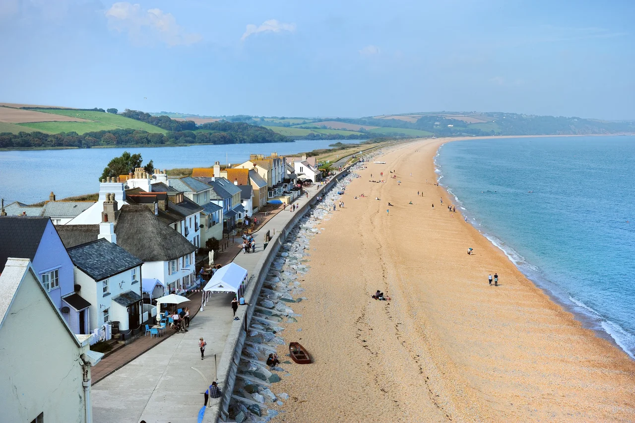

Torcross
There is a Sherman tank in the car park at Torcross. It came up out of the shallow water of Start Bay in 1984, raised at the private expense of a local hotelier named Ken Small who had spent fifteen years convinced of what was down there. The tank now stands at the south end of Slapton Sands as a memorial to the American servicemen who died in the early hours of 28 April 1944, during Exercise Tiger - the live-fire rehearsal for the Utah Beach landings, on this beach, six weeks before D-Day. At least 749 men were killed across the whole operation, with some estimates running as high as 946. Most were killed by friendly fire on a beach they were practising to take. Torcross remembers them.
A Village on a Beach
Torcross sits at the southern end of Slapton Sands, a remarkable shingle bar nearly three miles long that separates the freshwater lake of Slapton Ley from the open sea of Start Bay. The first written mention of the village comes from the manorial court rolls of 29 March 1602, when a representative reported everything was all well. For more than two centuries the village survived as a fishing settlement at the end of a track. In 1854 the coastal road from Kingsbridge to Dartmouth was punched through the shingle bar, passing along the seaward edge of Slapton Ley and changing Torcross forever. A coach service came in 1858. The village now lived on the road as much as the sea, but the road sat on a beach that the Channel did not really intend to leave alone.
The South Hams Cleared
In late 1943 the British government emptied the South Hams. About three thousand civilians from Torcross and the surrounding villages were given six weeks to leave their homes - farms, churches, shops, schools, cottages where families had lived for generations. The Allies needed Slapton Sands. The geography matched the Norman coast where the Americans would land at Utah Beach: a long shingle beach backed by a freshwater lagoon, low cliffs, gentle gradient. Fifteen thousand American troops moved in for full-scale landing rehearsals. The villagers came back at the end of 1944 to a landscape pocked with shell holes, ruined cottages and unexploded ordnance. Some properties were never inhabited again. The slate-roofed church at Stokenham still bore American graffiti for decades.
Exercise Tiger
Exercise Tiger was the largest of those rehearsals. Early on the morning of 28 April 1944 a convoy of LSTs - tank landing ships - approached Slapton Sands from the Isle of Portland to put men ashore in a full simulation of Utah Beach. Nine German E-boats, alerted by the heavy radio traffic across the Channel, slipped past the British escorts and into the middle of the convoy. Two LSTs were torpedoed and sunk. At least 749 American servicemen drowned or were killed in the engagement, with higher estimates running to 946 depending on which casualties are counted. On the beach itself, badly timed live shellfire from a British cruiser supporting the landings - the result of a communications breakdown about timings - also caused casualties, though the exact toll was never officially established. The great majority died either on their own side's fire or from a torpedo strike they had no warning of. The losses were classified, kept quiet to protect both morale and the secrecy of the upcoming invasion. When word leaked decades later, the families of the dead - many of whom had been told only that their sons had died on D-Day - began to look for answers.
Ken Small and the Tank
Ken Small ran a hotel at Torcross. From the early 1970s he could find shell casings and shattered equipment along the beach after rough weather. Local fishermen knew there was a Sherman tank out in the bay - one of the new amphibious DD tanks that had been sent to shore that night and never made it. Small spent years getting permission, raising money, organising divers. In 1984 the tank was lifted out of about sixty feet of water in Start Bay and brought ashore. It sits now in the car park between the beach and Slapton Ley, paint long gone, hatches welded shut, a brutal and uncluttered memorial. Plaques around it list the dead. Veterans of Exercise Tiger came to the unveiling. Some had not spoken about that night in forty years. The tank is, finally, the thing that Ken Small had wanted it to be - undeniable, here, watching the same water.
The Sea Coming Back
Slapton Sands is retreating. The Channel storms that have always battered this coast are arriving more often and with more energy. On 4 January 1979 enormous waves washed clean over the roofs of the seafront houses. A new curved seawall went up afterward. On 11 and 12 January 2001 the storms took five metres off the beach along a thousand-metre stretch and tore out a chunk of the A379. In February 2014 the sea entered every Torcross seafront property but one; cars had to be rescued from the beach road. Twenty-seven thousand tonnes of shingle imported at a quarter of a million pounds in 2015 was washed away by the next high tide. Natural England has concluded that with current sea level rise and storm frequency, Slapton Sands will keep retreating. The road will keep being moved or rebuilt. Torcross knows what a retreating beach looks like - Hallsands, just a few miles south, was destroyed by the sea in 1917 after its shingle was dredged away. The same coast. The same sea. The same lesson, given again.
From the Air
Torcross sits at the southern end of Slapton Sands at approximately 50.266 degrees N, 3.654 degrees W on the south Devon coast. From the air the shingle bar is unmistakable: a three-mile straight line of beach between the slate-grey sea of Start Bay and the freshwater Slapton Ley behind it, with the village clustered at the south end where the cliffs begin. Start Point lighthouse stands just to the south on its own promontory. Nearest airports are Exeter (EGTE) about 28 miles to the north and the closed Plymouth City Airport (EGHQ) about 22 miles west; Newquay Cornwall is the western alternative. Cruise altitudes of 1,500-3,000 feet give a perfect view of the bar, the Ley and the long sweep of Start Bay. Channel weather on this coast is changeable and the area is exposed to easterly fetches; expect quick visibility shifts year-round.
Nearby Stories
- Dartington Hall 0.3 km away
- Eddystone Lighthouse 3.4 km away
- Cotehele 5.2 km away
- HMS Formidable (1898) 7.8 km away
- Lyme Bay Canoeing Disaster 34 km away
- HMS Affray 48 km away
- Casquets Lighthouses 61 km away
- Battle off Lizard Point 72 km away